Area Overview for B19 1AU
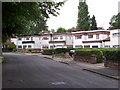
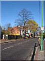
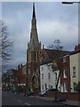
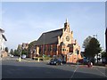
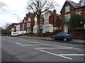
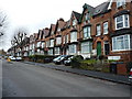
Photos of B19 1AU


Area Information
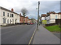
Living in B19 1AU means being part of a small, tightly knit residential cluster in Birmingham’s historic Jewellery Quarter. With a population of 2,248, the area retains echoes of its 18th-century industrial past while offering modern comforts. This postcode sits at the heart of a district designated as a 300-acre Improvement District, awarded World Craft City status in 2025 for its legacy in jewellery and metalwork. Daily life here blends heritage with practicality: Victorian architecture lines streets like Warstone Lane, while nearby retail and transport hubs ensure convenience. The area’s character is defined by its mix of historic workshops and contemporary living, with families and professionals drawn to its unique blend of tradition and accessibility. Proximity to rail stations, independent schools, and a thriving local economy makes it appealing for those seeking a balance between history and modernity. However, its small size means the housing stock is limited, and buyers may need to consider nearby areas for broader options.
- Area Type
- Postcode
- Area Size
- Not available
- Population
- 2248
- Population Density
- 6183 people/km²
The property market in B19 1AU is characterised by a low home ownership rate of 33%, suggesting that the majority of housing stock is rented rather than owned. The predominant accommodation type is houses, which aligns with the area’s historic development as a residential and industrial hub. Given the small size of the postcode and the limited housing stock, buyers may find the market constrained, with fewer properties available compared to larger districts. The presence of houses implies a focus on family-sized homes, though the low ownership rate suggests a reliance on rental options. For buyers, this means competition may be fierce, and exploring nearby areas could be necessary to find a broader range of properties. The mix of older homes and limited new developments also means property values may be influenced by the area’s historic character and preservation efforts.
House Prices in B19 1AU
No properties found in this postcode.
Energy Efficiency in B19 1AU
Residents of B19 1AU have access to a range of amenities within practical reach. Five metro stations, including Soho Benson Road and St Paul’s, provide easy access to public transport, while rail stations like Perry Barr and Birmingham Snow Hill connect to broader networks. Retail options include supermarkets such as Iceland Handsworth and Farmfoods Handsworth, ensuring convenience for daily shopping. The area’s historic character blends with modern facilities, offering a unique lifestyle that combines heritage with practicality. While the data does not detail parks or leisure venues, the proximity to the Jewellery Quarter’s cultural landmarks and the broader Birmingham city centre suggests opportunities for cultural engagement and recreation. The mix of retail, transport, and historic sites creates a dynamic environment for residents.
Amenities
Schools
The nearest school to B19 1AU is The Lambs Christian School, an independent institution. This school offers a private education option, which may appeal to families seeking alternative schooling. However, the data does not list any state schools in the immediate vicinity, so families relying on public education may need to look beyond the postcode for options. The presence of an independent school suggests a community that values choice in education, though the lack of state schools could be a consideration for those prioritising affordability or accessibility. Parents should assess the school’s performance and proximity to their specific needs, as the data does not include Ofsted ratings or academic outcomes.
| Rank | School | Type | Entry gender | Ages |
|---|
Explore more schools in this area
Go to Schools tabDemographics
The population of B19 1AU has a median age of 47, with the most common age group being adults aged 30–64. This suggests a community of middle-aged and older residents, likely including families and professionals. Home ownership stands at 33%, indicating a higher proportion of rental properties compared to owner-occupied homes. The predominant accommodation type is houses, reflecting a mix of older, larger properties typical of the area’s historic character. The dominant ethnic group is the Asian community, which shapes the cultural fabric of the neighbourhood. While deprivation data is not explicitly provided, the low home ownership rate and older demographic may point to a community with established residents rather than a rapidly growing population. This profile suggests a stable, long-term resident base with a strong connection to the area’s heritage.
Household Size
Accommodation Type
Tenure
Ethnic Group
Religion
Household Composition
Age
Household Deprivation
NS-SEC
Explore more demographic insights in this area
Go to Demographics tabPlanning
Planning Constraints
- Flood RiskPremium
- Ramsar Wetland SitesPremium
- Area of Outstanding Natural BeautyPremium
- Protected Nature ReservePremium
- Protected WoodlandPremium