Area Overview for B18 9GP
Photos of B18 9GP


Area Information
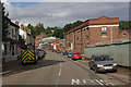
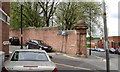
Living in B18 9GP means inhabiting a small, tightly defined postcode area within Birmingham’s historic Jewellery Quarter. With a population of 1,482, this cluster of residences sits at the heart of a district renowned for its craftsmanship legacy and recent designation as a World Craft City. The area’s character blends 18th-century industrial heritage with modern innovation, offering a unique mix of Victorian architecture and contemporary trade. Residents benefit from proximity to key landmarks like St Paul’s Church and the Museum of the Jewellery Quarter, while the area’s compact size ensures a strong sense of community. Daily life here is shaped by the presence of nearby railway stations, retail hubs, and the quarter’s ongoing revitalisation. Though small, B18 9GP sits within a broader historic district with a population of around 19,000, offering access to cultural and economic opportunities. This is a place where tradition meets practicality, with a focus on skilled trades and heritage preservation.
- Area Type
- Postcode
- Area Size
- Not available
- Population
- 1482
- Population Density
- 3933 people/km²
The property market in B18 9GP is characterised by low home ownership (21%) and a reliance on rental accommodation, with flats being the primary housing type. This reflects the area’s small size and its historical development as a residential cluster within a larger industrial district. The limited number of properties suggests a niche market, likely dominated by landlords catering to young professionals and students. Buyers considering the area should note the scarcity of owner-occupied homes, which may limit opportunities for long-term investment. The focus on flats also means that property sizes are likely modest, with little scope for major renovations or extensions. Proximity to transport links and amenities may offset the lack of traditional housing stock, but buyers should approach the market with realistic expectations about availability and competition.
House Prices in B18 9GP
No properties found in this postcode.
Energy Efficiency in B18 9GP
Daily life in B18 9GP is shaped by its proximity to retail hubs like Tesco Birmingham and Morrisons Daily, offering convenient shopping options. The area’s railway stations provide easy access to Birmingham’s cultural and commercial centres, while the nearby metro network connects to key destinations such as Soho Benson Road. Though the data does not list parks or leisure facilities directly, the broader Jewellery Quarter district includes historic streets like Warstone Lane and landmarks such as Key Hill Cemetery. The mix of retail, transport, and heritage sites creates a lifestyle that balances practicality with the area’s historic charm. Residents benefit from a compact, walkable environment where essential services are within reach, though larger recreational spaces may require travel beyond the immediate postcode.
Amenities
Schools
The nearest school to B18 9GP is Values Academy, a special school serving students with specific educational needs. No other schools are listed in the data, meaning families with children requiring mainstream education may need to look beyond the immediate area. The absence of primary or secondary schools within the postcode highlights a potential challenge for families seeking local schooling. However, the area’s proximity to Birmingham’s broader historic district—home to institutions like the Museum of the Jewellery Quarter—may offer alternative educational or cultural resources. Parents should consider the travel time to nearby schools in surrounding wards, as the data does not indicate any local state or private schools within B18 9GP itself.
| Rank | School | Type | Entry gender | Ages |
|---|---|---|---|---|
| 1 | Values Academy | special | N/A | N/A |
Explore more schools in this area
Go to Schools tabDemographics
The population of B18 9GP is overwhelmingly young, with a median age of 22 and the majority of residents aged 15–29. This suggests a community skewed towards students, young professionals, or those in training, reflecting the area’s historical ties to skilled trades. Home ownership is low at 21%, indicating that most residents rent their accommodation. The predominant housing type is flats, likely due to the area’s compact footprint and historic development patterns. The predominant ethnic group is White, though specific diversity metrics are not provided. The age profile and rental market suggest a transient population, with limited long-term family households. For buyers, this demographic profile implies a market driven by short-term tenancies rather than permanent home ownership, with flats forming the bulk of available properties.
Household Size
Accommodation Type
Tenure
Ethnic Group
Religion
Household Composition
Age
Household Deprivation
NS-SEC
Explore more demographic insights in this area
Go to Demographics tabPlanning
Planning Constraints
- Flood RiskPremium
- Ramsar Wetland SitesPremium
- Area of Outstanding Natural BeautyPremium
- Protected Nature ReservePremium
- Protected WoodlandPremium
- Crime RiskPremium