Area Overview for B18 7QP
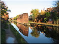
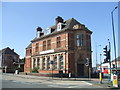
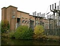
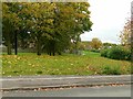
Photos of B18 7QP


Area Information
Living in B18 7QP means being part of a compact residential cluster within Birmingham’s Ladywood Ward, a historically significant inner-city district. With a population of 2,103, the area is small but densely populated, reflecting its role as a core part of Birmingham’s urban fabric. The ward encompasses parts of the city centre, including landmarks like the Council House and Town Hall, and is bordered by areas such as Hockley and Lee Bank. Despite its proximity to central Birmingham, the area retains a distinct character shaped by its history of redevelopment, including the clearance of 19th-century slums in the 1960s. Today, B18 7QP is a place where daily life is defined by urban convenience, with nearby retail, transport hubs, and a mix of housing stock. However, its inner-city location means it shares challenges common to such areas, including higher crime rates and a legacy of social issues. For those seeking a compact, accessible urban environment, B18 7QP offers proximity to Birmingham’s cultural and administrative heart, though its character is as much defined by its constraints as its opportunities.
- Area Type
- Postcode
- Area Size
- Not available
- Population
- 2103
- Population Density
- 3499 people/km²
The property market in B18 7QP is characterised by a low home ownership rate of 27%, suggesting that the area is more rental-oriented than owner-occupied. The predominant accommodation type is houses, which is notable in a densely urban setting and may indicate a mix of older, larger properties and newer developments. This combination of housing stock could appeal to families seeking more space than typical city flats, but it also means the market is likely limited in scale, with fewer properties available for sale. For buyers, this small area’s property landscape may be competitive, with limited options and a focus on rental properties. The presence of houses rather than apartments may also mean that the area is less suited to younger buyers or those seeking investment properties. Prospective purchasers should consider the area’s urban context, where property values may be influenced by proximity to transport and amenities, as well as the broader challenges of inner-city living.
House Prices in B18 7QP
No properties found in this postcode.
Energy Efficiency in B18 7QP
Residents of B18 7QP have access to a range of amenities within practical reach, including retail options such as Tesco Hockley, Lidl Winson, and Tesco Birmingham. These stores provide essential shopping and grocery needs, reducing the need for longer trips. The area’s proximity to rail and metro stations, such as Jewellery Quarter and Birmingham Snow Hill, enhances connectivity to Birmingham’s cultural and commercial hubs. While the data does not mention parks or leisure facilities, the urban setting suggests that green spaces may be limited, requiring residents to travel to nearby areas for recreation. The presence of multiple retail outlets and transport links contributes to a convenient, though compact, lifestyle. However, the area’s character is defined by its density and historical context, which may influence the availability of leisure options. For those prioritising accessibility over expansive amenities, B18 7QP offers a mix of urban convenience and proximity to the city’s core.
Amenities
Schools
Residents of B18 7QP have access to two primary schools with good Ofsted ratings: Barford Primary School and St Patrick and St Edmund’s Catholic Primary School. Both institutions are well-regarded, offering a solid foundation for young children’s education. The presence of two primary schools within the area provides families with options, though no secondary schools are listed in the data. This means parents may need to consider nearby districts for secondary education. The availability of two primary schools with good ratings is a positive factor for families prioritising early education, but the lack of secondary school data suggests that proximity to higher education institutions may be a consideration for long-term planning. The schools’ ratings indicate a commitment to quality teaching, which can be a key factor in choosing a home in this area.
| Rank | School | Type | Entry gender | Ages |
|---|
Explore more schools in this area
Go to Schools tabDemographics
The community in B18 7QP is predominantly composed of adults aged 30–64, with a median age of 47. This suggests a population skewed towards middle-aged individuals, likely including families and professionals. Home ownership is relatively low at 27%, indicating that a significant portion of residents are renters, which may reflect the area’s history of public housing and redevelopment. The accommodation type is primarily houses, which is unusual for a densely urban area, hinting at a mix of older, larger properties and newer developments. The predominant ethnic group is White, though no data is provided on other demographics. The age profile and home ownership rate suggest a community that may be more transient or reliant on rental markets, with limited intergenerational diversity. The absence of specific deprivation data means it is difficult to assess how economic factors influence quality of life, but the low home ownership rate and age distribution point to a population that may prioritise affordability over long-term investment.
Household Size
Accommodation Type
Tenure
Ethnic Group
Religion
Household Composition
Age
Household Deprivation
NS-SEC
Explore more demographic insights in this area
Go to Demographics tabPlanning
Planning Constraints
- Flood RiskPremium
- Ramsar Wetland SitesPremium
- Area of Outstanding Natural BeautyPremium
- Protected Nature ReservePremium
- Protected WoodlandPremium