Area Overview for B18 7QA
Photos of B18 7QA


Area Information
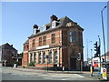
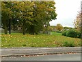
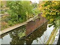
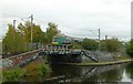
Living in B18 7QA, a small residential cluster in north-west Birmingham, offers a blend of urban proximity and historical character. Situated in the North Edgbaston ward, this area lies just south-west of the city centre, historically part of Warwickshire. With a population of 2,103, it is a compact community that retains echoes of its 19th-century heritage, when the Gough-Calthorpe and Gillott families shaped its development to exclude industrialisation. Today, it is a quiet residential enclave, bordered by Birmingham’s bustling core yet distinct in its tree-lined streets and low-density housing. The area’s proximity to landmarks like Edgbaston Hall and the Edgbaston Pool, a Site of Special Scientific Interest, adds to its unique charm. Residents benefit from easy access to Birmingham’s transport networks, including nearby railway stations and metro stops, while the ward’s low flood risk and absence of protected natural areas suggest a relatively straightforward planning environment. For those seeking a balance between city life and a sense of place, B18 7QA provides a focused, manageable community with clear links to the city’s broader fabric.
- Area Type
- Postcode
- Area Size
- Not available
- Population
- 2103
- Population Density
- 3499 people/km²
The property market in B18 7QA is characterised by a low home ownership rate of 27%, suggesting that the area is primarily a rental market rather than one dominated by owner-occupied homes. This aligns with the predominance of houses as the primary accommodation type, which may indicate a mix of larger properties suited to families or individuals seeking more space. The small population and compact nature of the area suggest limited housing turnover, potentially making it a niche market for buyers seeking specific properties. However, the low home ownership rate implies competition for available homes, particularly for those prioritising long-term investment. The focus on houses rather than flats may appeal to buyers seeking traditional housing stock, though the small size of the area means that property choices are likely limited to a handful of options. For those considering the area, understanding the rental dynamics and the potential for property appreciation in a low-ownership environment is crucial.
House Prices in B18 7QA
No properties found in this postcode.
Energy Efficiency in B18 7QA
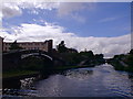
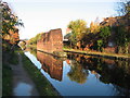
The lifestyle in B18 7QA is shaped by its proximity to retail, transport, and green spaces. Nearby amenities include five retail outlets such as Tesco Hockley, Lidl Winson, and Tesco Birmingham, offering everyday shopping convenience. The area’s rail and metro connections, including stations at Jewellery Quarter and Edgbaston Village, provide swift access to Birmingham’s cultural and commercial districts. While specific parks or leisure facilities are not detailed in the data, the ward’s historical ties to Edgbaston Pool—a Site of Special Scientific Interest—suggest nearby natural spaces for recreation. The mix of retail and transport options supports a practical, accessible daily life, though the absence of dedicated leisure venues means residents may need to travel for larger events or dining choices. The compact nature of the area ensures that amenities are within walking or short transit distance, contributing to a convenient, low-stress lifestyle.
Amenities
Schools
Residents of B18 7QA have access to two primary schools within practical reach: Barford Primary School and St Patrick and St Edmund’s Catholic Primary School. Both institutions hold an Ofsted rating of ‘good’, reflecting satisfactory standards in education and student outcomes. The presence of two primary schools suggests a family-friendly environment, though no secondary schools are listed in the data. For parents, the availability of two primary options provides choice, though the absence of secondary school data means families may need to consider commuting for higher education. The ‘good’ Ofsted ratings indicate that both schools meet acceptable benchmarks in teaching quality and pupil progress, though further details on specific subjects or extracurricular activities are not provided. The proximity of these schools to residential areas enhances the area’s appeal for families prioritising accessible education.
| Rank | School | Type | Entry gender | Ages |
|---|
Explore more schools in this area
Go to Schools tabDemographics
The population of B18 7QA is 2,103, with a median age of 47 and the majority of residents aged 30–64. This suggests a mature, stable community with a strong presence of middle-aged adults. Home ownership in the area is relatively low at 27%, indicating that rental properties dominate the housing stock. The primary accommodation type is houses, which contrasts with the higher proportion of flats typically found in urban centres. The predominant ethnic group is White, though specific data on diversity is not provided. The age profile and home ownership figures imply a community that may be more transient or reliant on rental markets. With no data on deprivation levels, it is unclear how economic pressures might affect quality of life, but the age range suggests a population likely focused on established careers and family life. The absence of specific figures on household composition or income brackets means broader demographic trends remain unexplored.
Household Size
Accommodation Type
Tenure
Ethnic Group
Religion
Household Composition
Age
Household Deprivation
NS-SEC
Explore more demographic insights in this area
Go to Demographics tabPlanning
Planning Constraints
- Flood RiskPremium
- Ramsar Wetland SitesPremium
- Area of Outstanding Natural BeautyPremium
- Protected Nature ReservePremium
- Protected WoodlandPremium