Area Overview for B18 7AB
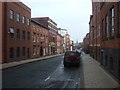
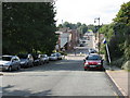
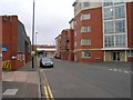
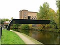
Photos of B18 7AB


Area Information
Living in B18 7AB means residing in a small, tightly packed residential cluster within Birmingham’s Ladywood Ward. With a population of 1,922, this area is part of a historically significant district that once encompassed the city’s core, including landmarks like the Council House and Town Hall. The area’s character is shaped by its urban density and proximity to central Birmingham, offering access to key city amenities while retaining a distinct local identity. Residents benefit from nearby retail hubs such as Tesco Hockley and Lidl Winson, as well as frequent rail and metro services connecting to major stations like Birmingham Snow Hill. However, the area’s history includes periods of deprivation, with social challenges persisting in some pockets. Despite this, B18 7AB remains a practical choice for those prioritising connectivity and affordability, though its compact size means housing options are limited to flats, reflecting a rental-dominated market. The presence of the BOA Stage and Screen Production Academy underscores a focus on post-secondary education, though families with younger children may need to look further afield for primary schooling.
- Area Type
- Postcode
- Area Size
- Not available
- Population
- 1922
- Population Density
- 6792 people/km²
The property market in B18 7AB is characterised by a high proportion of rental properties, with only 18% of homes owned by residents. This suggests that the area is not a traditional buyers’ market but rather one where flats dominate the housing stock. The prevalence of flats, a legacy of mid-20th-century social housing, means that most properties are purpose-built for multi-occupancy rather than single-family living. For buyers, this implies limited availability of owner-occupied homes and a focus on secondary residences or investment properties. The compact nature of the postcode, covering a small residential cluster, further restricts the range of options. Those seeking larger homes or land may need to look beyond the immediate area. The rental market’s dominance also means that property values are likely influenced by broader Birmingham trends rather than localised demand.
House Prices in B18 7AB
No properties found in this postcode.
Energy Efficiency in B18 7AB
Daily life in B18 7AB is shaped by its proximity to retail, transport, and urban amenities. Nearby shops include Tesco Hockley, Lidl Winson, and Tesco Birmingham, offering a range of grocery and convenience options. The area’s rail and metro stations—such as Five Ways and Edgbaston Village—provide frequent services to central Birmingham and beyond, making commuting efficient. While parks and green spaces are not explicitly mentioned in the data, the area’s historical ties to Ladywood suggest a legacy of urban regeneration that may include public spaces. The presence of landmarks like the Council House and Town Hall adds to the district’s cultural fabric. However, the lack of specific parks or leisure facilities in the data means that residents may need to travel for outdoor recreation. The combination of retail, transport, and city-centre access creates a functional, though densely packed, lifestyle.
Amenities
Schools
The nearest school to B18 7AB is the BOA Stage and Screen Production Academy, a sixth-form college specialising in performance and media education. No primary or secondary schools are listed in the data, which may pose challenges for families with younger children. The absence of schools catering to younger age groups suggests that residents must travel to nearby wards for primary or secondary education. This lack of local schooling could impact the area’s appeal to families prioritising convenience. However, the presence of a sixth-form institution indicates a focus on post-16 education, potentially attracting students pursuing vocational or creative pathways. Prospective buyers should consider the proximity of schools in adjacent areas when evaluating the suitability of B18 7AB for family living.
| Rank | School | Type | Entry gender | Ages |
|---|
Explore more schools in this area
Go to Schools tabDemographics
The population of B18 7AB has a median age of 47, with the majority of residents falling in the 30–64 age range. Home ownership is low at 18%, indicating that most households are likely to be renters. The accommodation type is predominantly flats, a legacy of post-war housing developments that have since seen many units demolished or repurposed. The predominant ethnic group is Black_total, reflecting the area’s demographic makeup. This statistic, combined with historical data on social deprivation, suggests a community shaped by economic challenges and urban regeneration efforts. While no specific deprivation scores are provided, the low home ownership rate and focus on rental housing imply limited long-term investment in property. The age profile suggests a mature population, potentially with established careers and families, though the absence of data on household composition means assumptions about family structures remain speculative.
Household Size
Accommodation Type
Tenure
Ethnic Group
Religion
Household Composition
Age
Household Deprivation
NS-SEC
Explore more demographic insights in this area
Go to Demographics tabPlanning
Planning Constraints
- Flood RiskPremium
- Ramsar Wetland SitesPremium
- Area of Outstanding Natural BeautyPremium
- Protected Nature ReservePremium
- Protected WoodlandPremium