Area Overview for B18 6LD
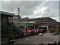
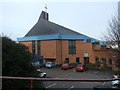
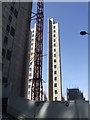
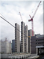
Photos of B18 6LD


Area Information
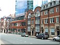
Living in B18 6LD means being part of a small residential cluster in central England, nestled within the historic Jewellery Quarter of Birmingham. With a population of just 1,482, this area is compact yet steeped in industrial heritage. The Jewellery Quarter, once a 18th-century manufacturing hub for jewellery and metalwork, now blends historic architecture with modern innovation. Residents here benefit from proximity to landmarks like St Paul’s Church and the Museum of the Jewellery Quarter, which highlights the area’s legacy as a centre for craftsmanship. Daily life is shaped by the area’s compact size, with amenities and transport links within easy reach. The community is young, with a median age of 22, reflecting a demographic skewed towards students and young professionals. While the area retains its Victorian and Edwardian character, it also supports contemporary needs, including retail and transport networks that connect to Birmingham’s broader urban fabric. For those seeking a mix of history and practicality, B18 6LD offers a unique slice of Birmingham’s evolving identity.
- Area Type
- Postcode
- Area Size
- Not available
- Population
- 1482
- Population Density
- 3933 people/km²
The property market in B18 6LD is characterised by low home ownership, with just 21% of residents owning their homes. This suggests a rental-dominated market, typical of smaller urban clusters with limited housing stock. The predominant accommodation type is flats, which aligns with the area’s compact size and historical development as a residential and industrial zone. Flats in this area are likely to be older properties, reflecting the Victorian and Edwardian architecture prevalent in the Jewellery Quarter. For buyers, this means limited opportunities for owner-occupation, with the market skewed towards short-term rentals or investment properties. The small population and focus on flats also indicate that the area may not be ideal for families seeking larger homes, though its proximity to Birmingham’s transport and amenities could appeal to those prioritising convenience over space.
House Prices in B18 6LD
No properties found in this postcode.
Energy Efficiency in B18 6LD
Residents of B18 6LD enjoy a range of amenities within practical reach. The area’s rail stations, including Jewellery Quarter and Birmingham Snow Hill, provide swift access to Birmingham’s urban core, while metro stations like St Paul’s and Centenary Square offer convenient local travel. Retail options such as Tesco Birmingham and Morrisons Daily cater to daily shopping needs. The proximity to landmarks like St Paul’s Church and the Museum of the Jewellery Quarter adds cultural value to the area. Though the data does not specify parks or leisure facilities, the historic character of the Jewellery Quarter suggests a mix of architectural heritage and community spaces. The compact size of the area means amenities are closely clustered, offering convenience without the need for long commutes. This blend of transport, retail, and heritage contributes to a lifestyle that balances practicality with historical richness.
Amenities
Schools
The nearest school to B18 6LD is Values Academy, a special school catering to students with specific educational needs. No other schools are listed in the data, so families with children requiring mainstream education may need to look beyond the immediate area. The presence of a special school suggests that the community includes residents with diverse family structures, though it does not provide a full range of educational options. Parents seeking a broader selection of schools would need to consider nearby wards or commuting to other parts of Birmingham. The lack of data on school ratings or performance means further research would be necessary to assess the quality of education available.
| Rank | School | Type | Entry gender | Ages |
|---|
Explore more schools in this area
Go to Schools tabDemographics
The community in B18 6LD is predominantly young, with a median age of 22 and the most common age range being 15–29 years. This suggests a population skewed towards students, recent graduates, and young professionals. Home ownership is low, at 21%, indicating that the majority of residents are likely renters. The accommodation type is primarily flats, reflecting the area’s residential density. The predominant ethnic group is White, though no specific diversity statistics are provided. The young demographic profile implies a dynamic, possibly transient population, which may influence local services and amenities. With such a small population, the area’s social fabric is likely closely knit, though the low home ownership rate could indicate limited long-term investment in property. This demographic profile shapes a community focused on accessibility, affordability, and proximity to urban opportunities.
Household Size
Accommodation Type
Tenure
Ethnic Group
Religion
Household Composition
Age
Household Deprivation
NS-SEC
Explore more demographic insights in this area
Go to Demographics tabPlanning
Planning Constraints
- Flood RiskPremium
- Ramsar Wetland SitesPremium
- Area of Outstanding Natural BeautyPremium
- Protected Nature ReservePremium
- Protected WoodlandPremium