Area Overview for B18 6LA
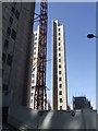
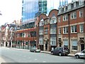
Photos of B18 6LA


Area Information
Living in B18 6LA means being part of a small, tightly knit residential cluster in central Birmingham, England. With a population of 1,482, the area is compact but rich in history, situated within the broader Jewellery Quarter Improvement District. This historic neighbourhood, once a hub of 18th- and 19th-century craftsmanship, now blends Victorian architecture with modern innovation. The area’s World Craft City status in 2025 underscores its legacy as a global centre for metalwork and jewellery. Daily life here is shaped by proximity to cultural landmarks like St. Paul’s Church and the Museum of the Jewellery Quarter, alongside a thriving retail and transport network. The community is young, with a median age of 22, and reflects a mix of students, young professionals, and families. While the area’s small size means limited housing stock, its strategic location near rail and metro lines makes it accessible to Birmingham’s wider amenities. Living here offers a balance of heritage, convenience, and a dynamic, youthful energy.
- Area Type
- Postcode
- Area Size
- Not available
- Population
- 1482
- Population Density
- 3933 people/km²
The property market in B18 6LA is defined by a 21% home ownership rate, indicating that the majority of residents rent their homes. This suggests a rental market with limited owner-occupied properties, likely concentrated in flats given the accommodation type data. The area’s small size means housing stock is limited, with few new developments to expand the market. Flats are the primary housing type, which aligns with the compact nature of the postcode and its proximity to transport hubs. For buyers, this presents challenges: the small area offers little scope for property growth, and competition for available homes may be fierce. However, the area’s historical significance and transport links could make it attractive for investors seeking rental income. Prospective buyers should consider the transient nature of the population and the potential for fluctuating demand in a market skewed towards short-term tenancies.
House Prices in B18 6LA
No properties found in this postcode.
Energy Efficiency in B18 6LA
Residents of B18 6LA have access to a range of amenities within practical reach, including major retail outlets like Tesco Birmingham and Morrisons Daily, which cater to everyday shopping needs. The area’s proximity to metro stops such as St Paul’s and Centenary Square enhances mobility, connecting residents to Birmingham’s cultural and commercial hubs. While the data does not specify parks or leisure facilities, the area’s historical character—marked by landmarks like St. Paul’s Church and the Museum of the Jewellery Quarter—adds cultural depth to daily life. The blend of historic architecture and modern retail creates a convenient, dynamic environment. However, the lack of detailed information on leisure options means residents may need to venture slightly beyond the postcode for gyms, cafes, or green spaces. The area’s compact size ensures that essential services are close, though the absence of specific leisure amenities may require additional planning for recreation.
Amenities
Schools
The only school explicitly listed near B18 6LA is Values Academy, a special school. While no Ofsted rating is provided, the presence of a special school indicates that the area caters to specific educational needs, potentially attracting families with children requiring tailored support. However, the absence of mainstream schools like primary or secondary institutions may require families to look beyond the immediate vicinity for broader educational options. This could be a consideration for parents prioritising a range of school types. The data does not mention other schools, so it is unclear whether additional educational facilities exist within a practical commuting distance. For families seeking a comprehensive school system, the area’s limited school diversity may necessitate a broader search.
| Rank | School | Type | Entry gender | Ages |
|---|
Explore more schools in this area
Go to Schools tabDemographics
B18 6LA has a median age of 22, with the majority of residents aged 15–29. This young demographic shapes the area’s character, reflecting a community of students, recent graduates, and early-career professionals. Home ownership is low at 21%, suggesting a rental-dominated market, with flats being the predominant accommodation type. The White ethnic group constitutes the largest proportion of the population, though specific diversity statistics are not provided. The high proportion of young adults indicates a transient population, which may affect the stability of local services and amenities. While the data does not quantify deprivation levels, the low home ownership rate and reliance on rental housing could influence the area’s affordability and long-term investment potential. The presence of a special school, Values Academy, also suggests a focus on tailored educational needs within the community.
Household Size
Accommodation Type
Tenure
Ethnic Group
Religion
Household Composition
Age
Household Deprivation
NS-SEC
Explore more demographic insights in this area
Go to Demographics tabPlanning
Planning Constraints
- Flood RiskPremium
- Ramsar Wetland SitesPremium
- Area of Outstanding Natural BeautyPremium
- Protected Nature ReservePremium
- Protected WoodlandPremium