Area Overview for B18 5SL
Photos of B18 5SL
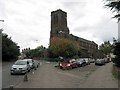
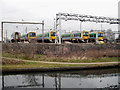

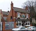
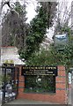
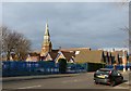

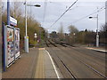

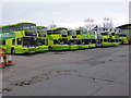
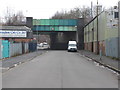

100 photos from this area
Area Information
Key information about the B18 5SL including its size, population, and administrative classification.
- Area Type
- Postcode
- Area Size
- 1.2 hectares
- Population
- 2097
- Population Density
- 3541 people/km²
House Prices in B18 5SL
48
Properties
£159,646
Average Sold Price
£115,950
Lowest Price
£245,000
Highest Price
Showing 48 properties
| Address | Type | Beds | Baths | Last Sale Price | Last Sale Date | |
|---|---|---|---|---|---|---|
| 52 Anchor Crescent, Birmingham, B18 5SL | Terraced | 3 | 2 | £191,000 | May 2024 | |
| 11 Anchor Crescent, Birmingham, B18 5SL | house | - | - | £245,000 | May 2022 | |
| 56 Anchor Crescent, Birmingham, B18 5SL | Terraced | 3 | 1 | £167,500 | Jul 2021 | |
| 15 Anchor Crescent, Birmingham, B18 5SL | Semi-detached | 1 | 1 | £207,000 | Jun 2021 | |
| 3 Anchor Crescent, Birmingham, B18 5SL | Semi-detached | 3 | 2 | £202,500 | Sep 2020 | |
| 37 Anchor Crescent, Birmingham, B18 5SL | Semi-detached | 3 | 2 | £180,000 | Sep 2020 | |
| 22 Anchor Crescent, Birmingham, B18 5SL | Semi-detached | 3 | 1 | £181,000 | May 2018 | |
| 60 Anchor Crescent, Birmingham, B18 5SL | Semi-detached | 3 | 2 | £175,000 | Apr 2018 | |
| 38 Anchor Crescent, Birmingham, B18 5SL | Semi-detached | 3 | 2 | £170,000 | Nov 2017 | |
| 45 Anchor Crescent, Birmingham, B18 5SL | Terraced | 3 | 3 | £168,000 | Nov 2017 |
Page 1 of 5
Energy Efficiency in B18 5SL
Amenities
Schools
| Rank | School | Type | Entry gender | Ages |
|---|
Explore more schools in this area
Go to Schools tabDemographics
Household Size
One person
most common
Accommodation Type
Houses
most common
Tenure
34
majority
Ethnic Group
black_total
most common
Religion
N/A
most common
Household Composition
N/A
most common
Age
47
median
Adults (30-64 years)
most common
Household Deprivation
N/A
with no deprivation
NS-SEC
20
in Lower managerial occupations
Explore more demographic insights in this area
Go to Demographics tabPlanning
Planning Constraints
- Flood RiskPremium
- Ramsar Wetland SitesPremium
- Area of Outstanding Natural BeautyPremium
- Protected Nature ReservePremium
- Protected WoodlandPremium