Area Overview for B18 5QS
Photos of B18 5QS

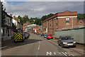
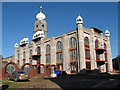
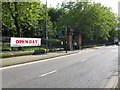
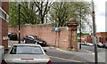
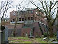
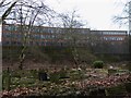
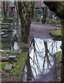
100 photos from this area
Area Information
Key information about the B18 5QS including its size, population, and administrative classification.
- Area Type
- Postcode
- Area Size
- 1.4 hectares
- Population
- 2097
- Population Density
- 3541 people/km²
House Prices in B18 5QS
40
Properties
£93,036
Average Sold Price
£37,000
Lowest Price
£161,000
Highest Price
Showing 40 properties
| Address | Type | Beds | Baths | Last Sale Price | Last Sale Date | |
|---|---|---|---|---|---|---|
| 54 Abbey Street, Birmingham, B18 5QS | Maisonette | - | - | £74,000 | Aug 2022 | |
| 47 Abbey Street, Birmingham, B18 5QS | Terraced | 3 | 1 | £109,900 | Nov 2017 | |
| 9 Abbey Street, Birmingham, B18 5QS | Terraced | 4 | 2 | £161,000 | Sep 2016 | |
| 19 Abbey Street, Birmingham, B18 5QS | Terraced | 4 | - | £110,000 | Dec 2015 | |
| 1 Abbey Street, Birmingham, B18 5QS | Terraced | 4 | 1 | £88,500 | Mar 2015 | |
| 45 Abbey Street, Birmingham, B18 5QS | Terraced | 3 | 1 | £86,000 | Jun 2014 | |
| 33 Abbey Street, Birmingham, B18 5QS | house | 3 | - | £85,000 | Oct 2012 | |
| 17 Abbey Street, Birmingham, B18 5QS | house | - | - | £129,000 | Dec 2009 | |
| 25 Abbey Street, Birmingham, B18 5QS | house | - | - | £106,000 | Jun 2006 | |
| 3 Abbey Street, Birmingham, B18 5QS | Terraced | - | - | £37,000 | Nov 1998 |
Page 1 of 4
Energy Efficiency in B18 5QS
Amenities
Schools
| Rank | School | Type | Entry gender | Ages |
|---|
Explore more schools in this area
Go to Schools tabDemographics
Household Size
One person
most common
Accommodation Type
Houses
most common
Tenure
34
majority
Ethnic Group
black_total
most common
Religion
N/A
most common
Household Composition
N/A
most common
Age
47
median
Adults (30-64 years)
most common
Household Deprivation
N/A
with no deprivation
NS-SEC
20
in Lower managerial occupations
Explore more demographic insights in this area
Go to Demographics tabPlanning
Planning Constraints
- Flood RiskPremium
- Ramsar Wetland SitesPremium
- Area of Outstanding Natural BeautyPremium
- Protected Nature ReservePremium
- Protected WoodlandPremium