Area Overview for B18 5PZ
Photos of B18 5PZ


Area Information
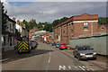
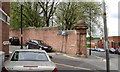
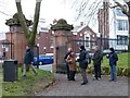
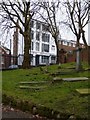
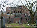
Living in B18 5PZ means being part of a tightly knit residential cluster nestled within Birmingham’s historic Jewellery Quarter. This postcode area covers just 1,019 m², housing 1,581 people in a densely populated space. The area’s character is shaped by its proximity to the broader Jewellery Quarter, a district renowned for its 18th-century industrial heritage and recent designation as a World Craft City. Daily life here blends historical architecture with modern amenities, from independent shops to transport links. The population density of 1.55 million people per km² reflects a compact, urban environment where community ties are strong. Residents benefit from proximity to the Quarter’s cultural landmarks, such as St Paul’s Church and the Museum of the Jewellery Quarter, while the area’s small size ensures a sense of familiarity. Despite its density, B18 5PZ retains a distinct identity, with a focus on craftsmanship and heritage that permeates local businesses and social networks. For buyers, this area offers a unique mix of historical charm and practical urban living, though the high population density may influence property availability and lifestyle choices.
- Area Type
- Postcode
- Area Size
- 1019 m²
- Population
- 1581
- Population Density
- 4240 people/km²
The property market in B18 5PZ is characterised by low home ownership (29%), suggesting a rental-dominated market rather than one focused on owner-occupation. The predominant accommodation type is houses, but the area’s small size (1,019 m²) and high population density (1.55 million per km²) imply that these are likely compact, possibly terraced or semi-detached homes. This dynamic creates a competitive rental market, with limited scope for large-scale property development. For buyers, the area’s small footprint means properties are scarce, and those available may be more suited to investors seeking long-term rentals than to first-time buyers seeking family homes. The high density also means proximity to amenities is a key advantage, though property values may be influenced by the area’s historical industrial legacy and its appeal to those prioritising convenience over space.
House Prices in B18 5PZ
Showing 1 properties
| Address | Type | Beds | Baths | Last Sale Price | Last Sale Date | |
|---|---|---|---|---|---|---|
| 404 Lodge Road, Soho All Saints, Birmingham, B18 5PZ | shop | - | - | - | - |
Energy Efficiency in B18 5PZ
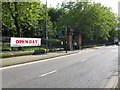
Residents of B18 5PZ enjoy a mix of retail, dining, and transport options within walking distance. Nearby, Tesco Birmingham and Morrisons Daily provide essential shopping, while the area’s rail and metro stations connect to Birmingham’s vibrant cultural and commercial districts. The Jewellery Quarter itself offers historic landmarks, such as St Paul’s Church and the Museum of the Jewellery Quarter, which combine heritage with modern leisure. The compact size of the postcode area ensures that amenities are conveniently located, reducing the need for long commutes. For daily life, the blend of retail, transport, and cultural sites creates a dynamic environment where residents can access both practical necessities and recreational opportunities. The area’s proximity to the broader Jewellery Quarter also means residents can engage with its unique character, from artisan workshops to historic streets like Warstone Lane.
Amenities
Schools
Residents of B18 5PZ have access to a range of educational institutions, including Brookfields Primary School, which holds an Ofsted rating of ‘good’. This state-funded primary school is a key option for families seeking local education. Nearby, Flexible Learning School, an independent institution, also carries an Ofsted ‘good’ rating, offering an alternative to state education. Central Birmingham Education Centre, another independent school, provides further options for parents prioritising non-state schooling. The presence of both state and independent schools reflects the area’s diverse educational landscape, allowing families to choose between publicly funded and privately run institutions. These schools are within practical reach, ensuring accessibility for local residents. The ‘good’ Ofsted ratings suggest a generally high standard of education, though prospective families should consider specific curricula and school policies when making decisions.
| Rank | School | Type | Entry gender | Ages |
|---|
Explore more schools in this area
Go to Schools tabDemographics
The demographic profile of B18 5PZ is defined by a median age of 47, with adults aged 30–64 forming the largest age group. This suggests a mature, established community, likely with strong ties to local employment and services. Home ownership is low at 29%, indicating that most residents are renters, which may reflect the area’s history as a mixed-use industrial and residential zone. The predominant accommodation type is houses, though the high population density implies these are likely smaller properties or terraced homes. The predominant ethnic group is Black, reflecting the broader demographic trends of Birmingham’s historic industrial areas. While specific deprivation data is not provided, the low home ownership rate and high density may correlate with a reliance on rental housing and shared living arrangements. This profile suggests a community prioritising stability and proximity to employment, with a mix of long-term residents and those drawn to the area’s cultural and economic opportunities.
Household Size
Accommodation Type
Tenure
Ethnic Group
Religion
Household Composition
Age
Household Deprivation
NS-SEC
Explore more demographic insights in this area
Go to Demographics tabPlanning
Planning Constraints
- Flood RiskPremium
- Ramsar Wetland SitesPremium
- Area of Outstanding Natural BeautyPremium
- Protected Nature ReservePremium
- Protected WoodlandPremium