Area Overview for B18 5NW
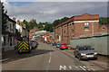
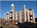
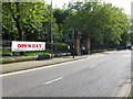
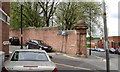
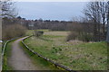
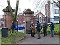
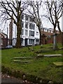
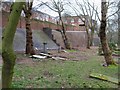
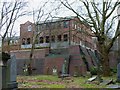
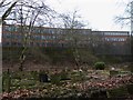
Photos of B18 5NW


Area Information
Living in B18 5NW means being part of a small, tightly knit residential cluster in central Birmingham, England. With a population of 2,097, this postcode area is a microcosm of the broader Jewellery Quarter, a historic district renowned for its craftsmanship legacy. The area’s character is shaped by its industrial past, with Victorian and Edwardian architecture still visible on streets like Warstone Lane. Daily life here blends heritage with modernity, offering proximity to landmarks such as St Paul’s Church and the Museum of the Jewellery Quarter. Residents benefit from a mix of retail, transport, and cultural amenities, including nearby metro stations, rail links, and independent shops. The community is predominantly composed of adults aged 30–64, reflecting a mature demographic that values the area’s historical significance and practical connectivity. While the population is small, the area’s strategic location within Birmingham ensures access to broader city resources, making it a compelling choice for those seeking a balance between tradition and convenience.
- Area Type
- Postcode
- Area Size
- Not available
- Population
- 2097
- Population Density
- 3541 people/km²
The property market in B18 5NW is defined by a 34% home ownership rate, indicating that a majority of properties are rented rather than owner-occupied. This suggests a rental-focused market, which may appeal to professionals or families seeking flexibility. The predominant accommodation type is houses, reflecting a residential area with more spacious, traditional properties rather than flats or apartments. Given the small population and limited area size, the housing stock is likely limited in scale, with fewer new developments. For buyers, this means a niche market with a focus on existing homes, often with historic features. The lower home ownership rate may also imply competition for rental properties, particularly in a desirable area like the Jewellery Quarter. Prospective buyers should consider the area’s limited size and the potential for a smaller pool of available properties, especially for those seeking owner-occupied homes.
House Prices in B18 5NW
No properties found in this postcode.
Energy Efficiency in B18 5NW
Residents of B18 5NW have access to a variety of amenities within practical reach. The area’s metro and rail stations, including Soho Benson Road and Five Ways, provide easy access to Birmingham’s transport network. Retail options such as Tesco Hockley and Iceland Handsworth cater to daily shopping needs, while nearby independent shops and cafes contribute to a vibrant local economy. The proximity to the Jewellery Quarter’s historic sites, such as St Paul’s Church and the Museum of the Jewellery Quarter, adds cultural value to daily life. Parks and open spaces are not explicitly mentioned in the data, but the area’s historic streets and architectural landmarks suggest a blend of urban convenience and heritage charm. This mix of practical amenities and historical character creates a lifestyle that balances modern needs with the area’s unique identity.
Amenities
Schools
Near B18 5NW, families have access to a range of school types, though quality varies. St Edmund’s Catholic Primary School is a primary institution, while City Hospital Teaching Unit serves special educational needs. Future First Independent School, an independent school, has an Ofsted rating of inadequate, raising concerns about its standards. In contrast, Orion School, another independent option, holds a good Ofsted rating, offering a more reliable educational environment. The mix of school types provides choice but highlights disparities in quality. Parents seeking independent education must weigh the risks of Future First against the stronger performance of Orion. For primary education, St Edmund’s offers a conventional option, though its performance is not specified. The presence of both state and independent schools reflects the area’s diversity but underscores the need for careful research when selecting a school for children.
| Rank | A + A* % | School | Type | Entry gender | Ages |
|---|---|---|---|---|---|
| 1 | N/A | St Edmund's Catholic Primary School | primary | N/A | N/A |
| 2 | N/A | City Hospital Teaching Unit | special | N/A | N/A |
| 3 | N/A | Future First Independent School | independent | N/A | N/A |
| 4 | N/A | Orion School | independent | N/A | N/A |
Explore more schools in this area
Go to Schools tabDemographics
The population of B18 5NW is 2,097, with a median age of 47, indicating a mature demographic. The most common age range is adults aged 30–64, suggesting a community focused on stability and long-term residency. Home ownership stands at 34%, below the national average, implying a higher proportion of rental properties. The predominant accommodation type is houses, reflecting a residential cluster with more traditional housing stock. The area’s predominant ethnic group is Black_total, highlighting its cultural diversity. This demographic profile shapes the area’s social dynamics, with a strong presence of established families and professionals. While the data does not specify deprivation levels, the lower home ownership rate may indicate a reliance on rental markets, which could influence local services and amenities. The community’s age profile also suggests a demand for mature, well-maintained housing, aligning with the area’s historic character.
Household Size
Accommodation Type
Tenure
Ethnic Group
Religion
Household Composition
Age
Household Deprivation
NS-SEC
Explore more demographic insights in this area
Go to Demographics tabPlanning
Planning Constraints
- Flood RiskLocked
- Ramsar Wetland SitesLocked
- Area of Outstanding Natural BeautyLocked
- Protected Nature ReserveLocked
- Protected WoodlandLocked
- Crime RiskLocked