Area Overview for B18 5NL
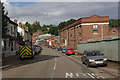
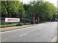
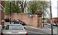
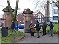
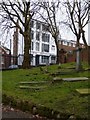
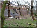
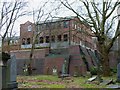
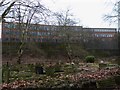
Photos of B18 5NL


Area Information
Living in B18 5NL means being part of a densely populated, historically rich postcode in central Birmingham. The area covers 4,090 square metres and is home to 2,097 residents, translating to a population density of over 512,000 people per square kilometre. This small cluster lies within the broader Jewellery Quarter, a historic district renowned for its 18th-century industrial heritage and World Craft City status. The area retains its Victorian and Edwardian architecture, with streets like Warstone Lane preserving the Quarter’s character. Daily life here blends heritage with modern convenience, offering proximity to rail and metro stations, retail hubs, and a mix of independent and specialist shops. While the population is relatively small, the area’s compact size means amenities are within easy reach. However, the high density and historical legacy also mean living here requires navigating a tightly packed urban environment, where every square metre is accounted for. For those seeking a compact, historically significant postcode with direct access to Birmingham’s cultural and transport networks, B18 5NL offers a unique blend of past and present.
- Area Type
- Postcode
- Area Size
- 4090 m²
- Population
- 2097
- Population Density
- 3541 people/km²
The property market in B18 5NL is characterised by a low home ownership rate of 34%, suggesting that the area is more rental-oriented than owner-occupied. Despite this, the predominant accommodation type is houses, which is notable in a high-density postcode. This mix may indicate a combination of older, family-sized homes and newer developments catering to renters. The small area size and high population density mean the housing stock is limited, with little scope for expansion. For buyers, this suggests a niche market where properties are likely to be in high demand, particularly for those seeking a house in a historically significant part of Birmingham. However, the low home ownership rate also means competition for available properties could be fierce, and buyers may face challenges in securing long-term tenure. The area’s compact nature means proximity to amenities is a key selling point, though the limited space may restrict the types of properties available.
House Prices in B18 5NL
Showing 1 properties
| Address | Type | Beds | Baths | Last Sale Price | Last Sale Date | |
|---|---|---|---|---|---|---|
| C A P Productions Ltd, The Crescent, Birmingham, B18 5NL | Office | - | - | - | - |
Energy Efficiency in B18 5NL
The lifestyle in B18 5NL is shaped by its proximity to retail, transport, and historical landmarks. Nearby amenities include major retailers like Tesco Birmingham and Morrisons Daily, ensuring everyday shopping needs are met within walking distance. The area’s rail and metro connections provide seamless access to Birmingham’s cultural and commercial centres, while its location in the Jewellery Quarter offers unique heritage experiences, such as St Paul’s Church and the Museum of the Jewellery Quarter. The compact size of the postcode means residents can access these amenities without long journeys, though the high population density may limit green spaces. The mix of historic architecture and modern retail creates a dynamic environment, blending tradition with convenience. For those valuing accessibility and a rich historical backdrop, B18 5NL offers a distinctive urban lifestyle.
Amenities
Schools
Near B18 5NL are several schools catering to different needs. St Edmund’s Catholic Primary School is a primary institution, while the City Hospital Teaching Unit serves special educational requirements. For independent schooling, Future First Independent School has an Ofsted rating of inadequate, which may raise concerns for families seeking high-quality private education. In contrast, Orion School, also independent, holds a good Ofsted rating, offering a more reliable option for those prioritising academic standards. The mix of school types provides choice, but the presence of an inadequate-rated school highlights variability in educational quality. Families should consider visiting schools and reviewing Ofsted reports to ensure alignment with their child’s needs. The area’s schools reflect both the diversity of educational provision and the challenges of maintaining consistent standards across different institutions.
| Rank | School | Type | Entry gender | Ages |
|---|
Explore more schools in this area
Go to Schools tabDemographics
The residents of B18 5NL have an average age of 47, with the majority falling within the 30–64 age range. This suggests a mature, established community, likely with long-term ties to the area. Home ownership is relatively low at 34%, indicating that a significant portion of the population rents their homes. The predominant accommodation type is houses, which is unusual for a high-density urban postcode, suggesting a mix of traditional and newer housing stock. The area’s predominant ethnic group is Black residents, reflecting the broader demographic trends of central Birmingham. While specific deprivation data is not provided, the low home ownership rate and high population density may point to a community where rental affordability and housing availability are key considerations. The age profile implies a population that may be more focused on stability than rapid growth, with fewer young families compared to other parts of the city.
Household Size
Accommodation Type
Tenure
Ethnic Group
Religion
Household Composition
Age
Household Deprivation
NS-SEC
Explore more demographic insights in this area
Go to Demographics tabPlanning
Planning Constraints
- Flood RiskPremium
- Ramsar Wetland SitesPremium
- Area of Outstanding Natural BeautyPremium
- Protected Nature ReservePremium
- Protected WoodlandPremium