Area Overview for B18 5AR
Photos of B18 5AR


Area Information
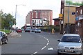
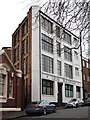
Living in B18 5AR, part of the Newtown Ward in north-west Birmingham, means being part of a compact residential cluster with a population of 1,968. Situated near the A34 road and bordered by areas such as the Jewellery Quarter and the University of Aston, this postcode is a legacy of post-war redevelopment. The area is defined by its tower block estate, a remnant of the 1968 Aston New Town project, which included 16 high-rise buildings. While some have been demolished, the remaining structures still shape the landscape. Daily life here is influenced by its proximity to Birmingham’s ring roads and rail networks, offering connectivity to the city centre and beyond. The community is diverse, with a median age of 22, though the most common age range is 30–64. This blend of younger and middle-aged residents creates a dynamic but compact social environment. The area’s history of industrial decline and redevelopment means its character is a mix of practical housing and evolving infrastructure, with limited green spaces but strong transport links.
- Area Type
- Postcode
- Area Size
- Not available
- Population
- 1968
- Population Density
- Not available
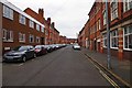
The property market in B18 5AR is dominated by flats, with 20% of homes owned by residents and 80% likely rented. This reflects the legacy of the 1968 redevelopment, which prioritised high-density housing. The area’s small size and focus on flats mean the housing stock is uniform, with limited variety in property types. For buyers, this suggests a market skewed towards rental investment rather than owner-occupation. The tower block estate, though functional, may not appeal to all buyers, particularly those seeking traditional homes. Proximity to transport hubs like the Jewellery Quarter Railway Station could offset the lack of diverse housing options. However, the limited size of B18 5AR means buyers should consider nearby areas for more varied choices.
House Prices in B18 5AR
No properties found in this postcode.
Energy Efficiency in B18 5AR
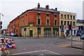
Residents of B18 5AR have access to essential amenities within practical reach. Retail options include Tesco Birmingham and Morrisons Daily, offering convenience for daily shopping. Metro stations like St Paul’s and Soho Benson Road provide easy access to Birmingham’s broader network. The area’s historical character includes venues like The Bartons Arms, a historic pub, and The Drum Arts Centre, though these are not explicitly listed in the data. The compact layout means most needs can be met locally, though the lack of green spaces or leisure facilities beyond the listed amenities may require travel to nearby areas. The mix of retail, transport, and cultural venues contributes to a functional, though not expansive, lifestyle.
Amenities
Schools
The nearest school to B18 5AR is St Francis Catholic Primary School, which has an Ofsted rating of ‘good’. This primary school serves the area’s younger residents, though no secondary schools are listed in the data. The presence of a primary school with a positive rating is a key consideration for families with young children, but parents may need to look beyond the immediate postcode for secondary education. The school’s rating suggests it meets acceptable standards, but the absence of higher education institutions nearby could be a limitation for families requiring a full range of schooling options.
| Rank | School | Type | Entry gender | Ages |
|---|
Explore more schools in this area
Go to Schools tabDemographics
B18 5AR has a median age of 22, though the most common age group is adults aged 30–64, indicating a mix of younger and middle-aged residents. Home ownership is low at 20%, suggesting the area is predominantly a rental market. The accommodation type is almost exclusively flats, reflecting the post-war tower block development. The predominant ethnic group is Black, highlighting the area’s cultural diversity. This demographic profile means the community is likely to be transient, with a high proportion of renters and a younger population. The low home ownership rate may affect long-term stability, while the flat-dominated housing stock suggests limited opportunities for owner-occupied properties. The age distribution also implies a need for services catering to both young professionals and families.
Household Size
Accommodation Type
Tenure
Ethnic Group
Religion
Household Composition
Age
Household Deprivation
NS-SEC
Explore more demographic insights in this area
Go to Demographics tabPlanning
Planning Constraints
- Flood RiskPremium
- Ramsar Wetland SitesPremium
- Area of Outstanding Natural BeautyPremium
- Protected Nature ReservePremium
- Protected WoodlandPremium