Area Overview for B18 5AE
Photos of B18 5AE


Area Information
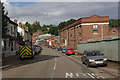
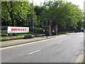
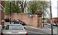
Living in B18 5AE means being part of a small, tightly knit residential cluster in central Birmingham, within the historic Jewellery Quarter Improvement District. The area has a population of 1,968, reflecting its compact nature. This postcode sits at the heart of a district renowned for its World Craft City status, blending centuries-old craftsmanship with modern innovation. The Jewellery Quarter’s industrial heritage, dating back to the 16th century, is evident in its Victorian and Edwardian architecture, particularly on Warstone Lane. Today, the area thrives as a mixed-use district, balancing heritage preservation with contemporary development. Residents benefit from proximity to landmarks like St Paul’s Church, the Museum of the Jewellery Quarter, and the Birmingham Assay Office. While the area’s population is small, its cultural and economic significance is vast, with a focus on jewellery manufacturing, heritage tourism, and creative industries. Living here offers access to a unique blend of history, skilled trades, and modern amenities, though the community remains relatively compact compared to larger urban areas.
- Area Type
- Postcode
- Area Size
- Not available
- Population
- 1968
- Population Density
- Not available
The property market in B18 5AE is characterised by a low home ownership rate of 20%, suggesting that the majority of properties are rented rather than owned. This aligns with the area’s status as a small residential cluster within a historically industrial district, where flats are the predominant accommodation type. The limited number of owner-occupied homes may reflect the area’s transient nature or its appeal to younger professionals and students. For buyers, this dynamic implies that the housing stock is largely available for rental, with limited opportunities for long-term ownership. The small size of the postcode means that property seekers may need to consider adjacent areas for a broader range of options. Flats in the area are likely to be part of larger developments or converted industrial spaces, reflecting the district’s heritage. Prospective buyers should also consider the area’s proximity to transport links and amenities, which may influence property value and desirability.
House Prices in B18 5AE
No properties found in this postcode.
Energy Efficiency in B18 5AE
Life in B18 5AE is defined by its proximity to a range of amenities within practical reach. Residents have access to five retail outlets, including Tesco Birmingham and Morrisons Daily, ensuring easy access to groceries and everyday essentials. The area’s transport links, including five railway stations and five metro stops, provide seamless connectivity to Birmingham’s wider network, supporting both daily commutes and weekend excursions. While the data does not specify parks or leisure facilities, the area’s historical character and proximity to landmarks like St Paul’s Church and the Museum of the Jewellery Quarter suggest a blend of cultural and heritage-based leisure options. The compact nature of the postcode means that amenities are concentrated, offering convenience without the sprawl of larger urban areas. This balance of accessibility and historical richness contributes to a lifestyle that is both practical and steeped in tradition.
Amenities
Schools
The nearest school to B18 5AE is St Francis Catholic Primary School, a primary school with an Ofsted rating of ‘good’. This single school serves the immediate area, though no secondary schools are listed in the data. The presence of a primary school with a positive rating is a key consideration for families with young children, as it provides access to education within walking distance. However, residents seeking secondary education may need to look beyond the postcode, as the data does not specify nearby secondary schools. The school’s rating indicates a satisfactory standard of teaching and facilities, but families should investigate further to understand the full range of educational options available. The limited number of schools in the area may reflect its small population and compact nature, but the quality of the primary school is a positive factor for prospective residents.
| Rank | School | Type | Entry gender | Ages |
|---|
Explore more schools in this area
Go to Schools tabDemographics
The demographic profile of B18 5AE is shaped by a median age of 22, with the most common age range being adults aged 30–64. This suggests a population skewed toward working-age individuals, though the low median age may reflect student or younger professional populations. Home ownership in the area is limited, with only 20% of residents owning their homes, indicating a predominantly rental market. The primary accommodation type is flats, reflecting the area’s historical development as a residential cluster within a formerly industrial zone. The predominant ethnic group is Black residents, though specific proportions are not quantified. The low home ownership rate and focus on flats suggest a transient or younger demographic, potentially influenced by the area’s proximity to employment hubs and educational institutions. However, the data does not indicate deprivation levels, so quality of life factors such as access to services and transport must be evaluated separately.
Household Size
Accommodation Type
Tenure
Ethnic Group
Religion
Household Composition
Age
Household Deprivation
NS-SEC
Explore more demographic insights in this area
Go to Demographics tabPlanning
Planning Constraints
- Flood RiskPremium
- Ramsar Wetland SitesPremium
- Area of Outstanding Natural BeautyPremium
- Protected Nature ReservePremium
- Protected WoodlandPremium
- Crime RiskPremium