Area Overview for B18 4NX
Photos of B18 4NX


Area Information
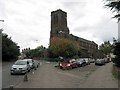
Living in B18 4NX means being part of a small, tightly knit residential cluster in England, with a population of 2098 people. This postcode area is distinct for its compact size and proximity to larger urban hubs, offering a quieter alternative to denser city centres. The community here is characterised by a median age of 47, with most residents falling within the 30-64 age range, suggesting a stable adult population. While the area is not explicitly tied to the historic Jewellery Quarter, its small footprint and residential focus make it a practical choice for those seeking a manageable, low-density living environment. Daily life here is shaped by proximity to essential services, including retail, transport links, and schools. The area’s modest size means residents are likely to know their neighbours, though the limited data on local culture or social activities means the community’s character remains largely defined by its practical amenities and infrastructure. For buyers, B18 4NX offers a snapshot of suburban living, with homes primarily in the private sector and a rental market that dominates due to low home ownership rates.
- Area Type
- Postcode
- Area Size
- Not available
- Population
- 2098
- Population Density
- 4173 people/km²
The property market in B18 4NX is defined by a low home ownership rate of 28%, suggesting that the area is predominantly a rental market rather than a buyers’ market. The accommodation type is primarily houses, which is notable for a small postcode area and may indicate a mix of semi-detached or larger properties. This contrasts with typical urban areas where flats or apartments dominate. For buyers, the limited number of owner-occupied homes could make finding a property for purchase challenging, though the presence of houses may appeal to those seeking private, spacious living. The small size of the area means that property availability is likely restricted to immediate surroundings, requiring buyers to consider nearby postcodes or larger urban centres for more options. The market’s rental focus also suggests that property values may be influenced more by demand from tenants than by long-term investment potential.
House Prices in B18 4NX
No properties found in this postcode.
Energy Efficiency in B18 4NX
Residents of B18 4NX have access to a range of amenities within practical reach, including five metro stations, five rail stations, and five retail outlets. Specific venues include Lidl Winson, M&S Midland, and Iceland Handsworth, offering everyday shopping needs. The presence of multiple transport hubs, such as Winson Green Outer Circle and Smethwick Rolfe Street Railway Station, enhances connectivity to nearby areas. While the data does not specify parks or leisure facilities, the proximity to rail and metro networks suggests easy access to larger urban amenities. The mix of retail, transport, and dining options contributes to a functional lifestyle, though the area’s small size means residents may need to venture further for more specialised services. The availability of both retail and transport infrastructure indicates a practical, convenience-focused living environment.
Amenities
Schools
The nearest school to B18 4NX is Sporting Edge Independent School, an independent institution. No Ofsted rating is provided in the data, so its academic performance remains unspecified. The presence of an independent school suggests that the area may attract families seeking private education, though the lack of state schools or further details on educational quality means buyers should investigate additional options. Families relying on state education may need to look beyond the immediate vicinity for schools, as no other institutions are listed in the data. The single school option highlights a potential limitation for those prioritising a range of educational choices.
| Rank | School | Type | Entry gender | Ages |
|---|
Explore more schools in this area
Go to Schools tabDemographics
The demographic profile of B18 4NX reflects a mature population, with a median age of 47 and the majority of residents aged between 30 and 64. This suggests a community of established professionals and families, rather than a younger or retired population. Home ownership in the area is relatively low at 28%, indicating that the majority of residents are likely to be renters. The primary accommodation type is houses, which is unusual for a small postcode area, hinting at a mix of single-family homes and possibly larger properties. The predominant ethnic group is Asian, though no further breakdown of diversity is provided. The age range and ownership statistics imply a stable, long-term resident base, but the low home ownership rate may reflect economic pressures or a transient population. For buyers, this could mean a competitive rental market and limited opportunities for property investment, though the focus on houses may appeal to those seeking private, spacious living.
Household Size
Accommodation Type
Tenure
Ethnic Group
Religion
Household Composition
Age
Household Deprivation
NS-SEC
Explore more demographic insights in this area
Go to Demographics tabPlanning
Planning Constraints
- Flood RiskPremium
- Ramsar Wetland SitesPremium
- Area of Outstanding Natural BeautyPremium
- Protected Nature ReservePremium
- Protected WoodlandPremium