Area Overview for B18 4LH
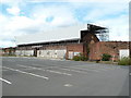
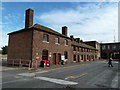
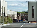
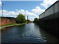
Photos of B18 4LH


Area Information
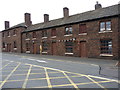
Living in B18 4LH means inhabiting a compact residential cluster in England, home to 1,736 people. This postcode area is small but distinct, with a population profile that reflects a mix of age groups. While the median age is 22, the most common age range is adults aged 30–64, suggesting a community of working-age residents. The area is characterised by a predominance of houses rather than flats, and home ownership sits at 44%, indicating a balance between owner-occupied and rental properties. B18 4LH is not a sprawling suburb but a focused neighbourhood, likely situated near Birmingham’s western fringes given proximity to nearby amenities. Daily life here is shaped by proximity to retail hubs, public transport, and schools, though the area’s size means it is not densely populated. Its small footprint may appeal to those seeking a quieter, more contained environment, though the lack of specific historical or cultural landmarks in the data suggests it is a functional, modern residential zone.
- Area Type
- Postcode
- Area Size
- Not available
- Population
- 1736
- Population Density
- 8799 people/km²
The property market in B18 4LH is defined by a 44% home ownership rate, which is below the national average, suggesting a rental-dominated market. The accommodation type is predominantly houses, which may appeal to families or those seeking more space than flats can offer. Given the area’s small size and limited housing stock, the market is likely constrained, with limited scope for new developments. Buyers should consider that the area is not expansive, meaning property values may be influenced more by proximity to amenities than by land size. The prevalence of houses could indicate a focus on traditional family homes, though the lower home ownership rate suggests competition for available properties. For those seeking a quiet, residential environment with access to nearby services, B18 4LH may offer a niche opportunity, but its small footprint limits scalability for larger housing needs.
House Prices in B18 4LH
No properties found in this postcode.
Energy Efficiency in B18 4LH
The lifestyle in B18 4LH is shaped by its proximity to retail, transport, and community hubs. Nearby shops include M&S Midland, Lidl Winson, and Farmfoods Smethwick, offering a range of grocery and retail options. Metro stations like Winson Green Outer Circle and Soho Benson Road provide easy access to local transit, while rail stations such as Smethwick Rolfe Street connect to further destinations. The area’s small size means amenities are concentrated, though residents may need to travel slightly for specialist services. The presence of multiple retail and transport points suggests a functional, accessible environment, though the lack of parks or leisure facilities in the data implies that outdoor activities may require venturing beyond the immediate postcode. Overall, daily life is convenient for those prioritising proximity to services over expansive recreational spaces.
Amenities
Schools
The nearest schools to B18 4LH include Summerfield Primary School, which serves the area’s primary education needs. No secondary schools are listed in the data, meaning families with older children may need to look beyond the immediate vicinity. The presence of a primary school suggests that the area is suitable for young families, though the lack of secondary options could be a consideration for those planning long-term residency. The school’s type is primary, but its Ofsted rating is not provided in the data, so its quality cannot be assessed here. The absence of additional schools implies that the area’s educational infrastructure is limited to early years, requiring commuters or access to nearby districts for higher education.
| Rank | School | Type | Entry gender | Ages |
|---|---|---|---|---|
| 1 | Summerfield Primary School | primary | N/A | N/A |
| 2 | Summerfield Primary School | primary | N/A | N/A |
Explore more schools in this area
Go to Schools tabDemographics
The community in B18 4LH is predominantly composed of adults aged 30–64, despite a median age of 22. This suggests a population skewed towards middle-aged residents, possibly including families or professionals. Home ownership is relatively low at 44%, indicating that nearly half of residents rent their homes. The accommodation type is largely houses, which contrasts with areas dominated by flats or apartments. The predominant ethnic group is listed as Asian_total, though no further breakdown is provided. This demographic profile implies a community with established roots, potentially influenced by migration patterns or historical settlement trends. The absence of specific deprivation data means quality of life cannot be assessed in this context, but the mix of age groups and housing types suggests a diverse, though not overly complex, social fabric.
Household Size
Accommodation Type
Tenure
Ethnic Group
Religion
Household Composition
Age
Household Deprivation
NS-SEC
Explore more demographic insights in this area
Go to Demographics tabPlanning
Planning Constraints
- Flood RiskPremium
- Ramsar Wetland SitesPremium
- Area of Outstanding Natural BeautyPremium
- Protected Nature ReservePremium
- Protected WoodlandPremium
- Crime RiskPremium