Area Overview for B18 4JJ
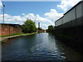
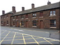
Photos of B18 4JJ


Area Information
Living in B18 4JJ means being part of a small, tightly knit residential cluster in England, with a population of just 1,736 people. This postcode area is compact, offering a quiet contrast to larger urban centres. The community is predominantly composed of adults aged 30–64, with a median age of 22, suggesting a mix of younger professionals and established families. The area is defined by its housing stock, which is primarily composed of houses rather than flats, reflecting a suburban or semi-rural character. Proximity to transport hubs and retail amenities makes daily life convenient, while the absence of major environmental constraints—such as protected woodlands or flood zones—adds to its appeal. However, the area’s small size means it is best suited for those prioritising proximity to services over expansive green spaces. For buyers, B18 4JJ presents a niche opportunity to invest in a low-density, family-oriented environment with straightforward access to essential infrastructure.
- Area Type
- Postcode
- Area Size
- Not available
- Population
- 1736
- Population Density
- 8799 people/km²
The property market in B18 4JJ is characterised by a 44% home ownership rate, with houses forming the primary accommodation type. This suggests a market skewed towards owner-occupied properties rather than rental units, though the relatively low ownership rate indicates a significant portion of the housing stock is available for rent. The dominance of houses implies a focus on family-friendly, larger homes, which may appeal to buyers seeking space and privacy. Given the area’s small size, the housing stock is limited, making it a niche market for those prioritising proximity to services over scale. Buyers should consider the potential for competition in a constrained market, where demand may outstrip supply. The absence of high-rise or multi-unit developments reinforces the area’s suburban character, though the lack of detailed property price data means broader market trends remain unclear.
House Prices in B18 4JJ
No properties found in this postcode.
Energy Efficiency in B18 4JJ
The lifestyle in B18 4JJ is shaped by its proximity to a range of practical amenities. Retail options include M&S Midland, Lidl Winson, and Farmfoods Smethwick, offering everyday shopping needs. The metro network, with stops such as Winson Green Outer Circle and Handsworth Booth Street, provides frequent local transport, while rail stations like Smethwick Rolfe Street and Jewellery Quarter connect residents to broader regional routes. These transport links, combined with accessible retail, make daily errands and commuting efficient. The area’s compact nature means residents must venture slightly beyond the postcode for larger leisure or cultural offerings, but the immediate vicinity supports a functional, suburban lifestyle. The mix of retail and transport infrastructure ensures a balance between convenience and the need for nearby hubs, catering to both practical and social needs.
Amenities
Schools
The nearest schools to B18 4JJ include two instances of Summerfield Primary School, both designated as primary institutions. While the data does not provide Ofsted ratings, the presence of two primary schools suggests a focus on early education within the area. Families with young children may benefit from the proximity of these schools, though the absence of secondary schools or further education institutions means older students may need to travel beyond the immediate postcode. The duplication of the same school name in the data may indicate a local emphasis on primary education, potentially serving a small but consistent student population. For parents, the availability of primary schooling is a practical advantage, though the lack of diversity in school types highlights a gap in educational infrastructure for older children.
| Rank | School | Type | Entry gender | Ages |
|---|
Explore more schools in this area
Go to Schools tabDemographics
The community in B18 4JJ is largely composed of adults aged 30–64, with a median age of 22, indicating a significant presence of working-age residents. Home ownership stands at 44%, meaning nearly half of the area’s homes are owner-occupied, while the remainder are likely rented. The accommodation type is predominantly houses, suggesting a focus on single-family dwellings rather than apartments or terraced housing. The predominant ethnic group is the Asian_total category, reflecting a culturally distinct demographic profile. While no specific deprivation data is provided, the relatively low population density and high home ownership rate suggest a stable, established community. However, the lack of detailed diversity metrics means broader social dynamics remain unexplored. The area’s demographic makeup positions it as a place where families and professionals coexist, with a strong emphasis on residential permanence.
Household Size
Accommodation Type
Tenure
Ethnic Group
Religion
Household Composition
Age
Household Deprivation
NS-SEC
Explore more demographic insights in this area
Go to Demographics tabPlanning
Planning Constraints
- Flood RiskPremium
- Ramsar Wetland SitesPremium
- Area of Outstanding Natural BeautyPremium
- Protected Nature ReservePremium
- Protected WoodlandPremium