Area Overview for B18 4EA
Photos of B18 4EA


Area Information
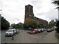
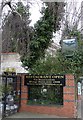
Living in B18 4EA means being part of a small, tightly knit residential cluster in Birmingham’s historic Jewellery Quarter. With a population of 2,098, the area retains a distinct character shaped by its 18th-century industrial heritage. The postcode lies within the broader Jewellery Quarter Improvement District, a 300-acre area designated for preservation and revitalisation. Despite its compact size, B18 4EA offers proximity to key landmarks like St. Paul’s Church and the Museum of the Jewellery Quarter, blending heritage with modern living. The median age of 47 suggests a community of established residents, many of whom are part of the area’s long-standing Asian population. Daily life here is influenced by the district’s legacy as a centre for craftsmanship, with a mix of historic architecture and contemporary amenities. While the area’s industrial past is evident, its present offers a blend of quiet residential streets and accessible transport links, making it appealing to those seeking a balance between tradition and convenience.
- Area Type
- Postcode
- Area Size
- Not available
- Population
- 2098
- Population Density
- 4173 people/km²
The property market in B18 4EA is characterised by a low home ownership rate of 28%, suggesting that most residents rent rather than own their homes. This contrasts with typical city-centre trends and may indicate limited availability of owner-occupied properties. The area’s accommodation type is primarily houses, which is rare for a central Birmingham postcode, pointing to a mix of older, low-rise housing stock. This could appeal to buyers seeking family homes with more space, though the small population and compact size of B18 4EA mean the housing stock is limited. The predominance of houses over flats or apartments may also mean fewer high-density developments, creating a more suburban feel within the city. For buyers, this suggests a niche market where properties are likely to be older and require renovation, but with potential for characterful living in a historically significant area.
House Prices in B18 4EA
No properties found in this postcode.
Energy Efficiency in B18 4EA
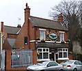
Residents of B18 4EA have access to a range of nearby amenities that support a practical, community-oriented lifestyle. The area’s proximity to five metro stops, including Winson Green Outer Circle and Handsworth Booth Street, ensures easy access to public transport for shopping, work, or leisure. Retail options include Lidl Winson and Iceland Handsworth, providing essentials within walking distance. For rail commuters, stations like Jewellery Quarter Railway Station and Smethwick Rolfe Street Railway Station offer direct links to Birmingham’s broader network. While the data does not mention parks or leisure facilities, the historic character of the Jewellery Quarter itself—featuring landmarks like St. Paul’s Church and the Museum of the Jewellery Quarter—adds cultural value. The mix of transport, retail, and heritage sites creates a convenient yet historically rich environment for daily life.
Amenities
Schools
The only school listed near B18 4EA is Sporting Edge Independent School, an independent institution. While no Ofsted rating is provided, independent schools typically charge fees and cater to specific educational philosophies. The absence of state schools in the data means families relying on free education may need to look beyond the immediate area. However, the proximity to the broader Jewellery Quarter, which includes historic and cultural landmarks, could offer alternative learning opportunities. For those prioritising independent education, Sporting Edge may be a viable option, though its specific academic performance or facilities are not detailed. Parents considering this area should factor in travel time to other schools in Birmingham, as the local school options are limited.
| Rank | School | Type | Entry gender | Ages |
|---|
Explore more schools in this area
Go to Schools tabDemographics
B18 4EA’s population of 2,098 is predominantly composed of adults aged 30–64, with a median age of 47. This suggests a community of settled, middle-aged residents, many of whom may be professionals or long-term locals. Home ownership in the area is low at 28%, indicating a higher reliance on rental properties. The accommodation type is primarily houses, which is unusual for a city-centre postcode, hinting at a mix of older, family-oriented homes. The predominant ethnic group is Asian_total, reflecting the area’s historical ties to jewellery manufacturing and its ongoing cultural diversity. While specific deprivation data is not provided, the low home ownership rate may suggest a higher proportion of renters, which could influence local services and housing affordability. The age profile also implies a community with established social networks, though the lack of younger residents may affect the vibrancy of local amenities.
Household Size
Accommodation Type
Tenure
Ethnic Group
Religion
Household Composition
Age
Household Deprivation
NS-SEC
Explore more demographic insights in this area
Go to Demographics tabPlanning
Planning Constraints
- Flood RiskPremium
- Ramsar Wetland SitesPremium
- Area of Outstanding Natural BeautyPremium
- Protected Nature ReservePremium
- Protected WoodlandPremium