Area Overview for B18 4DB
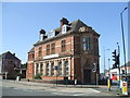
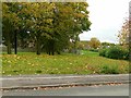
Photos of B18 4DB


Area Information
B18 4DB is a small, tightly knit residential postcode area in England, home to 1,736 people. It forms a compact cluster of homes, offering a quiet alternative to larger urban centres. The area’s character is defined by its modest scale and proximity to essential services. While it lacks the historical grandeur of nearby Edgbaston, it provides a practical, everyday living environment. The population is relatively young, with a median age of 22, though the most common age group is adults aged 30–64, suggesting a mix of families and professionals. This demographic balance creates a community that is neither overly youthful nor elderly, with a focus on stability. The area is not densely populated, which may appeal to those seeking space without the isolation of rural living. Its small size means amenities are concentrated, making daily life efficient. However, the absence of major landmarks or cultural hubs means it caters more to those prioritising convenience over novelty. For buyers, B18 4DB represents a straightforward, no-frills option in a region with broader urban connectivity.
- Area Type
- Postcode
- Area Size
- Not available
- Population
- 1736
- Population Density
- Not available
B18 4DB’s property market is characterised by a 44% home ownership rate, with houses being the primary accommodation type. This indicates a focus on single-family homes, which may appeal to families seeking space and privacy. The relatively low home ownership rate suggests a significant rental market, potentially attracting tenants or first-time buyers looking for affordable options. Given the area’s small size, property availability is limited, which could drive competition among buyers. The presence of houses rather than flats or apartments implies a quieter, more traditional residential environment. For those considering purchase, the market offers a straightforward choice: either buy a home in a compact, established cluster or rent within a community that prioritises stability. The lack of high-end properties or luxury developments means B18 4DB is unlikely to cater to high-net-worth buyers, instead serving a more modest demographic.
House Prices in B18 4DB
No properties found in this postcode.
Energy Efficiency in B18 4DB
B18 4DB offers a range of amenities within practical reach, including five retail outlets such as Lidl Winson, M&S Midland, and Farmfoods Smethwick. These shops provide everyday essentials, supporting a self-contained lifestyle. The area’s metro and rail stations connect residents to broader networks, enabling access to Birmingham’s commercial and cultural centres. While the data does not mention parks or leisure facilities, the presence of multiple transport options suggests proximity to recreational spaces in nearby postcodes. The mix of retail, dining, and transport options fosters a convenient, functional lifestyle. However, the absence of specific details about parks or community centres means residents may need to travel for outdoor activities or social events. Overall, the area caters to those prioritising accessibility over extensive leisure opportunities.
Amenities
Schools
B18 4DB is served by two primary schools, both named Summerfield Primary School. While the data does not specify Ofsted ratings, the duplication of the school name may indicate a single institution with multiple campuses or a shared facility. The presence of two primary schools suggests a focus on early education, which is critical for families with young children. However, the absence of secondary schools or further education institutions within the area means students may need to travel to nearby postcodes for higher-level schooling. The concentration of primary schools could be a draw for families prioritising convenience, though the lack of diversity in school types may limit options for older children. Parents should consider the proximity of secondary schools in surrounding areas when evaluating the area’s suitability for long-term family needs.
| Rank | School | Type | Entry gender | Ages |
|---|
Explore more schools in this area
Go to Schools tabDemographics
The population of B18 4DB is 1,736, with a median age of 22, though the most common age range is adults aged 30–64. This suggests a community where younger residents coexist with families and working-age adults. Home ownership is at 44%, indicating a significant proportion of renters, which may reflect the area’s affordability or the prevalence of rental properties. The predominant accommodation type is houses, implying a mix of single-family homes and possibly semi-detached or terraced housing. The dominant ethnic group is Asian_total, highlighting cultural diversity. This demographic profile suggests a community shaped by migration and family-oriented living. The relatively low median age contrasts with the older adult population, which may influence local services and amenities. While no specific deprivation data is provided, the combination of age groups and home ownership rates suggests a balance between stability and transient populations.
Household Size
Accommodation Type
Tenure
Ethnic Group
Religion
Household Composition
Age
Household Deprivation
NS-SEC
Explore more demographic insights in this area
Go to Demographics tabPlanning
Planning Constraints
- Flood RiskPremium
- Ramsar Wetland SitesPremium
- Area of Outstanding Natural BeautyPremium
- Protected Nature ReservePremium
- Protected WoodlandPremium
- Crime RiskPremium