Area Overview for B17 9RW
Photos of B17 9RW


Area Information
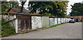
B17 9RW lies within the historic Harborne Ward, a small residential cluster in Birmingham’s southwest. With a population of 1,776, it blends old and new — the village heart of Harborne High Street, centred on St Peter’s Church (13th century), contrasts with modern retail and transport links. Once part of Staffordshire, the area became part of Birmingham in 1891, retaining its village character despite urban growth. Daily life here is shaped by proximity to historic sites like Harborne House and the former Roman fort near Queen Elizabeth Hospital. Residents benefit from nearby rail stations, including University and Selly Oak, and easy access to Birmingham’s cultural hubs. The area’s compact size fosters a tight-knit community, with local amenities and green spaces like Grove Park offering respite from city life. For those seeking a balance between heritage and convenience, B17 9RW offers a distinct blend of tradition and practicality.
- Area Type
- Postcode
- Area Size
- Not available
- Population
- 1776
- Population Density
- 5247 people/km²
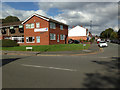
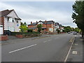
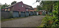
B17 9RW is predominantly a home-ownership area, with 57% of properties owned by residents rather than rented. The accommodation type is primarily houses, reflecting a residential cluster that likely includes semi-detached and detached homes. This contrasts with areas dominated by flats or rental stock, suggesting a market more suited to families or long-term buyers. The small postcode area implies limited housing stock, meaning buyers may need to consider nearby zones for more options. The focus on houses aligns with the area’s historic village character, where properties may retain traditional features. For buyers, this suggests a market where property values are likely to hold steady, though competition for homes could be keen due to the area’s compact size and appeal to established residents.
House Prices in B17 9RW
No properties found in this postcode.
Energy Efficiency in B17 9RW
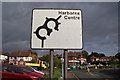
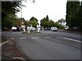
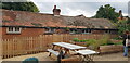
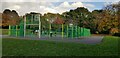
Living in B17 9RW means easy access to a range of amenities. Retail options include Asda Harborne, Waitrose Harborne, and Sainsburys Harborne, ensuring everyday shopping needs are met. The historic Harborne High Street offers a mix of traditional inns, the former lock-up, and churches like St Peter’s and St Mary’s Roman Catholic Church. Parks such as Grove Park provide green space for leisure. Rail and metro stations connect residents to Birmingham’s cultural and commercial hubs, including Edgbaston Village and Centenary Square. The blend of historic charm, modern convenience, and transport links creates a lifestyle that balances local character with urban accessibility.
Amenities
Schools
| Rank | School | Type | Entry gender | Ages |
|---|
Explore more schools in this area
Go to Schools tabDemographics
The population of B17 9RW is 1,776, with a median age of 47, indicating a mature demographic skewed toward adults aged 30–64. Home ownership stands at 57%, suggesting a stable, long-term resident base. The predominant ethnic group is White, reflecting the area’s historical roots. The age profile implies a community focused on family life and established careers, with fewer young families or retirees compared to other parts of Birmingham. This demographic mix supports a local economy centred on small businesses and light industry, though no major employers are noted. The lack of specific deprivation data means quality of life is inferred from amenities and safety metrics, which appear favourable. Overall, B17 9RW caters to those prioritising stability, with a clear majority of owner-occupied homes and a community that values continuity.
Household Size
Accommodation Type
Tenure
Ethnic Group
Religion
Household Composition
Age
Household Deprivation
NS-SEC
Explore more demographic insights in this area
Go to Demographics tabPlanning
Planning Constraints
- Flood RiskPremium
- Ramsar Wetland SitesPremium
- Area of Outstanding Natural BeautyPremium
- Protected Nature ReservePremium
- Protected WoodlandPremium