Area Overview for B17 9PS
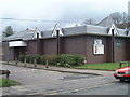
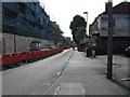
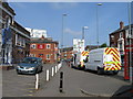
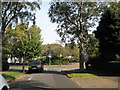
Photos of B17 9PS
Area Information
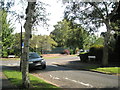
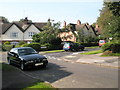
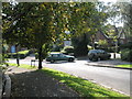
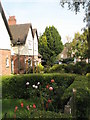
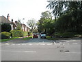
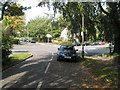
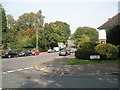
Living in B17 9PS, a small residential postcode in Harborne Ward, Birmingham, offers a blend of historic charm and modern convenience. This area, with a population of 1,586, is part of the larger Harborne Village, centred around Harborne High Street and St Peter’s Church. First mentioned in the Domesday Book of 1086, the settlement has retained its village character despite being absorbed into Birmingham in 1891. The area is defined by its compact size and proximity to the city centre, with historic roads converging from Smethwick and Northfield. Residents benefit from a tight-knit community feel, with local landmarks such as St Peter’s Church, Harborne House, and St Mary’s Roman Catholic Church anchoring daily life. The postcode covers a small cluster of homes, making it a quiet, residential enclave within the West Midlands. Its location near Birmingham’s transport hubs and amenities ensures accessibility without the city’s density, appealing to those seeking a balance between urban and rural living.
- Area Type
- Postcode
- Area Size
- Not available
- Population
- 1586
- Population Density
- 7269 people/km²
The property market in B17 9PS is characterised by a 52% home ownership rate, suggesting a modest proportion of owner-occupied homes alongside rental properties. The predominant accommodation type is houses, which aligns with the area’s historic and residential nature. This mix implies a market skewed towards family homes and long-term residents rather than speculative investment. Given the small size of the postcode, the housing stock is limited, and buyers may need to consider nearby areas for a broader selection. The presence of houses rather than flats or apartments indicates a preference for private, spacious living, which may appeal to those seeking a quieter, less densely populated environment. However, the limited scale of the area means property availability is constrained, requiring careful consideration of both price and location for potential buyers.
House Prices in B17 9PS
No properties found in this postcode.
Energy Efficiency in B17 9PS
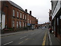
The lifestyle in B17 9PS is shaped by its proximity to retail, dining, and transport hubs. Nearby shops include Waitrose Harborne, Asda Harborne, and Sainsburys Harborne, offering convenience for daily errands. The historic Harborne High Street retains its village character, with local landmarks such as St Peter’s Church and Harborne House adding to the area’s distinctiveness. Residents can access Birmingham’s metro system via stops like Edgbaston Village and Centenary Square, facilitating travel to the city’s cultural and commercial centres. The area’s mix of historic charm and modern amenities provides a balanced lifestyle, with easy access to both local shops and broader urban resources. This accessibility, combined with the area’s quiet residential appeal, makes it suitable for those seeking a blend of convenience and tranquillity.
Amenities
Schools
Residents of B17 9PS have access to a range of primary schools, including Harborne Junior School, Harborne Infant School, St Mary’s Catholic Primary School (rated ‘good’ by Ofsted), and Harborne Primary School (rated ‘outstanding’). These institutions provide a mix of state and faith-based education, catering to diverse family needs. The presence of an ‘outstanding’ school in the area is a significant draw for families prioritising high-quality education. However, the absence of secondary schools within the postcode means students may need to travel to nearby areas for further education. The concentration of primary schools suggests a strong local focus on early education, which could be a deciding factor for families seeking a community with robust school infrastructure.
| Rank | A + A* % | School | Type | Entry gender | Ages |
|---|---|---|---|---|---|
| 1 | N/A | Harborne Junior School | primary | N/A | N/A |
| 2 | N/A | Harborne Infant School | primary | N/A | N/A |
| 3 | N/A | St Mary's Catholic Primary School | primary | N/A | N/A |
| 4 | N/A | Harborne Primary School | primary | N/A | N/A |
Explore more schools in this area
Go to Schools tabDemographics
The population of B17 9PS has a median age of 47, with the majority of residents aged 30–64 years. This suggests a mature, stable community with a focus on family living. Home ownership rates stand at 52%, indicating a mix of owner-occupied and rental properties. The predominant accommodation type is houses, reflecting a residential area with traditional, spacious homes. The predominant ethnic group is White, though specific data on diversity or deprivation is not provided. The age profile implies a population less likely to require extensive childcare services but more likely to value community amenities and local schools. With no data on deprivation, it is reasonable to infer that the area’s infrastructure and services cater to the needs of its middle-aged and older residents, though further details on socioeconomic factors remain unexplored.
Household Size
Accommodation Type
Tenure
Ethnic Group
Religion
Household Composition
Age
Household Deprivation
NS-SEC
Explore more demographic insights in this area
Go to Demographics tabPlanning
Planning Constraints
- Flood RiskLocked
- Ramsar Wetland SitesLocked
- Area of Outstanding Natural BeautyLocked
- Protected Nature ReserveLocked
- Protected WoodlandLocked
- Crime RiskLocked