Area Overview for B17 9PH
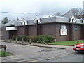
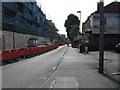
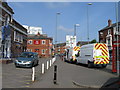
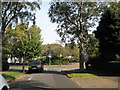
Photos of B17 9PH
Area Information
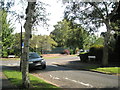
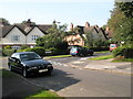
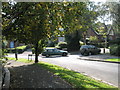
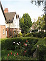
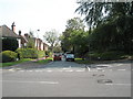
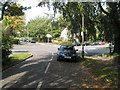
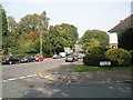
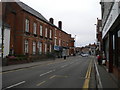
Living in B17 9PH means inhabiting a small, defined postcode area within Harborne Ward, a historic village south-west of Birmingham city centre. With a population of 1,641, the area retains a village character centred on Harborne High Street, where St Peter’s Church and historic buildings anchor daily life. This is a place where the past meets modern convenience, with nearby retail outlets like Waitrose Harborne and Sainsburys Harborne offering practical amenities. The area’s compact size means residents are close to Birmingham’s cultural and economic hubs, yet it retains a distinct identity shaped by its medieval roots and 19th-century development. Daily life here balances quiet residential streets with accessible transport links, including multiple railway stations and Metro stops. The community is defined by its proximity to green spaces like Grove Park and its integration into Birmingham’s broader transport network, making it suitable for those seeking a blend of historical charm and urban connectivity.
- Area Type
- Postcode
- Area Size
- Not available
- Population
- Not available
- Population Density
- Not available
The property market in B17 9PH is characterised by a 45% home ownership rate, with houses forming the predominant accommodation type. This indicates a market skewed towards owner-occupied properties rather than a high proportion of rentals, though the exact number of rental properties is not specified. The small size of the area means housing stock is limited, which could affect availability for buyers. The focus on houses suggests a preference for single-family homes, potentially appealing to families or those seeking more space. However, the compact nature of the postcode area may mean that buyers must look beyond immediate surroundings for larger or more varied housing options. The lack of flats or apartments implies a distinct market dynamic compared to more densely populated urban areas.
House Prices in B17 9PH
No properties found in this postcode.
Energy Efficiency in B17 9PH
Residents of B17 9PH have access to a range of amenities within practical reach, including major retail outlets like Waitrose Harborne, Sainsburys Harborne, and Asda Harborne. These stores cater to daily shopping needs, while the proximity to railway stations and Metro stops ensures easy access to Birmingham’s cultural and commercial centres. The historic Harborne High Street offers a village feel, with landmarks such as St Peter’s Church and St Mary’s Roman Catholic Church adding to the area’s character. Nearby green spaces like Grove Park provide recreational opportunities. The blend of retail, transport, and historic sites creates a lifestyle that balances convenience with a sense of local identity.
Amenities
Schools
| Rank | School | Type | Entry gender | Ages |
|---|
Explore more schools in this area
Go to Schools tabDemographics
The population of B17 9PH has a median age of 47, with the majority of residents aged 30–64. This suggests a mature, stable community with a focus on established households. Home ownership stands at 45%, indicating a mix of owner-occupied properties and rental homes, though the exact proportion of renters is not specified. The predominant accommodation type is houses, reflecting a residential area with fewer high-density developments. The predominant ethnic group is White, though specific diversity metrics are not detailed in the data. The age profile implies a demographic that may prioritise stability and long-term living over transient lifestyles. With no explicit data on deprivation, it is unclear how economic factors influence quality of life, but the presence of retail and transport infrastructure suggests basic needs are met.
Household Size
Accommodation Type
Tenure
Ethnic Group
Religion
Household Composition
Age
Household Deprivation
NS-SEC
Explore more demographic insights in this area
Go to Demographics tabPlanning
Planning Constraints
- Flood RiskPremium
- Ramsar Wetland SitesPremium
- Area of Outstanding Natural BeautyPremium
- Protected Nature ReservePremium
- Protected WoodlandPremium