Area Overview for B17 9NL
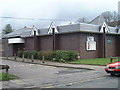
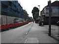
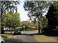
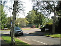
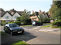
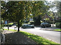
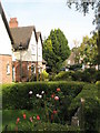
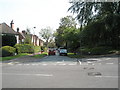
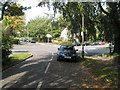
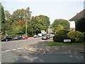
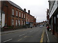
Photos of B17 9NL

Area Information
B17 9NL lies within Harborne Ward, a historic district in Birmingham’s southwest, once part of Staffordshire. This small postcode area, home to 1,641 residents, is a quiet residential cluster centred on Harborne High Street, a village core with roots in the Domesday Book of 1086. The area retains a village feel, with St Peter’s Church, a 13th-century parish church, anchoring its heritage. While modern Birmingham’s sprawl surrounds it, B17 9NL offers a compact, low-density living environment. Its proximity to Birmingham city centre, combined with local amenities like Sainsburys and rail links, balances convenience with a sense of community. The area’s history as a rural settlement with 19th-century development gives it a distinct character, though its current population reflects a mature demographic. For buyers seeking a blend of historical charm and practical connectivity, B17 9NL presents a niche opportunity in Birmingham’s evolving landscape.
- Area Type
- Postcode
- Area Size
- Not available
- Population
- Not available
- Population Density
- Not available
The property market in B17 9NL is characterised by a 45% home ownership rate, with houses forming the predominant accommodation type. This suggests a mix of owner-occupied and rental properties, though the exact balance between the two is unclear. The presence of houses, rather than flats or apartments, indicates a more traditional, low-rise housing stock typical of suburban or village settings. For buyers, this means a focus on individual homes rather than high-density developments. The small postcode area’s limited size implies that the housing stock is relatively uniform, with properties likely varying in size and condition but sharing a similar architectural style. Given the area’s historical roots, properties may retain period features, though newer builds are not mentioned. Buyers should consider the area’s proximity to Birmingham’s core, which could influence property value trends, but the small scale of B17 9NL means local market dynamics are distinct from broader citywide patterns.
House Prices in B17 9NL
No properties found in this postcode.
Energy Efficiency in B17 9NL
Living in B17 9NL offers access to a range of nearby amenities within practical reach. Retail options include Sainsburys Harborne, Iceland Harborne, and Waitrose Harborne, providing essential shopping and grocery needs. The area’s rail network connects residents to University Railway Station, Selly Oak Railway Station, and Five Ways Railway Station, enabling easy travel to Birmingham’s business districts and beyond. Metro stops like Edgbaston Village, Centenary Square, and Town Hall further enhance connectivity to the city’s cultural and commercial centres. While specific parks or leisure facilities are not detailed, the proximity to historic Harborne High Street and its surrounding infrastructure suggests a mix of local shops, cafes, and community spaces. The balance of retail, transport, and proximity to Birmingham’s core makes daily life in B17 9NL convenient, though the area’s small size means it relies heavily on nearby districts for broader amenities.
Amenities
Schools
| Rank | School | Type | Entry gender | Ages |
|---|
Explore more schools in this area
Go to Schools tabDemographics
The population of B17 9NL has a median age of 47, with the majority of residents aged 30–64. This suggests a community of established professionals and families, rather than students or younger workers. Home ownership stands at 45%, indicating that nearly half of properties are owner-occupied, while the remaining 55% are likely rental properties. The predominant accommodation type is houses, reflecting a more traditional housing stock compared to high-density flats. The predominant ethnic group is White, with no data provided on other demographics. The age profile and home ownership rate imply a stable, long-term resident base. However, the lack of specific data on deprivation or income levels means that quality of life factors such as access to services or affordability cannot be fully assessed. The area’s older demographic may influence local amenities and community dynamics, but this remains unquantified in the data.
Household Size
Accommodation Type
Tenure
Ethnic Group
Religion
Household Composition
Age
Household Deprivation
NS-SEC
Explore more demographic insights in this area
Go to Demographics tabPlanning
Planning Constraints
- Flood RiskPremium
- Ramsar Wetland SitesPremium
- Area of Outstanding Natural BeautyPremium
- Protected Nature ReservePremium
- Protected WoodlandPremium