Area Overview for B17 9HZ
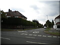
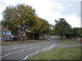
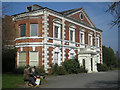
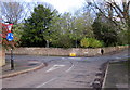
Photos of B17 9HZ


Area Information
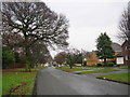
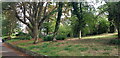
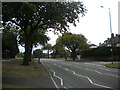
Living in B17 9HZ means inhabiting a small, tightly knit residential cluster in the Harborne Ward of Birmingham. With a population of just 1,938, this area retains a quiet, village-like character despite its proximity to the city. Historically rooted, it centres on Harborne High Street, a historic thoroughfare flanked by St Peter’s Church, a 13th-century parish church that has long been a focal point for the community. The area’s compact size means residents are close to local amenities, schools, and transport links, blending suburban comfort with urban accessibility. While it is part of Birmingham, its distinct identity as a former Staffordshire village persists, evident in its traditional architecture and low-density housing. The median age of 47 suggests a mature, stable population, with many residents likely to have lived in the area for decades. For those seeking a quieter alternative to Birmingham’s bustling core, B17 9HZ offers a mix of historical charm and practical modernity, though its small size means it is best suited for those prioritising convenience over expansive space.
- Area Type
- Postcode
- Area Size
- Not available
- Population
- Not available
- Population Density
- Not available
The property market in B17 9HZ is dominated by owner-occupied homes, with 77% of properties owned outright. This high rate of home ownership suggests a community of long-term residents rather than a transient rental market. The accommodation type is primarily houses, which is unusual for a postcode area of this size but aligns with the area’s suburban, low-density layout. Given the small population and limited land area, the housing stock is likely to be tightly clustered, with little scope for new developments. For buyers, this means a limited number of properties to choose from, though the existing stock may offer characterful, traditional homes. The area’s proximity to Birmingham’s transport networks and schools could make it attractive to families, though the small size of the postcode means the immediate surroundings are key to assessing broader property options.
House Prices in B17 9HZ
No properties found in this postcode.
Energy Efficiency in B17 9HZ
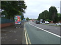
Residents of B17 9HZ benefit from a range of nearby amenities, including retail outlets like Asda Harborne, Waitrose Harborne, and Tesco Edgbaston, which provide convenience for daily shopping. The area’s historic Harborne High Street adds character, with its traditional shops and landmarks such as St Peter’s Church. For transport, rail and metro stations offer easy access to Birmingham’s urban core and surrounding areas. While the data does not specify parks or leisure facilities, the presence of historic sites like Harborne House and The Grove Park suggests opportunities for cultural and recreational activities. The mix of retail, transport, and heritage elements contributes to a lifestyle that balances practicality with a touch of historical charm, ideal for those seeking a well-connected yet distinct community.
Amenities
Schools
Residents of B17 9HZ have access to a range of schools, including primary and academy institutions. Lordswood Boys’ School and King Edward VI Lordswood School for Girls are notable, with the latter receiving a ‘good’ Ofsted rating. The presence of both primary and academy schools suggests a comprehensive educational offering, catering to different stages of schooling. Lordswood Girls’ School and The Sixth Form Centre, Harborne A Specialist Media Arts College further adds to the diversity of options, though its primary designation may indicate a focus on younger students. The mix of school types ensures families can choose between traditional state schools and specialist academies. However, the data does not specify catchment areas or performance metrics beyond Ofsted ratings, meaning prospective parents should conduct further research to determine suitability for their needs.
| Rank | School | Type | Entry gender | Ages |
|---|
Explore more schools in this area
Go to Schools tabDemographics
The community in B17 9HZ is predominantly composed of adults aged 30–64, with a median age of 47. This suggests a mature population, likely with established careers and families, contributing to a stable local economy. Home ownership is high at 77%, indicating a strong sense of permanence and investment in the area. The accommodation type is primarily houses, which aligns with the area’s low-density, suburban character. The predominant ethnic group is White, reflecting the demographic profile of much of Birmingham’s outer suburbs. While no specific deprivation data is provided, the high home ownership and age profile imply a relatively affluent, settled community. However, the absence of detailed diversity statistics means the full scope of the area’s social makeup remains partially unexplored. For residents, this demographic structure likely translates to a quiet, family-oriented environment with minimal turnover, fostering a cohesive local identity.
Household Size
Accommodation Type
Tenure
Ethnic Group
Religion
Household Composition
Age
Household Deprivation
NS-SEC
Explore more demographic insights in this area
Go to Demographics tabPlanning
Planning Constraints
- Flood RiskPremium
- Ramsar Wetland SitesPremium
- Area of Outstanding Natural BeautyPremium
- Protected Nature ReservePremium
- Protected WoodlandPremium