Area Overview for B17 9EZ
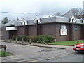
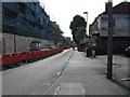
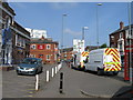
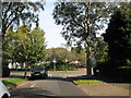
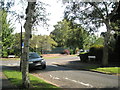
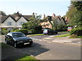
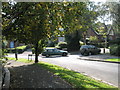
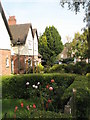
Photos of B17 9EZ
Area Information
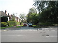
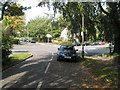
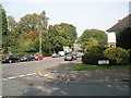
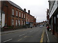
B17 9EZ is a small, residential postcode area nestled in the Harborne Ward of Birmingham, a historically significant district with roots tracing back to the Domesday Book of 1086. This compact cluster of homes sits to the southwest of Birmingham’s city centre, centred around Harborne High Street, a historic village core marked by St Peter’s Church, founded in the 13th century. The area’s character is defined by its village-like feel, with narrow streets and traditional architecture, though modern infrastructure is evident in its broadband connectivity and proximity to rail networks. With a population of 1,641, the community is tight-knit, reflecting the area’s long-standing role as a suburban enclave. Residents benefit from nearby amenities such as Sainsburys Harborne and multiple railway stations, including University and Selly Oak, which link to Birmingham’s wider transport system. While the area lacks large commercial hubs, its charm lies in its quiet, residential nature, making it appealing to those seeking a balance between city access and suburban tranquillity.
- Area Type
- Postcode
- Area Size
- Not available
- Population
- Not available
- Population Density
- Not available
The property market in B17 9EZ is characterised by a focus on houses, with 45% of residents owning their homes. This suggests a mix of owner-occupied properties and rental units, though the exact proportion of the latter is not specified. The area’s small size means the housing stock is limited, likely centred on traditional family homes rather than high-density developments. Given the predominance of houses, the market may appeal to buyers seeking spacious, single-family residences, though the lack of detailed data on property types or price ranges makes it difficult to assess affordability. The area’s proximity to rail links and amenities like Harborne High Street could enhance its appeal, but its small size may limit availability for those seeking larger or newer properties. Buyers should consider the limited scope for expansion in this compact postcode and its integration with Birmingham’s broader housing market.
House Prices in B17 9EZ
No properties found in this postcode.
Energy Efficiency in B17 9EZ
Living in B17 9EZ offers access to a range of amenities within practical reach. The area’s retail options include Sainsburys Harborne, Iceland Harborne, and M&S Harborne SF, providing everyday shopping convenience. Harborne High Street, the historic village core, retains a traditional character with landmarks such as St Peter’s Church and the former Harborne House. For transport, residents can utilise nearby railway stations like University and Selly Oak, as well as metro stops at Edgbaston Village and Centenary Square, linking to Birmingham’s wider network. While the area lacks large-scale leisure facilities, its proximity to Birmingham’s cultural and commercial hubs compensates. The village’s quiet streets and historic architecture create a distinct atmosphere, blending suburban comfort with easy access to city amenities.
Amenities
Schools
| Rank | School | Type | Entry gender | Ages |
|---|
Explore more schools in this area
Go to Schools tabDemographics
The population of B17 9EZ is predominantly adults aged 30–64, with a median age of 47. This suggests a community of established professionals and families, rather than students or retirees. Home ownership stands at 45%, indicating a mix of owner-occupied properties and rental units. The accommodation type is primarily houses, reflecting a preference for single-family homes over flats. The predominant ethnic group is White, though the data does not specify further diversity metrics. The age profile and ownership rates imply a stable, mature demographic, likely drawn to the area’s historical character and established infrastructure. However, the absence of detailed deprivation data means it is unclear how economic pressures or social inequalities might affect daily life. The age range also suggests a community with strong family ties, potentially supporting local schools and community institutions.
Household Size
Accommodation Type
Tenure
Ethnic Group
Religion
Household Composition
Age
Household Deprivation
NS-SEC
Explore more demographic insights in this area
Go to Demographics tabPlanning
Planning Constraints
- Flood RiskPremium
- Ramsar Wetland SitesPremium
- Area of Outstanding Natural BeautyPremium
- Protected Nature ReservePremium
- Protected WoodlandPremium