Area Overview for B17 9DL
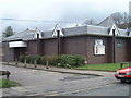
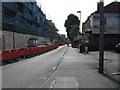
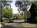
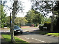
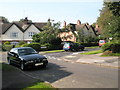
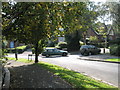
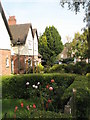
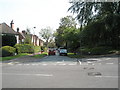
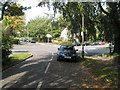
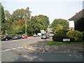
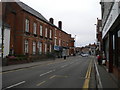
Photos of B17 9DL

Area Information
Living in B17 9DL means inhabiting a small, defined residential cluster in the heart of Birmingham’s Harborne Ward. With a population of 1,633, this area balances historic charm with modern convenience. Situated southwest of the city centre, it is part of a ward that traces its roots to the Domesday Book of 1086, with St Peter’s Church serving as a focal point since the 13th century. The area’s compact nature means residents enjoy a tight-knit community feel, though its proximity to Birmingham’s broader infrastructure ensures accessibility. Daily life here is shaped by a mix of traditional village character—such as Harborne High Street’s historic inns and shops—and contemporary amenities. The median age of 47 suggests a mature demographic, with many households likely to be long-established. While the area lacks large commercial hubs, its strategic location near rail lines and retail corridors offers practical connectivity. For buyers, B17 9DL represents a blend of quiet residential living and proximity to the city’s vibrancy, though its small size means property choices are limited to a cluster of homes.
- Area Type
- Postcode
- Area Size
- Not available
- Population
- 1633
- Population Density
- 2944 people/km²
B17 9DL is a small residential cluster where 72% of properties are owner-occupied, suggesting a market dominated by long-term residents rather than renters. The accommodation type is predominantly houses, which is unusual in modern Birmingham’s more densely built areas. This indicates a semi-rural or suburban character, with homes likely spread across the ward’s historic village core and surrounding neighborhoods. Given the area’s compact size, property choices are limited to a small number of homes, making it a niche market for buyers seeking a quieter, established environment. The high home ownership rate also implies limited availability for purchase, with most properties likely to be family homes passed down through generations. For buyers, this means a focus on existing stock rather than new developments, with potential challenges in finding properties that meet specific criteria. The immediate surroundings may offer more options, but proximity to the city centre could influence property values and demand.
House Prices in B17 9DL
No properties found in this postcode.
Energy Efficiency in B17 9DL
Life in B17 9DL is shaped by its proximity to retail, transport, and historic sites. The area’s retail offerings include major supermarkets such as Asda, Waitrose, and Sainsburys in Harborne, providing access to groceries and daily necessities. Nearby rail stations—University, Selly Oak, and Five Ways—connect residents to Birmingham’s transport network, while metro stops at Edgbaston Village, Centenary Square, and Town Hall offer links to the city’s commercial and cultural centres. Though the area itself is small, its integration with Birmingham’s infrastructure ensures residents can access a wide range of services. The historic character of Harborne High Street, with its 13th-century St Peter’s Church and traditional village layout, adds a distinct local flavour. For lifestyle, the balance of quiet residential living and practical connectivity makes it appealing to those seeking convenience without the density of central Birmingham.
Amenities
Schools
The nearest school to B17 9DL is Woodbourne Hospital School, an independent institution. No Ofsted rating is provided in the data, but its independent status suggests it may cater to a specific demographic, potentially offering specialized education or selective admission criteria. The absence of other schools in the immediate area means families relying on local state education may need to look further afield. This could be a consideration for parents prioritizing proximity to schools, though the presence of an independent option may appeal to those seeking alternative educational pathways. The limited school choice reflects the area’s small size and focus on residential living rather than large-scale infrastructure. For families, this necessitates careful planning to ensure access to a broader range of educational options beyond the immediate vicinity.
| Rank | School | Type | Entry gender | Ages |
|---|
Explore more schools in this area
Go to Schools tabDemographics
The community in B17 9DL is predominantly composed of adults aged 30–64, with a median age of 47. This suggests a population skewed toward middle-aged residents, likely including families and professionals. Home ownership is high at 72%, indicating a stable, long-term resident base rather than a transient rental market. The accommodation type is primarily houses, reflecting a suburban or semi-rural character within Birmingham. The predominant ethnic group is White, though no specific data on diversity or deprivation is provided. The absence of detailed demographic breakdowns means the area’s social composition remains less defined in terms of cultural or socioeconomic variation. For quality of life, the high home ownership rate and mature age profile may imply established communities with lower turnover, though the lack of specific data on deprivation or income levels leaves gaps in understanding broader socioeconomic factors.
Household Size
Accommodation Type
Tenure
Ethnic Group
Religion
Household Composition
Age
Household Deprivation
NS-SEC
Explore more demographic insights in this area
Go to Demographics tabPlanning
Planning Constraints
- Flood RiskPremium
- Ramsar Wetland SitesPremium
- Area of Outstanding Natural BeautyPremium
- Protected Nature ReservePremium
- Protected WoodlandPremium