Area Overview for B17 9DE
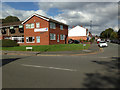
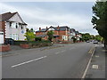
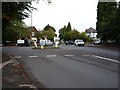
Photos of B17 9DE


Area Information
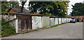
Living in B17 9DE means being part of a small, residential cluster in the Harborne Ward of Birmingham. With a population of 1,776, the area retains a village-like character centred on Harborne High Street, where St Peter’s Church and historic buildings anchor daily life. This postcode is part of a district with deep roots, mentioned in the Domesday Book of 1086 and shaped by centuries of development. The community balances historic charm with modern convenience, with easy access to nearby retail hubs like Asda Harborne and Sainsburys Harborne. Residents benefit from proximity to railway stations such as University and Selly Oak, linking them to Birmingham’s broader transport network. The area’s compact size fosters a tight-knit feel, while its location in the West Midlands offers both urban and rural influences. For those seeking a blend of heritage and practicality, B17 9DE provides a distinct living experience, where the past and present coexist seamlessly.
- Area Type
- Postcode
- Area Size
- Not available
- Population
- 1776
- Population Density
- 5247 people/km²
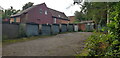
The property market in B17 9DE is characterised by a 57% home ownership rate, indicating that nearly half of the housing stock is owner-occupied, while the remaining properties are likely rented. The area is predominantly composed of houses, which suggests a focus on family homes and more spacious living arrangements. This contrasts with areas dominated by flats or apartments, offering a different dynamic for buyers. The small residential cluster nature of B17 9DE means the housing stock is concentrated, with limited scope for expansion. For buyers, this implies a potentially stable market with properties that cater to those seeking traditional homes. The absence of large-scale commercial development or major employers may mean the area is more suited to those prioritising community and heritage over investment potential. The mix of ownership and rental properties also hints at a balance between long-term residents and those seeking short-term housing solutions.
House Prices in B17 9DE
No properties found in this postcode.
Energy Efficiency in B17 9DE
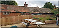
Residents of B17 9DE have access to a range of amenities within practical reach, enhancing daily life. The area’s retail offerings include major stores like Asda Harborne, Waitrose Harborne, and Sainsburys Harborne, providing convenience for shopping needs. Nearby railway stations such as University and Selly Oak offer easy access to Birmingham’s wider network, while metro stops like Edgbaston Village and Centenary Square connect to the city’s central districts. The historic Harborne High Street, with its churches and old buildings, adds character to the area. Parks and green spaces, such as Grove Park (adjacent to The Grove, a former MP’s home), offer recreational opportunities. The mix of retail, transport, and historic sites creates a lifestyle that balances practicality with a sense of local identity. Whether shopping, commuting, or exploring the area’s heritage, residents benefit from a well-rounded set of amenities.
Amenities
Schools
| Rank | School | Type | Entry gender | Ages |
|---|
Explore more schools in this area
Go to Schools tabDemographics
The population of B17 9DE has a median age of 47, with the majority of residents falling within the 30-64 age range. This suggests a community of established adults, many of whom may be settled in long-term housing. Home ownership stands at 57%, indicating a mix of owner-occupied properties and rental homes. The predominant accommodation type is houses, reflecting a residential area with more traditional housing stock. The predominant ethnic group is White, though specific diversity metrics are not detailed in the data. The age profile and ownership figures suggest a stable, mature demographic, likely with strong ties to the local area. With no explicit data on deprivation, the focus remains on the tangible aspects of living here: a steady population, a clear age structure, and a housing market that caters to both families and individuals.
Household Size
Accommodation Type
Tenure
Ethnic Group
Religion
Household Composition
Age
Household Deprivation
NS-SEC
Explore more demographic insights in this area
Go to Demographics tabPlanning
Planning Constraints
- Flood RiskPremium
- Ramsar Wetland SitesPremium
- Area of Outstanding Natural BeautyPremium
- Protected Nature ReservePremium
- Protected WoodlandPremium