Area Overview for B17 8RW
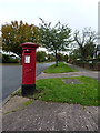
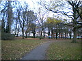
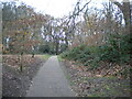
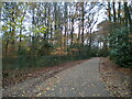
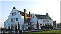
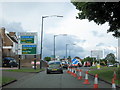
Photos of B17 8RW


Area Information
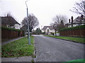
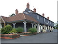
Living in B17 8RW, a small residential cluster in England, offers a blend of suburban tranquillity and practical connectivity. With a population of 1,747, this area is compact yet distinct, situated in a part of Birmingham that retains traces of its historical development along the Kidderminster-Birmingham road. The community is predominantly composed of adults aged 30–64, reflecting a mature demographic profile. Daily life here is shaped by the presence of local amenities, including retail outlets like Co-op Harborne and Iceland Bearwood, and transport links such as University Railway Station and Langley Green Railway Station. While the area is not defined by natural beauty or protected landscapes, its proximity to green spaces like Woodgate Valley Country Park adds a layer of outdoor accessibility. The housing stock is largely composed of owner-occupied homes, with 77% of residents living in their own properties. This suggests a stable, long-term community characterised by established households rather than transient renters. The area’s small size means that most needs are met within a short distance, though its appeal lies in its balance of practicality and low environmental constraints.
- Area Type
- Postcode
- Area Size
- Not available
- Population
- 1747
- Population Density
- 4924 people/km²
The property market in B17 8RW is dominated by owner-occupied homes, with 77% of residents living in their own properties. This contrasts with areas where rental markets dominate, suggesting a community of established homeowners rather than transient tenants. The accommodation type is primarily houses, which is unusual for inner-city areas and indicative of a suburban or semi-rural setting. This housing stock likely includes older, traditional properties, given the area’s historical roots as a village and its retention of Victorian terraced homes. For buyers, this means a focus on individual ownership rather than leasehold or shared equity schemes. The small size of the postcode area means that property availability is limited, and buyers may need to consider nearby suburbs for more options. The emphasis on houses also implies larger living spaces, which could appeal to families or those seeking more private outdoor space.
House Prices in B17 8RW
No properties found in this postcode.
Energy Efficiency in B17 8RW
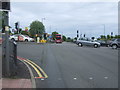
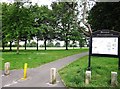
The lifestyle in B17 8RW is shaped by its proximity to retail, transport, and green spaces. Local shops such as Co-op Harborne, Co-op Hagley, and Iceland Bearwood provide everyday essentials, while the nearby Woodgate Valley Country Park offers opportunities for outdoor recreation. The area’s rail and metro stations, including University Railway Station and Handsworth Booth Street, facilitate easy access to Birmingham’s cultural and employment hubs. For leisure, the Quinton Recreation Ground and Old Burial Ground (restored post-2006) add to the local character. The presence of community spaces like Quinborne Community Centre and Bennett Hall suggests a focus on social engagement. However, the limited range of amenities means residents may need to travel further for specialist services, such as healthcare or higher education.
Amenities
Schools
Residents of B17 8RW have access to two primary schools within practical reach: Woodhouse Primary School and Woodhouse Primary Academy. Both institutions cater to the area’s younger population, though Woodhouse Primary Academy holds an Ofsted rating of ‘good’, indicating a higher standard of education. The presence of two primary schools suggests a capacity to serve the local community’s needs, though no secondary schools are listed in the data. For families, this means a focus on primary education with limited options for secondary schooling, potentially requiring travel to nearby areas. The ‘good’ rating at Woodhouse Primary Academy is a positive indicator, but the absence of detailed performance metrics or pupil outcomes means further research would be needed to assess long-term educational quality.
| Rank | School | Type | Entry gender | Ages |
|---|
Explore more schools in this area
Go to Schools tabDemographics
The demographic profile of B17 8RW is defined by a median age of 47, with the majority of residents falling within the 30–64 age range. This suggests a community of working-age adults and older homeowners, with fewer younger families or retirees compared to other areas. Home ownership is high at 77%, indicating a strong presence of long-term residents who have invested in property. The predominant accommodation type is houses, which aligns with the area’s suburban character and lower density compared to city centres. The predominant ethnic group is White, reflecting broader trends in the West Midlands. While no specific deprivation data is provided, the high home ownership rate and stable age distribution suggest a relatively secure economic environment. However, the absence of detailed diversity metrics means the full scope of the community’s composition remains partially unexplored.
Household Size
Accommodation Type
Tenure
Ethnic Group
Religion
Household Composition
Age
Household Deprivation
NS-SEC
Explore more demographic insights in this area
Go to Demographics tabPlanning
Planning Constraints
- Flood RiskPremium
- Ramsar Wetland SitesPremium
- Area of Outstanding Natural BeautyPremium
- Protected Nature ReservePremium
- Protected WoodlandPremium