Area Overview for B17 8QE
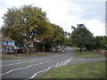
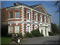
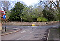
Photos of B17 8QE


Area Information
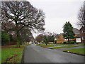
B17 8QE lies within the Harborne Ward of Birmingham, a historic area with roots stretching back to the Domesday Book of 1086. This small postcode area, home to 1,938 residents, sits in the south-west of the city, blending suburban charm with proximity to Birmingham’s urban core. The village of Harborne, centred on High Street and St Peter’s Church, retains its 13th-century character, though modern life is evident in its retail and transport links. The area’s compact size means residents enjoy a tight-knit community feel, with easy access to Birmingham’s amenities. Historically a rural settlement, Harborne transitioned into a residential hub by the late 19th century, supported by railway development. Today, it offers a mix of older homes and modern infrastructure, with a population skewed toward adults aged 30–64. Living here means navigating a balance between historic heritage and contemporary needs, with schools, shops, and transport options within practical reach.
- Area Type
- Postcode
- Area Size
- Not available
- Population
- Not available
- Population Density
- Not available
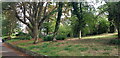
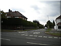
B17 8QE is a predominantly owner-occupied area, with 77% of homes owned by residents rather than rented. The accommodation type is primarily houses, which is uncommon in many parts of Birmingham but reflects the area’s historic development as a village. This mix of older properties and suburban housing suggests a market skewed toward family homes and long-term buyers rather than short-term rentals. The compact nature of the postcode means that property availability is limited, and buyers should consider the surrounding areas for broader options. The high home ownership rate indicates a community that values stability, with properties likely to be well-maintained and in demand. For those seeking a home in B17 8QE, the focus is on established homes with potential for long-term value, though the small size of the area may require looking beyond immediate surroundings for more choice.
House Prices in B17 8QE
No properties found in this postcode.
Energy Efficiency in B17 8QE
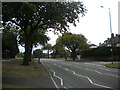
The lifestyle in B17 8QE is shaped by its proximity to retail, transport, and historic sites. Nearby amenities include Iceland Bearwood, Aldi Warley, and Tesco Edgbaston, offering essential shopping for daily needs. The area’s rail and metro connections—such as University Railway Station and Edgbaston Village—provide easy access to Birmingham’s cultural and commercial hubs. Historically, Harborne High Street has been a focal point, with St Peter’s Church and Harborne House adding a sense of heritage. While the data does not specify parks or leisure facilities, the presence of churches like St Mary’s Roman Catholic Church and the mention of Grove Park suggest green spaces for recreation. The mix of retail, transport, and historic sites creates a convenient yet characterful environment, blending practicality with a touch of tradition.
Amenities
Schools
B17 8QE is served by a range of schools, including Lordswood Boys’ School (primary), King Edward VI Lordswood School for Girls (academy, Ofsted rating: good), and Lordswood Girls’ School and The Sixth Form Centre (primary). The presence of both primary and academy schools offers families flexibility, with the latter providing specialist media arts education. The good Ofsted rating at King Edward VI Lordswood School for Girls highlights the quality of education available. The mix of school types suggests a commitment to both traditional and specialized education, catering to diverse needs. For parents, this means access to a variety of options, from early years education to sixth-form provision. The proximity of these schools to residential areas ensures convenience, though specific catchment details are not provided. The overall school infrastructure appears robust, supporting families across different stages of education.
| Rank | School | Type | Entry gender | Ages |
|---|
Explore more schools in this area
Go to Schools tabDemographics
The population of B17 8QE is 1,938, with a median age of 47, indicating a mature community. The most common age range is 30–64 years, suggesting a mix of working-age adults and families. Home ownership is high at 77%, reflecting a stable, long-term resident base. The area is predominantly composed of houses, which aligns with the demographic profile of established households. The predominant ethnic group is White, though specific diversity metrics are not provided. This age profile and ownership rate imply a community focused on stability and long-term investment. The absence of detailed data on deprivation or income levels means that quality of life is inferred from infrastructure and services, such as the presence of good-rated schools and reliable digital connectivity. The demographic makeup suggests a low turnover of residents, with many likely to have lived in the area for years.
Household Size
Accommodation Type
Tenure
Ethnic Group
Religion
Household Composition
Age
Household Deprivation
NS-SEC
Explore more demographic insights in this area
Go to Demographics tabPlanning
Planning Constraints
- Flood RiskPremium
- Ramsar Wetland SitesPremium
- Area of Outstanding Natural BeautyPremium
- Protected Nature ReservePremium
- Protected WoodlandPremium