Area Overview for B17 8PD
Photos of B17 8PD
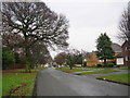
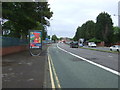

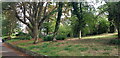
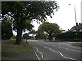
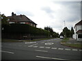
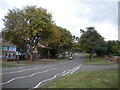
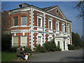

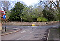

16 photos from this area
Area Information
Key information about the B17 8PD including its size, population, and administrative classification.
- Area Type
- Postcode
- Area Size
- 1.8 hectares
- Population
- Not available
- Population Density
- Not available
House Prices in B17 8PD
17
Properties
£563,308
Average Sold Price
£165,000
Lowest Price
£1,075,000
Highest Price
Showing 17 properties
| Address | Type | Beds | Baths | Last Sale Price | Last Sale Date | |
|---|---|---|---|---|---|---|
| 51 Gillhurst Road, Birmingham, B17 8PD | Flat | 1 | 1 | £760,000 | Jan 2022 | |
| 43 Gillhurst Road, Birmingham, B17 8PD | Semi-detached | - | - | £631,000 | Nov 2020 | |
| 35 Gillhurst Road, Birmingham, B17 8PD | Detached | 6 | - | £1,075,000 | Dec 2019 | |
| 33 Gillhurst Road, Birmingham, B17 8PD | Detached | 5 | 3 | £941,000 | Jan 2018 | |
| 47 Gillhurst Road, Birmingham, B17 8PD | Detached | 4 | 2 | £665,000 | Apr 2017 | |
| 59 Gillhurst Road, Birmingham, B17 8PD | Detached | 4 | - | £557,500 | Aug 2013 | |
| 49 Gillhurst Road, Birmingham, B17 8PD | Detached | - | - | £576,500 | Jun 2008 | |
| 61 Gillhurst Road, Birmingham, B17 8PD | Detached | - | - | £615,000 | Nov 2007 | |
| 55 Gillhurst Road, Birmingham, B17 8PD | Detached | 3 | 2 | £415,000 | Jul 2005 | |
| 39 Gillhurst Road, Birmingham, B17 8PD | Semi-detached | - | - | £406,000 | Mar 2004 |
Page 1 of 2
Energy Efficiency in B17 8PD
Amenities
Schools
| Rank | School | Type | Entry gender | Ages |
|---|
Explore more schools in this area
Go to Schools tabDemographics
Household Size
One person
most common
Accommodation Type
Houses
most common
Tenure
77
majority
Ethnic Group
White
most common
Religion
N/A
most common
Household Composition
N/A
most common
Age
47
median
Adults (30-64 years)
most common
Household Deprivation
N/A
with no deprivation
NS-SEC
51
in Lower managerial occupations
Explore more demographic insights in this area
Go to Demographics tabPlanning
Planning Constraints
- Flood RiskPremium
- Ramsar Wetland SitesPremium
- Area of Outstanding Natural BeautyPremium
- Protected Nature ReservePremium
- Protected WoodlandPremium