Area Overview for B17 8NE
Photos of B17 8NE


Area Information
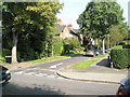
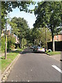
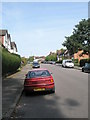
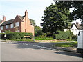
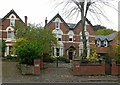
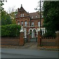
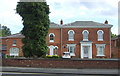
Living in B17 8NE means being part of a small, tightly knit residential cluster in the Harborne Ward of Birmingham. With a population of 1,633, this area retains a village-like character centred on Harborne High Street, where historic buildings such as St Peter’s Church and Harborne House stand as reminders of its medieval origins. The postcode lies to the south-west of Birmingham city centre, blending proximity to urban amenities with a quieter, more traditional feel. Daily life here is shaped by its compact size and historical roots, with the High Street serving as a focal point for local shops, churches, and community spaces. The area’s mix of older homes and modern infrastructure offers a balance between heritage and practicality, while its position within Birmingham ensures easy access to the city’s cultural and commercial hubs. For those seeking a residential area with a distinct identity, B17 8NE provides a blend of historical significance and contemporary convenience.
- Area Type
- Postcode
- Area Size
- Not available
- Population
- 1633
- Population Density
- 2944 people/km²
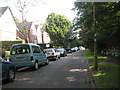
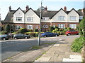
The property market in B17 8NE is dominated by owner-occupied homes, with 72% of properties owned by residents rather than rented. The accommodation type is primarily houses, which is unusual for urban areas and suggests a focus on family homes or larger residences. This makes the area more appealing to buyers seeking private, spacious properties rather than rental opportunities. The small size of the postcode area means the housing stock is limited, potentially leading to competition among buyers. For those considering the area, the emphasis on houses implies a market that prioritises long-term investment over short-term rental yields. The compact nature of the cluster also means proximity to Birmingham’s amenities without the density of city-centre living.
House Prices in B17 8NE
No properties found in this postcode.
Energy Efficiency in B17 8NE
The lifestyle in B17 8NE is shaped by its proximity to a range of amenities within practical reach. Retail options include major chains like Tesco and Aldi, ensuring everyday shopping needs are met. The area’s metro stations, such as Edgbaston Village and Soho Benson Road, provide easy access to Birmingham’s transport network, while rail stations like University Railway Station connect residents to further destinations. Historic Harborne High Street offers a mix of traditional shops, churches, and community spaces, adding to the area’s character. The presence of multiple retail and transport hubs means daily life here balances convenience with a sense of local identity, making it suitable for those who value accessibility without sacrificing a village atmosphere.
Amenities
Schools
The nearest school to B17 8NE is Woodbourne Hospital School, an independent institution. Independent schools typically charge fees and are not state-funded, offering smaller class sizes and specialised curricula. While the data does not provide Ofsted ratings or academic performance metrics, the presence of an independent school suggests the area may attract families seeking alternative educational options. However, the absence of other schools in the data means the local education landscape is limited to this single option. Families relying on state education may need to look further afield, as no other schools are listed within the area.
| Rank | School | Type | Entry gender | Ages |
|---|
Explore more schools in this area
Go to Schools tabDemographics
The community in B17 8NE is predominantly composed of adults aged 30–64, with a median age of 47. This suggests a mature, stable population, likely with established careers and families. Home ownership is high at 72%, indicating a strong presence of long-term residents. The area is characterised by houses rather than flats, reflecting a preference for detached or semi-detached properties. The predominant ethnic group is White, though no specific data on diversity or deprivation is provided. This demographic profile points to a community that values stability and property investment. The absence of detailed diversity statistics means the area’s social composition remains less defined in the data, but the high home ownership rate and age range suggest a focus on family-oriented living.
Household Size
Accommodation Type
Tenure
Ethnic Group
Religion
Household Composition
Age
Household Deprivation
NS-SEC
Explore more demographic insights in this area
Go to Demographics tabPlanning
Planning Constraints
- Flood RiskPremium
- Ramsar Wetland SitesPremium
- Area of Outstanding Natural BeautyPremium
- Protected Nature ReservePremium
- Protected WoodlandPremium