Area Overview for B17 8LR
Photos of B17 8LR

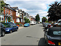
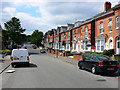


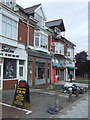
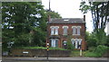
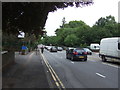
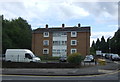
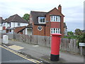

60 photos from this area
Area Information
Key information about the B17 8LR including its size, population, and administrative classification.
- Area Type
- Postcode
- Area Size
- 1.0 hectares
- Population
- 2216
- Population Density
- 8186 people/km²
House Prices in B17 8LR
23
Properties
£169,667
Average Sold Price
£55,000
Lowest Price
£595,000
Highest Price
Showing 23 properties
| Address | Type | Beds | Baths | Last Sale Price | Last Sale Date | |
|---|---|---|---|---|---|---|
| 258 Portland Road, Soho, Birmingham, B17 8LR | Detached | 5 | 2 | £595,000 | Jan 2020 | |
| 240 Portland Road, Soho, Birmingham, B17 8LR | Semi-detached | - | - | £175,000 | Feb 2019 | |
| 248 Portland Road, Soho, Birmingham, B17 8LR | Terraced | 3 | - | £160,000 | Aug 2018 | |
| 246 Portland Road, Soho, Birmingham, B17 8LR | Semi-detached | 3 | 1 | £120,000 | Mar 2013 | |
| 300 Portland Road, Soho, Birmingham, B17 8LR | house | - | - | £248,000 | Nov 2011 | |
| 256 Portland Road, Soho, Birmingham, B17 8LR | Detached | 6 | 4 | £255,000 | Sep 2011 | |
| 236 Portland Road, Soho, Birmingham, B17 8LR | house | - | - | £125,000 | Dec 2008 | |
| 244 Portland Road, Soho, Birmingham, B17 8LR | house | - | - | £110,000 | Aug 2002 | |
| 254 Portland Road, Soho, Birmingham, B17 8LR | Terraced | - | - | £69,000 | May 2000 | |
| 232 Portland Road, Soho, Birmingham, B17 8LR | house | 3 | - | £55,000 | Sep 1999 |
Page 1 of 3
Energy Efficiency in B17 8LR
Amenities
Schools
| Rank | School | Type | Entry gender | Ages |
|---|
Explore more schools in this area
Go to Schools tabDemographics
Household Size
Family (3-5 people)
most common
Accommodation Type
Houses
most common
Tenure
66
majority
Ethnic Group
asian_total
most common
Religion
N/A
most common
Household Composition
N/A
most common
Age
47
median
Adults (30-64 years)
most common
Household Deprivation
N/A
with no deprivation
NS-SEC
28
in Lower managerial occupations
Explore more demographic insights in this area
Go to Demographics tabPlanning
Planning Constraints
- Flood RiskPremium
- Ramsar Wetland SitesPremium
- Area of Outstanding Natural BeautyPremium
- Protected Nature ReservePremium
- Protected WoodlandPremium