Area Overview for B17 8LA
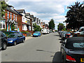
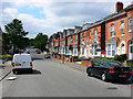
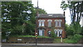
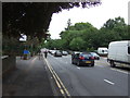
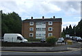
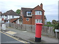
Photos of B17 8LA


Area Information
Living in B17 8LA means being part of a small, tightly knit residential cluster in the western edge of Birmingham city centre. With a population of 1,908, this postcode area reflects the historical character of North Edgbaston, a ward known for its 19th-century heritage and tree-lined streets. Once a haven for wealthier residents due to restrictions on industrial development, the area now balances its historic charm with modern amenities. Proximity to Birmingham’s core offers easy access to cultural and professional opportunities, while the surrounding landscape retains pockets of greenery and architectural legacy. Residents benefit from a mix of local schools, retail, and transport links, though the small size of the area means the community is both intimate and closely connected to the city’s broader dynamics. Whether you’re drawn to its heritage or its practicality, B17 8LA offers a distinct blend of residential tranquillity and urban convenience.
- Area Type
- Postcode
- Area Size
- Not available
- Population
- 1908
- Population Density
- 5113 people/km²
The property market in B17 8LA is characterised by a low home ownership rate of 30%, indicating that the majority of housing is rented. The accommodation type is predominantly flats, which are common in older residential developments. This suggests a housing stock that is largely purpose-built and may include older properties, potentially offering value for renters but presenting challenges for buyers seeking owner-occupied homes. The small size of the area means the housing stock is limited, and buyers should consider the immediate surroundings for more options. The flat-dominated market may appeal to those prioritising convenience and proximity to amenities, but it also means competition for available properties. For buyers, the area’s compact nature and rental focus may require a broader search beyond B17 8LA itself.
House Prices in B17 8LA
No properties found in this postcode.
Energy Efficiency in B17 8LA
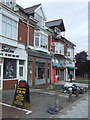
Residents of B17 8LA have access to a range of amenities within walking or short driving distance. Retail options include Tesco Edgbaston, Farmfoods Smethwick, and Aldi Warley, offering everyday shopping needs. Public transport is well served by rail stations such as Smethwick Rolfe Street and Hawthorns, as well as metro stops like Winson Green Outer Circle, providing connections to Birmingham’s transport network. While the area’s small size means limited large-scale leisure facilities, its proximity to Birmingham’s city centre opens up broader cultural and recreational opportunities. The presence of multiple schools and community hubs suggests a focus on family-friendly living, with a balance between practicality and accessibility. The mix of retail, transport, and local services supports a convenient, connected lifestyle.
Amenities
Schools
Residents of B17 8LA have access to a range of schools, including George Dixon Primary School, Cardinal Newman Catholic School, and George Dixon International School and Sixth Form Centre, all of which cater to primary education. For secondary and sixth-form provision, George Dixon Academy is an academy with a Good Ofsted rating, offering a structured educational pathway. The presence of multiple primary schools suggests a strong local focus on early education, while the academy provides continuity for older students. This mix of school types ensures families have options for both primary and secondary schooling, though the absence of independent or specialist institutions may be a consideration for some. The proximity of these schools to residential areas reinforces the area’s appeal to families seeking established educational infrastructure.
| Rank | School | Type | Entry gender | Ages |
|---|
Explore more schools in this area
Go to Schools tabDemographics
The population of B17 8LA is predominantly adults aged 30–64, with a median age of 47. This suggests a community of established professionals, families, and retirees. Home ownership is low at 30%, indicating that most residents rent their properties. The accommodation type is primarily flats, reflecting a housing stock shaped by older, purpose-built residential blocks. The predominant ethnic group is White, though specific diversity statistics are not provided. The age profile and ownership figures imply a mix of long-term residents and those seeking rental properties in a stable, mature neighbourhood. The absence of detailed deprivation data means the area’s socioeconomic profile remains less defined, but the low ownership rate suggests a reliance on private rental markets rather than owner-occupation.
Household Size
Accommodation Type
Tenure
Ethnic Group
Religion
Household Composition
Age
Household Deprivation
NS-SEC
Explore more demographic insights in this area
Go to Demographics tabPlanning
Planning Constraints
- Flood RiskPremium
- Ramsar Wetland SitesPremium
- Area of Outstanding Natural BeautyPremium
- Protected Nature ReservePremium
- Protected WoodlandPremium