Area Overview for B17 0TT
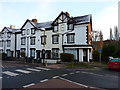
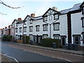
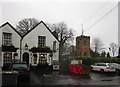
Photos of B17 0TT


Area Information
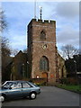
B17 0TT is a small, residential postcode area nestled in the Harborne Ward of Birmingham, a historic district with roots tracing back to the Domesday Book of 1086. With a population of just 1,499, it is a tight-knit community centred around Harborne High Street, a historic village core featuring St Peter’s Church, a 13th-century landmark. The area’s character is defined by its mix of traditional architecture and modern amenities, offering a quiet contrast to Birmingham’s bustling city centre. Daily life here is shaped by its proximity to local shops, rail links, and green spaces, while the low crime risk and excellent broadband connectivity support both work-from-home setups and everyday connectivity. The area’s small size means it is ideal for those seeking a close-knit environment with easy access to urban opportunities. Its history as a former rural settlement, now integrated into Birmingham, adds a layer of heritage to its modern appeal. For buyers, B17 0TT represents a blend of historical charm and practical modernity, with homes primarily occupied by long-term residents.
- Area Type
- Postcode
- Area Size
- Not available
- Population
- 1499
- Population Density
- 5435 people/km²
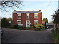
B17 0TT is characterised by a housing stock that is 53% owner-occupied, with the majority of properties being houses. This suggests a market skewed towards private ownership rather than rental, which is common in smaller, residential postcode areas. The prevalence of houses over flats or apartments indicates a focus on family homes, likely appealing to buyers seeking space and privacy. Given the area’s small size, the property market is likely limited in scale, with limited scope for new developments due to planning constraints. Buyers should consider the potential for long-term value retention, as the area’s historical stability and low crime risk may support steady demand. However, the small population and limited surrounding infrastructure mean the market is niche, catering to those prioritising a quiet, established community over proximity to larger urban amenities.
House Prices in B17 0TT
No properties found in this postcode.
Energy Efficiency in B17 0TT
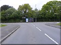
The lifestyle in B17 0TT is shaped by its proximity to a range of amenities, from retail to transport hubs. Local shops such as Asda Barnes and Co-op Quinton provide everyday essentials, while the nearby rail stations—University, Selly Oak, and Bournville—offer easy access to Birmingham’s wider network. Metro stops like Edgbaston Village and Centenary Square connect residents to the city’s cultural and commercial districts. The area’s historic charm, including Harborne High Street and St Peter’s Church, adds character to daily life, blending tradition with modern convenience. Parks and open spaces, though not explicitly named, are implied by the absence of planning constraints related to protected areas. This mix of practical amenities and historical features supports a lifestyle that balances quiet residential living with urban accessibility, ideal for those who value both comfort and connectivity.
Amenities
Schools
The schools nearest to B17 0TT include Paganel Junior School, Paganel Infant School (NC)(SU), and Paganel Primary School, all of which are primary institutions. The repetition of the name Paganel Primary School suggests possible administrative duplication or a cluster of schools serving the same area. While specific Ofsted ratings are not provided, the presence of multiple primary schools indicates a strong local education infrastructure, which is critical for families with young children. The concentration of schools in the area suggests that the community places a high value on accessible, local education. However, the absence of secondary schools or data on academic performance means buyers should investigate further if school quality is a priority. The proximity of these schools to residential properties underscores the area’s appeal to families seeking convenient, local amenities.
| Rank | School | Type | Entry gender | Ages |
|---|
Explore more schools in this area
Go to Schools tabDemographics
The population of B17 0TT is 1,499, with a median age of 47, indicating a community skewed towards adults aged 30–64. Home ownership stands at 53%, suggesting a balance between owner-occupied properties and rental stock. The area is predominantly occupied by White residents, with no specific data on other ethnic groups provided. The accommodation type is largely houses, reflecting a more traditional housing stock compared to high-density areas. This demographic profile suggests a stable, middle-aged population likely focused on family living and long-term residency. The absence of detailed diversity data means the community’s full composition remains unspecified, but the age range implies a mix of professionals and retirees. The low crime risk score of 73 (on a 100-point scale) further supports the area’s reputation as a safe, family-friendly environment.
Household Size
Accommodation Type
Tenure
Ethnic Group
Religion
Household Composition
Age
Household Deprivation
NS-SEC
Explore more demographic insights in this area
Go to Demographics tabPlanning
Planning Constraints
- Flood RiskPremium
- Ramsar Wetland SitesPremium
- Area of Outstanding Natural BeautyPremium
- Protected Nature ReservePremium
- Protected WoodlandPremium