Area Overview for B17 0RL
Photos of B17 0RL
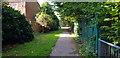
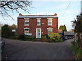
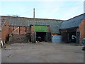
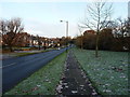
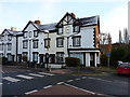
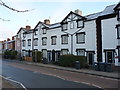
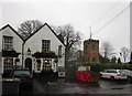
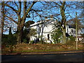
33 photos from this area
Area Information
Key information about the B17 0RL including its size, population, and administrative classification.
- Area Type
- Postcode
- Area Size
- 1.2 hectares
- Population
- 1609
- Population Density
- 4267 people/km²
House Prices in B17 0RL
22
Properties
£280,088
Average Sold Price
£104,000
Lowest Price
£515,000
Highest Price
Showing 22 properties
| Address | Type | Beds | Baths | Last Sale Price | Last Sale Date | |
|---|---|---|---|---|---|---|
| 245 Quinton Road, Birmingham, B17 0RL | Semi-detached | 3 | 1 | £325,000 | Sep 2024 | |
| 253 Quinton Road, Birmingham, B17 0RL | house | 4 | 1 | £515,000 | Oct 2022 | |
| 217 Quinton Road, Birmingham, B17 0RL | house | - | - | £375,000 | Jan 2022 | |
| 223 Quinton Road, Birmingham, B17 0RL | house | - | - | £317,000 | Nov 2020 | |
| 215 Quinton Road, Birmingham, B17 0RL | Semi-detached | 5 | 1 | £390,000 | Sep 2019 | |
| 213 Quinton Road, Birmingham, B17 0RL | Semi-detached | 3 | 1 | £355,000 | May 2019 | |
| 249 Quinton Road, Birmingham, B17 0RL | Detached | 4 | 1 | £365,000 | Jul 2018 | |
| 233 Quinton Road, Birmingham, B17 0RL | Semi-detached | 3 | 1 | £320,000 | Nov 2017 | |
| 243 Quinton Road, Birmingham, B17 0RL | Semi-detached | 3 | 1 | £278,500 | Oct 2016 | |
| 231 Quinton Road, Birmingham, B17 0RL | Semi-detached | 3 | 1 | £267,000 | Nov 2015 |
Page 1 of 3
Energy Efficiency in B17 0RL
Amenities
Schools
| Rank | School | Type | Entry gender | Ages |
|---|
Explore more schools in this area
Go to Schools tabDemographics
Household Size
Family (3-5 people)
most common
Accommodation Type
Houses
most common
Tenure
64
majority
Ethnic Group
White
most common
Religion
N/A
most common
Household Composition
N/A
most common
Age
47
median
Adults (30-64 years)
most common
Household Deprivation
N/A
with no deprivation
NS-SEC
42
in Lower managerial occupations
Explore more demographic insights in this area
Go to Demographics tabPlanning
Planning Constraints
- Flood RiskPremium
- Ramsar Wetland SitesPremium
- Area of Outstanding Natural BeautyPremium
- Protected Nature ReservePremium
- Protected WoodlandPremium