Area Overview for B17 0NP
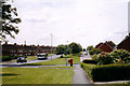
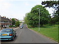
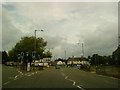
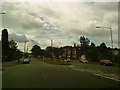
Photos of B17 0NP


Area Information
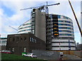
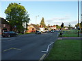
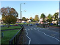
Living in B17 0NP means being part of a tightly knit residential cluster in Harborne, a historic ward in Birmingham’s west. With a population of 2,550 and a density of 2,388 people per square kilometre, this area is compact yet rich in character. Centred around Harborne High Street, it blends medieval heritage with modern convenience. The village’s origins date back to the Domesday Book of 1086, with St Peter’s Church standing as a 13th-century anchor. Today, residents benefit from proximity to Birmingham’s city centre, with rail links to Selly Oak and Bournville stations. The area’s charm lies in its mix of historic buildings, like Harborne House, and practical amenities such as Sainsburys Selly and M&S stores. While small, B17 0NP offers a balance of quiet residential living and easy access to urban opportunities, making it appealing to those seeking a community with roots in history but connected to contemporary life.
- Area Type
- Postcode
- Area Size
- Not available
- Population
- 2550
- Population Density
- 2388 people/km²
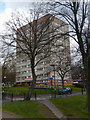
The property market in B17 0NP is defined by its low home ownership rate of 35%, suggesting a rental-dominated landscape. The area’s accommodation type is predominantly houses, which contrasts with the high population density of 2,388 people per square kilometre. This implies a mix of smaller, possibly older homes accommodating multiple households. Given the area’s small size and high density, property availability is likely limited, making it competitive for buyers. The presence of historic buildings, such as Harborne House and St Peter’s Church, may contribute to a distinct architectural identity, though the data does not specify property values or development trends. For buyers, the focus would be on securing a home in a tightly packed area with strong transport links, though the rental market’s dominance may influence both affordability and long-term investment potential.
House Prices in B17 0NP
No properties found in this postcode.
Energy Efficiency in B17 0NP
The lifestyle in B17 0NP is shaped by its mix of retail, transport, and historic amenities. Nearby shops include M&S Birmingham QE Hospital, Sainsburys Selly, and M&S, providing everyday essentials. The area’s rail and metro connections—such as University Railway Station and Edgbaston Village—facilitate easy access to Birmingham’s city centre, where cultural and leisure opportunities abound. Harborne High Street itself retains a village character, with St Peter’s Church and historic buildings adding to its charm. While specific parks or recreational spaces are not detailed in the data, the presence of places like Grove Park, linked to The Grove’s historical significance, suggests green spaces for relaxation. The combination of practical amenities and historic appeal makes daily life in B17 0NP both convenient and rooted in tradition.
Amenities
Schools
| Rank | School | Type | Entry gender | Ages |
|---|
Explore more schools in this area
Go to Schools tabDemographics
The community in B17 0NP is predominantly middle-aged, with a median age of 47 and the most common age range being adults aged 30–64. This suggests a mature, stable population, likely with established careers and families. Home ownership here is relatively low at 35%, indicating a higher proportion of renters compared to the national average. The accommodation type is primarily houses, reflecting a residential character distinct from high-density housing. The predominant ethnic group is White, though no specific diversity statistics are provided. The lower home ownership rate may impact property market dynamics, with a greater reliance on rental properties. This demographic profile points to a community focused on long-term stability, with residents prioritising proximity to services and transport over property investment.
Household Size
Accommodation Type
Tenure
Ethnic Group
Religion
Household Composition
Age
Household Deprivation
NS-SEC
Explore more demographic insights in this area
Go to Demographics tabPlanning
Planning Constraints
- Flood RiskPremium
- Ramsar Wetland SitesPremium
- Area of Outstanding Natural BeautyPremium
- Protected Nature ReservePremium
- Protected WoodlandPremium