Area Overview for B17 0LQ
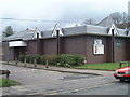
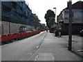
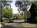
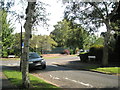
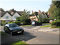
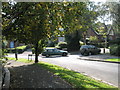
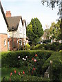
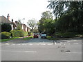
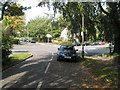
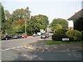
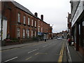
Photos of B17 0LQ

Area Information
Living in B17 0LQ, part of Harborne Ward in Birmingham, offers a blend of historical charm and modern convenience. This small residential cluster, with a population of 1,693, is centred around Harborne High Street and St Peter’s Church, a 13th-century parish church that has shaped the area since medieval times. The ward’s roots trace back to the Domesday Book of 1086, though today it is a quiet, low-density neighbourhood with a focus on family homes. Its proximity to Birmingham city centre, combined with nearby transport links, makes it appealing for those seeking a balance between urban accessibility and a village-like atmosphere. The area’s character is defined by its historic roads, old inns, and landmarks such as Harborne House, now Bishops Croft. With a median age of 47 and a population skewed toward adults aged 30–64, it is a stable, mature community. For buyers, the area’s compact size and limited development mean properties retain distinct character, though the small population suggests a close-knit, familiar environment.
- Area Type
- Postcode
- Area Size
- Not available
- Population
- 1693
- Population Density
- 1834 people/km²
The property market in B17 0LQ is defined by its low-density housing stock, with houses making up the majority of accommodation types. At 49% home ownership, the area is not dominated by rental properties, though a significant portion of the population rents. This suggests a mix of long-term residents and those in transient housing, but the focus on family homes implies a market geared toward stability rather than short-term investment. The compact size of the postcode and its limited development mean properties are likely to retain distinct character, with potential for individuality in architecture or layout. For buyers, this small area and its immediate surroundings offer a niche market with limited competition, though the small population may also mean fewer options. The emphasis on houses rather than flats or apartments could appeal to those prioritising space and privacy, though the lack of large-scale housing projects may limit future growth in the market.
House Prices in B17 0LQ
No properties found in this postcode.
Energy Efficiency in B17 0LQ
The lifestyle in B17 0LQ is shaped by its proximity to retail, transport, and urban amenities. Within practical reach are five retail outlets, including major supermarkets like Waitrose, Asda, and Sainsburys, ensuring everyday needs are met locally. The area’s rail and metro connections link it to Birmingham’s cultural and commercial centres, such as Edgbaston Village and Centenary Square, offering access to dining, entertainment, and leisure. While the postcode itself is small, its integration with Birmingham’s transport network allows residents to explore the city’s broader offerings. The historic character of Harborne High Street, with its old inns and churches, adds a sense of continuity to daily life. For those seeking convenience without urban congestion, the balance of local amenities and city connectivity makes B17 0LQ a practical choice.
Amenities
Schools
Residents of B17 0LQ have access to a range of schools, including St Peter’s Church of England Infant and Nursery School, St Peter’s Church of England Junior School, and St Peters CofE Primary School, which holds a ‘good’ Ofsted rating. These state-funded primary schools provide a solid foundation for younger children, while Eccleston School, an independent institution, offers alternative educational options for families seeking fee-based schooling. The presence of both state and independent schools reflects the area’s appeal to diverse family needs. For parents, the mix of school types ensures flexibility, whether prioritising affordability or specific educational philosophies. The ‘good’ rating at St Peters CofE Primary School indicates a reliable, well-regarded local option, reducing the need for long commutes. However, the absence of secondary schools in the immediate area may require families to consider nearby districts for older children.
| Rank | School | Type | Entry gender | Ages |
|---|
Explore more schools in this area
Go to Schools tabDemographics
The population of B17 0LQ is 1,693, with a median age of 47, indicating a mature demographic. The most common age range is adults aged 30–64, suggesting a community focused on family life and stability. Home ownership in the area stands at 49%, meaning nearly half of residents rent, reflecting a mix of owner-occupied and rental properties. The predominant accommodation type is houses, which aligns with the area’s low-density, residential character. The predominant ethnic group is White, though no specific data on diversity or deprivation is provided. The age profile implies a population with established careers and long-term commitments, likely contributing to a quiet, unchanging neighbourhood. This demographic profile may appeal to buyers seeking a settled environment with minimal turnover, though the lack of data on socioeconomic diversity means the full picture of community life remains partially obscured.
Household Size
Accommodation Type
Tenure
Ethnic Group
Religion
Household Composition
Age
Household Deprivation
NS-SEC
Explore more demographic insights in this area
Go to Demographics tabPlanning
Planning Constraints
- Flood RiskPremium
- Ramsar Wetland SitesPremium
- Area of Outstanding Natural BeautyPremium
- Protected Nature ReservePremium
- Protected WoodlandPremium