Area Overview for B17 0EZ
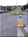
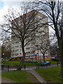
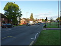
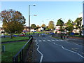
Photos of B17 0EZ


Area Information
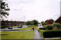
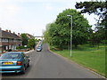
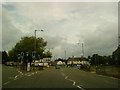
Living in B17 0EZ, a small residential postcode area in Birmingham’s Harborne Ward, offers a blend of historical charm and modern convenience. With a population of 1,693, the area is compact yet rich in character, centred around Harborne High Street and St Peter’s Church, which dates back to the 13th century. This postcode lies in the south-west of Birmingham, a region with roots tracing to the Domesday Book of 1086. Daily life here is shaped by its village-like atmosphere, with historic inns, old smithy sites, and the 18th-century Harborne House now serving as Bishops Croft. The area’s proximity to Birmingham city centre and its transport links make it accessible for commuters, while its low crime risk and excellent broadband connectivity cater to both professionals and families. Schools like St Peter’s Church of England Primary and Eccleston School provide educational options, and nearby amenities such as Asda Harborne and rail stations offer practical convenience. For those seeking a quieter, community-focused lifestyle within a major city, B17 0EZ balances heritage with contemporary needs.
- Area Type
- Postcode
- Area Size
- Not available
- Population
- 1693
- Population Density
- 1834 people/km²
The property market in B17 0EZ is defined by its 49% home ownership rate, which suggests a modest rental market alongside owner-occupied homes. The area’s accommodation is predominantly houses, a rarity in modern Birmingham, where flats and apartments dominate. This housing type likely appeals to families seeking space and privacy, reflecting the area’s historical village character. Given the small population and compact postcode, the housing stock is limited but potentially characterful, with properties possibly retaining historic features from the 18th and 19th centuries. Buyers should consider that the area’s size restricts the availability of new developments, making existing homes highly sought after. The balance between owner-occupiers and renters may create a stable market, though competition for properties could be fierce. For those prioritising space and a traditional setting, B17 0EZ offers a niche opportunity within Birmingham’s broader urban landscape.
House Prices in B17 0EZ
No properties found in this postcode.
Energy Efficiency in B17 0EZ
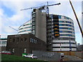
The lifestyle in B17 0EZ is enriched by its proximity to a variety of amenities. Retail options include Asda Harborne, Waitrose Harborne, and M&S Birmingham QE Hospital, providing access to everyday shopping needs. For transport, residents can utilise nearby rail stations like University, Selly Oak, and Bournville, as well as metro stops at Edgbaston Village, Centenary Square, and Town Hall, ensuring easy travel to Birmingham’s key areas. The area’s historic character is complemented by modern conveniences, with Harborne High Street offering a village-centre feel. Parks and open spaces, though not explicitly named in the data, are likely accessible given the area’s historical context of rural roots and light industry. The mix of retail, transport, and historic settings creates a convenient, balanced lifestyle, ideal for those seeking both community and accessibility.
Amenities
Schools
Residents of B17 0EZ have access to a range of schools, including St Peter’s Church of England Infant and Nursery School and St Peter’s Church of England Junior School, both primary institutions that serve the local community. St Peters CofE Primary School, also a primary school, holds a ‘good’ Ofsted rating, indicating a reliable standard of education. For independent schooling, Eccleston School provides an alternative for families seeking non-state education. The mix of state and independent schools offers flexibility, allowing parents to choose between free public education and fee-paying options. This diversity supports families with varying preferences and financial circumstances. The presence of multiple primary schools within proximity ensures that children have access to early education without long commutes. While secondary schools are not specified in the data, the primary options available suggest a strong foundation for local education, which is a key consideration for homebuyers prioritising family needs.
| Rank | School | Type | Entry gender | Ages |
|---|---|---|---|---|
| 1 | St Peter's Church of England Junior School | primary | N/A | N/A |
| 2 | St Peter's Church of England Infant and Nursery School | primary | N/A | N/A |
| 3 | Eccleston School | independent | N/A | N/A |
| 4 | St Peters CofE Primary School | primary | N/A | N/A |
Explore more schools in this area
Go to Schools tabDemographics
The community in B17 0EZ is predominantly composed of adults aged 30–64, with a median age of 47. This suggests a mature, settled population, likely with established careers and family ties. Home ownership stands at 49%, indicating a mix of owner-occupied properties and rental homes. The area’s accommodation is primarily houses, reflecting a traditional, family-oriented housing stock. The predominant ethnic group is White, which aligns with broader demographic trends in Birmingham’s historic wards. While specific data on deprivation is absent, the low crime risk score of 69 (on a 100-point scale) and the absence of environmental constraints suggest a stable, low-risk environment. This profile implies a community focused on long-term residency, with a balance between private homeownership and rental options. The age range also hints at a demographic that may prioritise schools, safety, and proximity to amenities, all of which are present in B17 0EZ.
Household Size
Accommodation Type
Tenure
Ethnic Group
Religion
Household Composition
Age
Household Deprivation
NS-SEC
Explore more demographic insights in this area
Go to Demographics tabPlanning
Planning Constraints
- Flood RiskPremium
- Ramsar Wetland SitesPremium
- Area of Outstanding Natural BeautyPremium
- Protected Nature ReservePremium
- Protected WoodlandPremium
- Crime RiskPremium