Area Overview for B17 0EW
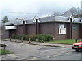
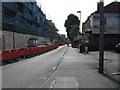
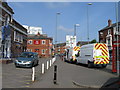
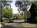
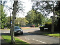
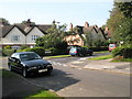
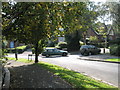
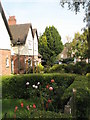
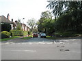
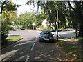
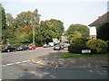
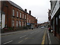
Photos of B17 0EW
Area Information
B17 0EW lies in the Harborne Ward, a historic district within Birmingham City Council, situated southwest of the city centre. This small residential cluster, with a population of 1,586, retains echoes of its medieval roots, centred around Harborne High Street and St Peter’s Church, which dates back to the 13th century. The area’s charm stems from its village-like character, with historic inns, the 18th-century Harborne House, and churches such as St Mary’s Roman Catholic Church. Though now part of Birmingham, Harborne was once a rural settlement with farms like Hill Top Farm, and its development was shaped by a 19th-century railway line. Today, it offers a quiet contrast to the city’s pace, with a focus on community and heritage. Residents benefit from proximity to Birmingham’s cultural and commercial hubs, while the area’s compact size fosters a close-knit environment. Whether drawn to its history or its modern amenities, B17 0EW provides a blend of tradition and convenience for those seeking a balanced lifestyle.
- Area Type
- Postcode
- Area Size
- Not available
- Population
- 1586
- Population Density
- 7269 people/km²
B17 0EW is predominantly a housing area, with 52% of properties owned by residents. The accommodation type is primarily houses, which suggests a focus on family homes and a less densely populated layout. Given the small size of the postcode area, the housing stock is limited, and the market is likely to be competitive for buyers. The high proportion of owner-occupied homes indicates a stable, long-term resident base, which may influence property values and availability. However, the lack of specific data on rental properties or commercial developments means the extent of the rental market remains unclear. For buyers, the area offers a chance to invest in a historic, low-density environment, though the limited size of B17 0EW means proximity to larger Birmingham districts may be necessary for expanded housing options. The presence of houses also aligns with the area’s village-like character, appealing to those seeking traditional, spacious living.
House Prices in B17 0EW
No properties found in this postcode.
Energy Efficiency in B17 0EW
Living in B17 0EW offers access to a range of amenities within practical reach. Retail options include major supermarkets such as Waitrose Harborne, Asda Harborne, and Sainsburys Harborne, providing convenience for daily shopping. The area’s proximity to rail stations like University, Selly Oak, and Five Ways, as well as metro points such as Edgbaston Village and Centenary Square, ensures easy access to Birmingham’s cultural and commercial hubs. While specific parks or leisure facilities are not detailed in the data, the historic Harborne High Street and surrounding areas suggest a mix of traditional and modern amenities. The presence of local shops, combined with transport links, supports a lifestyle that balances convenience with the area’s village character. Residents can enjoy the benefits of a small community while remaining connected to the broader city.
Amenities
Schools
Residents of B17 0EW have access to several primary schools, including Harborne Junior School, Harborne Infant School, St Mary’s Catholic Primary School (rated ‘good’ by Ofsted), and Harborne Primary School (rated ‘outstanding’). These institutions provide a range of educational options, with both state and faith-based schools available. The presence of an ‘outstanding’ school suggests high-quality education is accessible, which is a significant draw for families. The variety of primary schools ensures that parents can choose between different curricula and environments, whether secular or religious. Given the area’s focus on family living, the proximity of these schools to homes reinforces B17 0EW’s appeal as a place to raise children. The Ofsted ratings also indicate that educational standards in the area are generally strong, supporting long-term residency and community stability.
| Rank | School | Type | Entry gender | Ages |
|---|
Explore more schools in this area
Go to Schools tabDemographics
The population of B17 0EW is 1,586, with a median age of 47 and the majority of residents falling within the 30-64 age range. This suggests a mature, stable community, likely with established families and professionals. Home ownership stands at 52%, indicating a mix of owner-occupied and rental properties, though the exact proportion of rentals is not specified. The predominant accommodation type is houses, reflecting a residential area with a focus on family homes. The predominant ethnic group is White, though no further breakdown of diversity is provided. The absence of specific deprivation data means the area’s socio-economic profile remains unquantified, but the age profile and home ownership rate imply a relatively settled population with moderate economic stability. This demographic structure supports a community-oriented environment, where local amenities and schools are likely to cater to the needs of adults and children alike.
Household Size
Accommodation Type
Tenure
Ethnic Group
Religion
Household Composition
Age
Household Deprivation
NS-SEC
Explore more demographic insights in this area
Go to Demographics tabPlanning
Planning Constraints
- Flood RiskPremium
- Ramsar Wetland SitesPremium
- Area of Outstanding Natural BeautyPremium
- Protected Nature ReservePremium
- Protected WoodlandPremium