Area Overview for B17 0EN
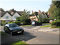
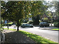
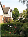
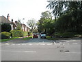
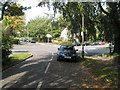
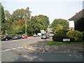
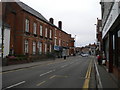
Photos of B17 0EN

Area Information
Living in B17 0EN means inhabiting a small, tightly knit residential cluster in the south-west of Birmingham, a historically significant area with roots tracing back to the Domesday Book of 1086. The postcode covers Harborne Village, centred around Harborne High Street and St Peter’s Church, a 13th-century parish church that has long been a focal point for the community. With a population of 1,586, this area blends historic charm with modern convenience. Daily life here is shaped by its proximity to Birmingham’s city centre, yet it retains a village-like character, with narrow streets, historic buildings, and a focus on local amenities. The area’s compact size means residents are close to essential services, while its history as a former Staffordshire parish adds a layer of heritage. For those seeking a balance between urban accessibility and traditional English village life, B17 0EN offers a distinct blend of quiet residential living and historical significance.
- Area Type
- Postcode
- Area Size
- Not available
- Population
- 1586
- Population Density
- 7269 people/km²
The property market in B17 0EN is dominated by owner-occupied homes, with 52% of properties in private ownership. This suggests a community of long-term residents rather than a transient rental market. The area’s accommodation type is primarily houses, reflecting its historic character and the absence of high-density housing. Given the small size of the postcode area, the housing stock is likely limited in scale, with properties concentrated around Harborne High Street and its surrounding streets. For buyers, this means a focus on individual homes rather than apartments or flats. The predominance of houses may appeal to those seeking traditional, spacious living, though the limited size of the area means competition for properties could be fierce. Proximity to Birmingham’s city centre adds value, but buyers should consider the small footprint of the postcode and its potential for limited expansion.
House Prices in B17 0EN
No properties found in this postcode.
Energy Efficiency in B17 0EN
The lifestyle in B17 0EN is shaped by its proximity to a range of amenities, including retail hubs like Waitrose Harborne, Asda Harborne, and Sainsburys Harborne, which cater to everyday shopping needs. The area’s historic High Street retains a village character, with local businesses and community spaces. Nearby, railway stations such as University and Selly Oak provide access to Birmingham’s cultural and commercial centres. Parks and green spaces, though not named, are implied by the absence of environmental constraints like protected woodlands or AONB coverage. The mix of retail, transport, and historic architecture creates a convenient, community-focused environment. Residents can enjoy a blend of traditional charm and modern convenience, with easy access to both local and city-wide amenities. The area’s compact size ensures that essential services are within walking or short driving distance, supporting a low-stress lifestyle.
Amenities
Schools
B17 0EN is served by several primary schools, including Harborne Junior School, Harborne Infant School, St Mary’s Catholic Primary School (rated ‘good’ by Ofsted), and Harborne Primary School (rated ‘outstanding’). These institutions provide a range of educational options for families, with both state and faith-based schools available. The presence of an outstanding-rated school suggests high academic standards in the area, while the mix of primary schools ensures coverage for younger children. For parents, the proximity of multiple schools within walking distance is a significant advantage, reducing the need for long commutes. The quality of education here is likely a key draw for families prioritising strong schooling, though secondary education options are not detailed in the data. The availability of multiple primary schools also supports a community-oriented approach to education, fostering local engagement.
| Rank | School | Type | Entry gender | Ages |
|---|
Explore more schools in this area
Go to Schools tabDemographics
The community in B17 0EN is predominantly middle-aged, with a median age of 47 and the majority of residents falling within the 30-64 age range. Home ownership is strong, with 52% of properties owned outright, suggesting a stable, long-term population. The area is characterised by a high proportion of houses, reflecting a traditional housing stock that contrasts with more modern apartment-led developments. The predominant ethnic group is White, though specific data on diversity or deprivation is not provided. This demographic profile indicates a community that is largely family-oriented, with a focus on established residential living. The age range suggests a mix of professionals, retirees, and families, all contributing to a steady, low-turnover environment. The lack of specific data on deprivation means the area’s quality of life remains unquantified, but the high home ownership and age profile imply a relatively affluent, settled population.
Household Size
Accommodation Type
Tenure
Ethnic Group
Religion
Household Composition
Age
Household Deprivation
NS-SEC
Explore more demographic insights in this area
Go to Demographics tabPlanning
Planning Constraints
- Flood RiskPremium
- Ramsar Wetland SitesPremium
- Area of Outstanding Natural BeautyPremium
- Protected Nature ReservePremium
- Protected WoodlandPremium