Area Overview for B17 0EJ
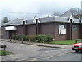
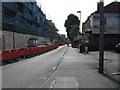
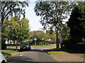
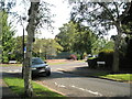
Photos of B17 0EJ

Area Information
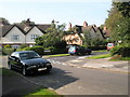
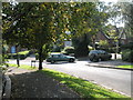
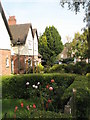
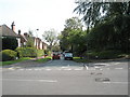
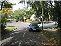
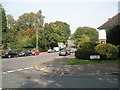
Living in B17 0EJ means being part of a small, tightly knit residential cluster in the heart of Birmingham’s West Midlands. This postcode area, part of the Harborne Ward, sits to the south-west of the city centre, with a population of 1,641 residents. Its character is defined by historic roots, including St Peter’s Church, which dates back to the 13th century, and Harborne High Street, a focal point of the village since medieval times. The area blends rural charm with urban convenience, offering proximity to Birmingham’s cultural and commercial hubs. Daily life here is shaped by its compact size, with easy access to shops, transport, and green spaces. While it retains a village feel, its connectivity to major rail lines and nearby amenities makes it a practical choice for commuters. The demographic profile—primarily adults aged 30–64—suggests a community rooted in stability, with a focus on family-oriented living. For buyers, B17 0EJ presents a rare mix of heritage and modernity, though its small scale means the property market is tightly focused on individual homes rather than large developments.
- Area Type
- Postcode
- Area Size
- Not available
- Population
- Not available
- Population Density
- Not available
The property market in B17 0EJ is characterised by a 45% home ownership rate, indicating that nearly half of residents rent their homes. This suggests a balance between owner-occupied and rental properties, though the area is not dominated by either. The accommodation type is predominantly houses, which is unusual for a small postcode area, implying a focus on individual, family-sized homes rather than larger developments or flats. This could mean the housing stock is relatively limited in scale, with properties likely to be semi-detached or detached. For buyers, the small size of the area means the market is tightly concentrated, with limited new builds or speculative investment opportunities. The presence of houses may appeal to those seeking space and privacy, though the lack of high-density housing could limit options for first-time buyers or those needing smaller units.
House Prices in B17 0EJ
No properties found in this postcode.
Energy Efficiency in B17 0EJ
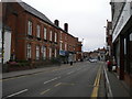
Residents of B17 0EJ have access to a range of amenities within practical reach, including five retail venues such as Waitrose Harborne, Asda Harborne, and Sainsburys Harborne, ensuring everyday shopping needs are met. The area’s transport links also provide easy access to nearby leisure and cultural spots, with metro stops connecting to Edgbaston Village, Centenary Square, and Town Hall. The historic Harborne High Street adds character, offering a mix of traditional and modern services, while St Peter’s Church and other landmarks contribute to a sense of local identity. The presence of multiple rail stations and metro connections means residents can quickly reach Birmingham’s broader offerings, from dining to entertainment. This blend of convenience, heritage, and connectivity makes daily life in B17 0EJ both practical and enriched by its small-town charm.
Amenities
Schools
| Rank | School | Type | Entry gender | Ages |
|---|
Explore more schools in this area
Go to Schools tabDemographics
The community in B17 0EJ is predominantly composed of adults aged 30–64, with a median age of 47. This suggests a mature, established population, likely with long-term ties to the area. Home ownership is at 45%, meaning nearly half of residents rent, reflecting a mix of owner-occupied and rental properties. The accommodation type is primarily houses, indicating a focus on family homes rather than flats or apartments. The predominant ethnic group is White, though no specific data on diversity or deprivation is provided. The age profile suggests a population that may be less transient, with fewer young families or students compared to other urban areas. This demographic structure could influence local services, with amenities tailored to adults rather than children. The absence of detailed diversity metrics means the community’s cultural composition remains less defined in the data.
Household Size
Accommodation Type
Tenure
Ethnic Group
Religion
Household Composition
Age
Household Deprivation
NS-SEC
Explore more demographic insights in this area
Go to Demographics tabPlanning
Planning Constraints
- Flood RiskPremium
- Ramsar Wetland SitesPremium
- Area of Outstanding Natural BeautyPremium
- Protected Nature ReservePremium
- Protected WoodlandPremium