Area Overview for B17 0EA
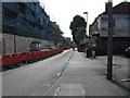
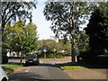
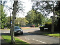
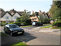
Photos of B17 0EA


Area Information
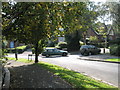
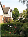
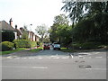
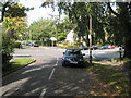
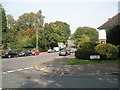
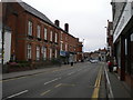
B17 0EA, part of Harborne Ward in Birmingham, is a small residential cluster with a population of 1,586. Nestled in the historic village of Harborne, it is centred around Harborne High Street and St Peter’s Church, with roots tracing back to the Domesday Book of 1086. The area retains a village character, with narrow streets and historic buildings like the 13th-century church and Harborne House. Despite its compact size, it offers a mix of residential tranquillity and proximity to Birmingham’s urban amenities. The median age of 47 suggests a mature community, with adults aged 30–64 forming the largest demographic. Living here means navigating a tight-knit, low-density area where daily life revolves around local shops, schools, and historic landmarks. The postcode’s small footprint means it is ideal for those seeking a quieter alternative to Birmingham’s city centre, though its limited size may restrict options for larger families or those needing extensive space.
- Area Type
- Postcode
- Area Size
- Not available
- Population
- 1586
- Population Density
- 7269 people/km²
The property market in B17 0EA is characterised by a 52% home ownership rate, with houses forming the majority of accommodation types. This suggests a residential area dominated by family homes rather than flats or apartments, which may appeal to buyers seeking traditional housing stock. Given the postcode’s small size, the housing stock is likely limited, with fewer options for larger properties or new builds. The 52% ownership rate implies a significant portion of the area is rented, though the balance between rental and owner-occupied properties is not quantified. For buyers, this means a focus on existing homes rather than speculative development. The area’s compact nature may also mean that proximity to local amenities like schools and transport is a key selling point, though the limited size could restrict expansion or redevelopment opportunities.
House Prices in B17 0EA
No properties found in this postcode.
Energy Efficiency in B17 0EA
The lifestyle in B17 0EA is shaped by its proximity to retail, transport, and green spaces. Local shops include major supermarkets like Asda Harborne, Waitrose Harborne, and Sainsburys Harborne, ensuring everyday convenience. The area’s transport links to railway stations and metro stops provide access to Birmingham’s cultural and commercial hubs, such as Edgbaston Village and Centenary Square. While parks or leisure facilities are not explicitly detailed in the data, the historic village centre around Harborne High Street offers a mix of old inns, churches, and traditional architecture. This blend of retail, transport, and heritage contributes to a characterful, practical living environment, though the small size of the postcode may limit access to larger recreational spaces.
Amenities
Schools
B17 0EA is served by several primary schools, including Harborne Junior School, Harborne Infant School, St Mary’s Catholic Primary School (rated ‘good’ by Ofsted), and Harborne Primary School (rated ‘outstanding’). These schools cater to young families, offering a range of educational options from early years to primary education. The presence of an ‘outstanding’ school suggests high-quality teaching and facilities, which may be a significant draw for families prioritising education. The variety of primary schools ensures that children have multiple choices, though secondary schools are not listed in the data. The proximity of these institutions to the postcode means that parents can access schools within practical walking or cycling distance, enhancing the area’s appeal for families.
| Rank | School | Type | Entry gender | Ages |
|---|
Explore more schools in this area
Go to Schools tabDemographics
The population of B17 0EA is 1,586, with a median age of 47, indicating a mature community. The most common age group is adults aged 30–64, suggesting a stable, family-oriented population. Home ownership stands at 52%, with houses being the predominant accommodation type. This reflects a mix of owner-occupied properties and rental stock, though the exact balance of tenures is not specified. The predominant ethnic group is White, though specific data on diversity or deprivation is not provided. The age profile implies a community with established residents, potentially with children in local schools and a focus on long-term residency. The relatively high median age may indicate lower demand for student housing or transient populations, though this is not explicitly confirmed by the data.
Household Size
Accommodation Type
Tenure
Ethnic Group
Religion
Household Composition
Age
Household Deprivation
NS-SEC
Explore more demographic insights in this area
Go to Demographics tabPlanning
Planning Constraints
- Flood RiskPremium
- Ramsar Wetland SitesPremium
- Area of Outstanding Natural BeautyPremium
- Protected Nature ReservePremium
- Protected WoodlandPremium