Area Overview for B17 0AJ
Photos of B17 0AJ


Area Information
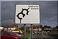
Living in B17 0AJ, a small residential cluster in Birmingham’s Harborne Ward, offers a blend of historic charm and modern convenience. This area, once part of Staffordshire, is centred on Harborne High Street, a historic village core with St Peter’s Church, founded in the 13th century, as its focal point. With a population of 1,693, it is a compact community where the past meets the present. The area’s proximity to Birmingham city centre, combined with its low crime risk and excellent broadband connectivity, makes it appealing for families and professionals. Residents benefit from nearby schools, retail hubs, and transport links, while the village atmosphere retains a sense of tradition. Its inclusion in Birmingham since 1891 and its role as a civil parish until 1912 reflect its long-standing significance. For those seeking a balance between urban accessibility and a quieter, historic setting, B17 0AJ provides a distinct character rooted in its heritage.
- Area Type
- Postcode
- Area Size
- Not available
- Population
- 1693
- Population Density
- 1834 people/km²
The property market in B17 0AJ is characterised by a 49% home ownership rate, indicating that nearly half of properties are owner-occupied, while the remaining are likely rentals. The accommodation type is predominantly houses, which suggests a focus on family homes and larger dwellings. Given the area’s small size and the prevalence of houses, the housing stock is limited, potentially making it a competitive market for buyers. The mix of ownership and rental properties implies a balance between long-term residents and those seeking temporary or investment properties. For buyers, this means a need to act swiftly, as the small area may have limited inventory. The presence of historic homes, such as Harborne House, adds to the area’s appeal, though specific property values or trends are not detailed in the data.
House Prices in B17 0AJ
No properties found in this postcode.
Energy Efficiency in B17 0AJ
The lifestyle in B17 0AJ is enriched by nearby amenities, including retail hubs like Asda Harborne, Waitrose Harborne, and Sainsburys Harborne, which provide everyday shopping convenience. The area’s proximity to rail and metro stations, such as University Railway Station and Centenary Square, facilitates easy access to Birmingham’s cultural and commercial centres. Residents can enjoy the historic charm of Harborne High Street, with its mix of old inns and modern shops. The nearby St Peter’s Church and Harborne House add a touch of heritage to daily life. While the data does not detail parks or leisure facilities, the village’s character and transport links suggest a balance between local amenities and urban opportunities. This blend of practicality and tradition supports a lifestyle that is both convenient and rooted in history.
Amenities
Schools
Residents of B17 0AJ have access to a range of educational institutions, including St Peter’s Church of England Junior School and St Peter’s Church of England Infant and Nursery School, both primary schools. Eccleston School, an independent institution, offers an alternative to state education, while St Peters CofE Primary School holds a good Ofsted rating. This mix of school types provides families with options, from faith-based state schools to independent education. The presence of multiple primary schools suggests a strong focus on early education, though no secondary schools are listed. The good Ofsted rating at St Peters CofE Primary School indicates a reliable standard of teaching, which is a key consideration for parents. The proximity of these schools to the area enhances its appeal for families prioritising quality education.
| Rank | School | Type | Entry gender | Ages |
|---|
Explore more schools in this area
Go to Schools tabDemographics
The population of B17 0AJ is 1,693, with a median age of 47 and the majority of residents aged 30–64. This suggests a community of established adults, likely with families. Home ownership rates stand at 49%, indicating a mix of owner-occupied and rental properties. The predominant accommodation type is houses, reflecting a residential area with larger properties. The predominant ethnic group is White, though no specific data on diversity or deprivation levels is provided. The age profile and ownership figures suggest a stable, mature population with a focus on long-term living. The absence of specific data on deprivation means the area’s quality of life cannot be fully assessed, but the low crime risk and access to amenities imply a generally secure and well-served environment.
Household Size
Accommodation Type
Tenure
Ethnic Group
Religion
Household Composition
Age
Household Deprivation
NS-SEC
Explore more demographic insights in this area
Go to Demographics tabPlanning
Planning Constraints
- Flood RiskPremium
- Ramsar Wetland SitesPremium
- Area of Outstanding Natural BeautyPremium
- Protected Nature ReservePremium
- Protected WoodlandPremium