Area Overview for B17 0AF
Photos of B17 0AF


Area Information
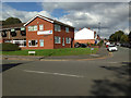
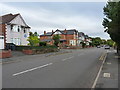
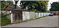
Living in B17 0AF, a small residential cluster in Birmingham’s Harborne Ward, offers a blend of historical charm and modern convenience. The area, with a population of 1,693, is centred around Harborne High Street, a historic village core marked by St Peter’s Church, founded in the 13th century. This postcode area, once part of Staffordshire, now lies within Birmingham’s West Midlands, offering a quiet, village-like atmosphere near the city’s edge. Daily life here is shaped by its compact size and proximity to key amenities. Residents benefit from a low crime rate, excellent broadband connectivity, and a mix of retail, rail, and metro access. The area’s character is defined by its heritage, including 18th-century buildings like Harborne House and 19th-century roads, yet it remains well-served by contemporary infrastructure. For those seeking a balance between tradition and practicality, B17 0AF provides a distinct, manageable community with a strong sense of local identity.
- Area Type
- Postcode
- Area Size
- Not available
- Population
- 1693
- Population Density
- 1834 people/km²
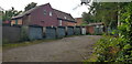
The property market in B17 0AF is characterised by a 49% home ownership rate, with houses being the predominant accommodation type. This suggests a focus on family homes rather than apartments or flats, typical of suburban or village settings. The relatively low home ownership percentage may indicate a mix of owner-occupied properties and rental stock, though specific rental data is not available. Given the area’s small size and historical character, housing stock is likely limited, with properties ranging from older, period homes to more modern builds. For buyers, this means competition could be fierce, particularly for well-maintained houses with garden space. The compact nature of the postcode area means that immediate surroundings—such as nearby wards or neighbouring postcode clusters—may hold more housing options. Buyers should consider the area’s limited size when planning for future growth or family expansion.
House Prices in B17 0AF
No properties found in this postcode.
Energy Efficiency in B17 0AF
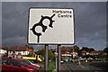
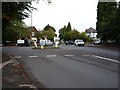
The lifestyle in B17 0AF is enriched by a range of amenities within practical reach. Retail options include major supermarkets such as Asda Harborne, Waitrose Harborne, and Sainsburys Harborne, ensuring everyday shopping needs are met. For transport, nearby rail stations like University and Selly Oak connect residents to Birmingham’s business districts and cultural hubs, while the metro system links to Edgbaston Village and Centenary Square. The area’s historic character is complemented by modern convenience, with Harborne High Street serving as a focal point for local activity. Parks and open spaces are not explicitly detailed in the data, but the absence of environmental constraints suggests accessible green areas. The mix of retail, transport, and community-centric features makes daily life in B17 0AF both practical and pleasant, offering a balance between suburban tranquillity and urban connectivity.
Amenities
Schools
Residents of B17 0AF have access to a range of schools, including St Peter’s Church of England Junior School and St Peter’s Church of England Infant and Nursery School, both primary institutions serving younger children. Eccleston School, an independent institution, offers an alternative for families seeking private education. St Peters CofE Primary School, also a primary school, holds an Ofsted rating of ‘good’, reflecting its quality of teaching and facilities. The presence of both state and independent schools provides flexibility for families, whether prioritising affordability or specific educational approaches. For primary-age children, the area’s schools are well-established, with St Peter’s Church schools deeply rooted in the community. However, secondary education options are not detailed in the data, so prospective families may need to consider nearby areas for comprehensive schooling.
| Rank | School | Type | Entry gender | Ages |
|---|
Explore more schools in this area
Go to Schools tabDemographics
The community in B17 0AF has a median age of 47, with the most common age range being adults aged 30–64. This suggests a mature, established population, likely with long-term ties to the area. Home ownership stands at 49%, indicating a mix of owner-occupied and rental properties. The predominant accommodation type is houses, reflecting a residential character focused on family homes. The majority of residents identify as White, though specific diversity figures are not provided. With 1,693 residents, the area is small enough to foster close-knit relationships but large enough to support essential services. The age profile and home ownership rate suggest a stable, low-turnover community, where many residents may have lived for decades. This demographic profile aligns with a quiet, family-oriented environment, though the relatively low home ownership rate could imply a proportion of renters or younger households.
Household Size
Accommodation Type
Tenure
Ethnic Group
Religion
Household Composition
Age
Household Deprivation
NS-SEC
Explore more demographic insights in this area
Go to Demographics tabPlanning
Planning Constraints
- Flood RiskPremium
- Ramsar Wetland SitesPremium
- Area of Outstanding Natural BeautyPremium
- Protected Nature ReservePremium
- Protected WoodlandPremium