Area Overview for B17 0AE
Photos of B17 0AE

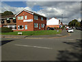
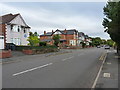
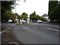

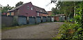
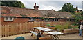
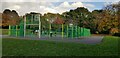


42 photos from this area
Area Information
Key information about the B17 0AE including its size, population, and administrative classification.
- Area Type
- Postcode
- Area Size
- 6477 m²
- Population
- 1776
- Population Density
- 5247 people/km²
House Prices in B17 0AE
42
Properties
£225,100
Average Sold Price
£67,000
Lowest Price
£328,000
Highest Price
Showing 42 properties
| Address | Type | Beds | Baths | Last Sale Price | Last Sale Date | |
|---|---|---|---|---|---|---|
| 102 Victoria Road, Harborne, Birmingham, B17 0AE | Terraced | 2 | 1 | £308,500 | Nov 2025 | |
| 44 Victoria Road, Harborne, Birmingham, B17 0AE | Terraced | 2 | 1 | £320,000 | Jul 2025 | |
| 68 Victoria Road, Harborne, Birmingham, B17 0AE | Terraced | 2 | 1 | £240,000 | Sep 2024 | |
| 96 Victoria Road, Harborne, Birmingham, B17 0AE | Terraced | 2 | 1 | £315,000 | Jul 2024 | |
| 66 Victoria Road, Harborne, Birmingham, B17 0AE | Terraced | 2 | 1 | £270,000 | Mar 2024 | |
| 72 Victoria Road, Harborne, Birmingham, B17 0AE | house | - | - | £283,000 | Oct 2022 | |
| 90 Victoria Road, Harborne, Birmingham, B17 0AE | Terraced | 2 | 1 | £328,000 | Mar 2022 | |
| 64 Victoria Road, Harborne, Birmingham, B17 0AE | house | 2 | - | £293,500 | Mar 2022 | |
| 78 Victoria Road, Harborne, Birmingham, B17 0AE | Terraced | 2 | 2 | £325,350 | Jun 2021 | |
| 110 Victoria Road, Harborne, Birmingham, B17 0AE | house | - | - | £275,000 | Feb 2021 |
Page 1 of 5
Energy Efficiency in B17 0AE
Amenities
Schools
| Rank | School | Type | Entry gender | Ages |
|---|
Explore more schools in this area
Go to Schools tabDemographics
Household Size
Two person
most common
Accommodation Type
Houses
most common
Tenure
57
majority
Ethnic Group
White
most common
Religion
N/A
most common
Household Composition
N/A
most common
Age
47
median
Adults (30-64 years)
most common
Household Deprivation
N/A
with no deprivation
NS-SEC
53
in Lower managerial occupations
Explore more demographic insights in this area
Go to Demographics tabPlanning
Planning Constraints
- Flood RiskPremium
- Ramsar Wetland SitesPremium
- Area of Outstanding Natural BeautyPremium
- Protected Nature ReservePremium
- Protected WoodlandPremium