Area Overview for B16 9WD
Photos of B16 9WD


Area Information
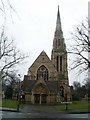
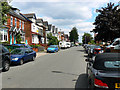
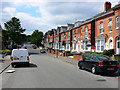
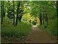
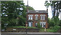
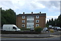
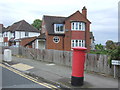
Living in B16 9WD means being part of a small, tightly knit residential cluster in the west of Birmingham, within the North Edgbaston ward. With a population of just 1,968, the area is compact but historically significant, having once been part of Warwickshire. Its 19th-century heritage shaped its character, with restrictions on industrial development that preserved its appeal for wealthier residents. Today, the area blends suburban tranquillity with proximity to Birmingham’s city centre. The median age of 47 suggests a mature community, with adults aged 30–64 forming the largest demographic. The presence of houses, rather than flats, and a 48% home ownership rate indicates a mix of owner-occupied properties and rentals. Residents benefit from proximity to amenities like Edgbaston Pool, a Site of Special Scientific Interest, and Edgbaston Hall, a Grade II listed building. While small, the area offers a distinct sense of place, rooted in its history and green spaces.
- Area Type
- Postcode
- Area Size
- Not available
- Population
- 1968
- Population Density
- 5595 people/km²
The property market in B16 9WD is defined by its 48% home ownership rate, indicating a balance between owner-occupied homes and rental properties. The area is dominated by houses, not flats, which suggests a focus on family-friendly, suburban-style living. Given the small population and the concentration of houses, the housing stock is limited in scale, making the area more suitable for buyers seeking a specific type of property rather than a wide selection. The 48% ownership rate also implies a significant portion of the housing stock is available for rent, potentially offering opportunities for investors. However, the small size of the area means that buyers must consider nearby regions for broader options. The presence of houses may appeal to those prioritising space and privacy over high-density living.
House Prices in B16 9WD
No properties found in this postcode.
Energy Efficiency in B16 9WD
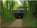
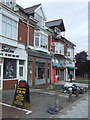
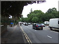
Residents of B16 9WD have access to a range of amenities within walking or short driving distance. Retail options include Tesco Edgbaston, Farmfoods Smethwick, and Tesco Hagley, offering everyday shopping needs. The area’s metro stops, such as Edgbaston Village and Winson Green Outer Circle, provide easy access to local services and transport links. Rail stations like Smethwick Rolfe Street and Jewellery Quarter Railway Station connect to Birmingham’s wider network. Beyond shopping, the area’s historical and natural features add to its character, with Edgbaston Pool and Deer’s Leap Wood offering green spaces for leisure. The presence of Edgbaston Hall, a listed building, and proximity to Birmingham Dental Hospital highlight the blend of heritage and modern facilities that define daily life here.
Amenities
Schools
| Rank | School | Type | Entry gender | Ages |
|---|
Explore more schools in this area
Go to Schools tabDemographics
The community in B16 9WD is predominantly composed of adults aged 30–64, with a median age of 47. This suggests a stable, middle-aged population, likely with established careers and families. The 48% home ownership rate indicates that nearly half of residents live in properties they own, while the remaining 52% are likely renters. The area is characterised by houses, not flats, reflecting a suburban rather than urban housing stock. The predominant ethnic group is Asian_total, though specific subgroups are not detailed. The small population of 1,968 means the community is close-knit, with limited diversity in household types. The absence of specific deprivation data means no direct commentary on socioeconomic challenges, but the age profile and home ownership figures suggest a relatively stable demographic.
Household Size
Accommodation Type
Tenure
Ethnic Group
Religion
Household Composition
Age
Household Deprivation
NS-SEC
Explore more demographic insights in this area
Go to Demographics tabPlanning
Planning Constraints
- Flood RiskPremium
- Ramsar Wetland SitesPremium
- Area of Outstanding Natural BeautyPremium
- Protected Nature ReservePremium
- Protected WoodlandPremium