Area Overview for B16 9SA
Photos of B16 9SA


Area Information
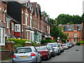
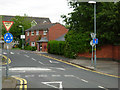
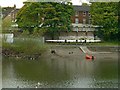
Living in B16 9SA, a small residential cluster in North Edgbaston, offers a blend of urban convenience and historic charm. Situated in Birmingham’s west, this area lies just south-west of the city centre, historically part of Warwickshire. With a population of 2,077, it is a compact community shaped by 19th-century landowners who prioritised green spaces over industrial development, earning Edgbaston the nickname “where the trees begin.” The ward is home to landmarks like Edgbaston Hall, a Grade II-listed building, and Edgbaston Pool, a Site of Special Scientific Interest. Proximity to the University of Birmingham and nearby amenities makes it appealing for professionals and families. While the area feels distinct from Birmingham’s bustling core, its location ensures easy access to the city’s cultural and commercial hubs. The mix of historic architecture and modern infrastructure creates a lived-in, community-focused environment where residents benefit from both local character and connectivity.
- Area Type
- Postcode
- Area Size
- Not available
- Population
- 2077
- Population Density
- 5483 people/km²
The property market in B16 9SA is characterised by a low home ownership rate of 29%, indicating that the majority of residents are likely to be renters rather than homeowners. The predominant accommodation type is flats, which suggests a focus on smaller, more compact living spaces. This dynamic positions the area as part of Birmingham’s rental market, with limited availability of owner-occupied properties. The small size of the postcode area means that housing stock is limited, and buyers may need to consider nearby wards for more options. The prevalence of flats also implies that the area may cater to younger professionals or families seeking affordable, manageable living spaces. However, the low home ownership rate could signal a transient population or a market where property investment is less common.
House Prices in B16 9SA
No properties found in this postcode.
Energy Efficiency in B16 9SA
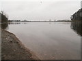
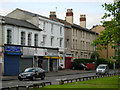
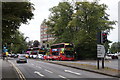
Residents of B16 9SA have access to a range of amenities within walking or short-vehicle distance. Retail options include major chains like Tesco Hagley, Spar Ample, and Morrisons Edgbaston, providing everyday shopping convenience. The area’s proximity to Edgbaston Village, Centenary Square, and Town Hall offers vibrant urban spaces for dining, leisure, and socialising. Historic sites such as Edgbaston Hall and Deer’s Leap Wood add cultural and recreational value, while the nearby university campus brings a dynamic student presence. The area’s mix of local shops, public spaces, and green spaces creates a balanced lifestyle, blending practicality with the charm of Birmingham’s historic districts. These amenities contribute to a community feel that is both accessible and rooted in the city’s heritage.
Amenities
Schools
The nearest school to B16 9SA is St Paul’s School for Girls, a primary school with an outstanding Ofsted rating. This institution provides high-quality education for young students, making it a key asset for families in the area. The presence of a top-rated primary school enhances the area’s appeal, particularly for parents prioritising educational standards. While no secondary schools are listed in the data, the proximity to St Paul’s School for Girls suggests that families may also have access to other educational institutions in nearby parts of Edgbaston. The school’s excellence reinforces the area’s suitability for households with children, though further research would be needed to confirm the full range of educational options available.
| Rank | School | Type | Entry gender | Ages |
|---|
Explore more schools in this area
Go to Schools tabDemographics
The population of B16 9SA has a median age of 47, with the majority of residents aged between 30 and 64. This suggests a community skewed towards middle-aged adults, likely including professionals and families. Home ownership in the area is relatively low at 29%, indicating that a significant portion of the housing stock is rented out. The predominant accommodation type is flats, reflecting the area’s residential density. The predominant ethnic group is White, though specific data on diversity or deprivation is not provided. The age profile and home ownership figures suggest a mix of long-term residents and renters, with limited data on socioeconomic diversity. The absence of detailed deprivation metrics means the area’s quality of life cannot be fully contextualised, but the demographic composition points to a stable, middle-aged population with established roots in the ward.
Household Size
Accommodation Type
Tenure
Ethnic Group
Religion
Household Composition
Age
Household Deprivation
NS-SEC
Explore more demographic insights in this area
Go to Demographics tabPlanning
Planning Constraints
- Flood RiskPremium
- Ramsar Wetland SitesPremium
- Area of Outstanding Natural BeautyPremium
- Protected Nature ReservePremium
- Protected WoodlandPremium