Area Overview for B16 9QY
Photos of B16 9QY
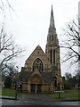
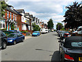
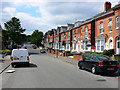
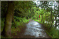

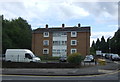
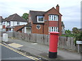

60 photos from this area
Area Information
Key information about the B16 9QY including its size, population, and administrative classification.
- Area Type
- Postcode
- Area Size
- 8247 m²
- Population
- 1553
- Population Density
- 6879 people/km²
House Prices in B16 9QY
18
Properties
£165,719
Average Sold Price
£58,750
Lowest Price
£250,000
Highest Price
Showing 18 properties
| Address | Type | Beds | Baths | Last Sale Price | Last Sale Date | |
|---|---|---|---|---|---|---|
| 29 Deblen Drive, Birmingham, B16 9QY | Terraced | 3 | 1 | £180,000 | Jul 2025 | |
| 27 Deblen Drive, Birmingham, B16 9QY | Terraced | 3 | 1 | £240,000 | Feb 2025 | |
| 12 Deblen Drive, Birmingham, B16 9QY | Terraced | 3 | 1 | £250,000 | Nov 2021 | |
| 31 Deblen Drive, Birmingham, B16 9QY | Terraced | 3 | 1 | £195,000 | Sep 2017 | |
| 18 Deblen Drive, Birmingham, B16 9QY | house | - | - | £138,500 | Dec 2009 | |
| 34 Deblen Drive, Birmingham, B16 9QY | Terraced | - | - | £140,000 | Oct 2006 | |
| 36 Deblen Drive, Birmingham, B16 9QY | house | - | - | £123,500 | Oct 2003 | |
| 16 Deblen Drive, Birmingham, B16 9QY | Terraced | - | - | £58,750 | Mar 1995 | |
| 10 Deblen Drive, Birmingham, B16 9QY | Terraced | 3 | 1 | - | - | |
| 28 Deblen Drive, Birmingham, B16 9QY | Terraced | - | - | - | - |
Page 1 of 2
Energy Efficiency in B16 9QY
Amenities
Schools
| Rank | School | Type | Entry gender | Ages |
|---|
Explore more schools in this area
Go to Schools tabDemographics
Household Size
One person
most common
Accommodation Type
Flats
most common
Tenure
27
majority
Ethnic Group
White
most common
Religion
N/A
most common
Household Composition
N/A
most common
Age
47
median
Adults (30-64 years)
most common
Household Deprivation
N/A
with no deprivation
NS-SEC
37
in Lower managerial occupations
Explore more demographic insights in this area
Go to Demographics tabPlanning
Planning Constraints
- Flood RiskPremium
- Ramsar Wetland SitesPremium
- Area of Outstanding Natural BeautyPremium
- Protected Nature ReservePremium
- Protected WoodlandPremium