Area Overview for B16 9PH
Photos of B16 9PH
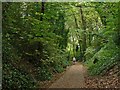
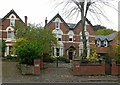
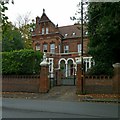
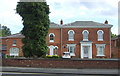
68 photos from this area
Area Information
Key information about the B16 9PH including its size, population, and administrative classification.
- Area Type
- Postcode
- Area Size
- 1.1 hectares
- Population
- 1693
- Population Density
- 6204 people/km²
House Prices in B16 9PH
73
Properties
£260,000
Average Sold Price
£260,000
Lowest Price
£260,000
Highest Price
Showing 73 properties
| Address | Type | Beds | Baths | Last Sale Price | Last Sale Date | |
|---|---|---|---|---|---|---|
| 214 Hagley Road, Edgbaston, Birmingham, B16 9PH | house | - | - | £260,000 | Sep 2021 | |
| Flat, 212 Hagley Road, Edgbaston, Birmingham, B16 9PH | Flat | - | - | - | - | |
| Flat 1, 206 Hagley Road, Edgbaston, Birmingham, B16 9PH | Flat | - | 1 | - | - | |
| Flat 40, Holmpark, 212 Hagley Road, Edgbaston, Birmingham, B16 9PH | Unknown | - | - | - | - | |
| Total Back Care Centre Limited, Studio At, 214 Hagley Road, Edgbaston, Birmingham, B16 9PH | office_workshop | - | - | - | - | |
| Holmpark, 212 Hagley Road, Edgbaston, Birmingham, B16 9PH | hospital_care_home | - | - | - | - | |
| Flat 10, Holmpark, 212 Hagley Road, Edgbaston, Birmingham, B16 9PH | Unknown | - | - | - | - | |
| Flat 17, Holmpark, 212 Hagley Road, Edgbaston, Birmingham, B16 9PH | Unknown | - | - | - | - | |
| Flat 7, Holmpark, 212 Hagley Road, Edgbaston, Birmingham, B16 9PH | Unknown | - | - | - | - | |
| Flat 8, Holmpark, 212 Hagley Road, Edgbaston, Birmingham, B16 9PH | Unknown | - | - | - | - |
Page 1 of 8
Energy Efficiency in B16 9PH
Amenities
Schools
| Rank | School | Type | Entry gender | Ages |
|---|
Explore more schools in this area
Go to Schools tabDemographics
Household Size
One person
most common
Accommodation Type
Flats
most common
Tenure
29
majority
Ethnic Group
White
most common
Religion
N/A
most common
Household Composition
N/A
most common
Age
47
median
Adults (30-64 years)
most common
Household Deprivation
N/A
with no deprivation
NS-SEC
36
in Lower managerial occupations
Explore more demographic insights in this area
Go to Demographics tabPlanning
Planning Constraints
- Flood RiskPremium
- Ramsar Wetland SitesPremium
- Area of Outstanding Natural BeautyPremium
- Protected Nature ReservePremium
- Protected WoodlandPremium