Area Overview for B16 9JW
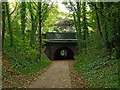
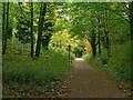
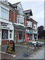
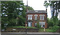
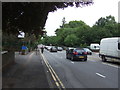
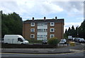
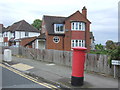
Photos of B16 9JW

Area Information
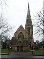
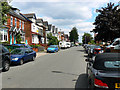
B16 9JW lies in the heart of North Edgbaston, a historic ward in Birmingham’s west, just south-west of the city centre. With a population of 1,553, it is a small, tightly knit residential cluster shaped by 19th-century landowners who prioritised green spaces over industrial development. This legacy is evident in the area’s tree-lined streets and proximity to landmarks like Edgbaston Hall, a Grade II-listed country house now home to a golf club. The ward’s charm blends historic architecture with modern convenience, offering a quiet contrast to Birmingham’s bustling core. Residents benefit from proximity to Birmingham University, with nearby railway stations linking to the city’s transport network. While compact, the area is rich in cultural and natural features, from the Site of Special Scientific Interest at Edgbaston Pool to the former BBC Pebble Mill Studios site. Living here means balancing a historic, tree-filled environment with easy access to urban amenities, making it appealing to those seeking a mix of heritage and practicality.
- Area Type
- Postcode
- Area Size
- Not available
- Population
- 1553
- Population Density
- 6879 people/km²
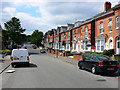
The property market in B16 9JW is characterised by a low home ownership rate of 27%, indicating that the majority of residents are renters. The primary accommodation type is flats, which aligns with the area’s small size and historical development as a residential cluster. This suggests a housing stock that is largely purpose-built or converted, with limited scope for owner-occupied properties. For buyers, this means the area is not a traditional market for home ownership, but rather a rental-focused environment. The concentration of flats may reflect older buildings or developments designed for multi-occupancy. Given the area’s compact nature, property availability is likely limited, and buyers should consider the broader Birmingham region for more diverse options. The rental market here may cater to professionals working in nearby universities or the city centre, offering convenience over expansive living spaces.
House Prices in B16 9JW
No properties found in this postcode.
Energy Efficiency in B16 9JW
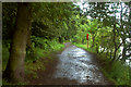
Living in B16 9JW offers access to a range of amenities within practical reach. Retail options include Tesco Hagley, Tesco Edgbaston, and Spar Ample, providing everyday shopping convenience. The area’s proximity to metro stops like Edgbaston Village and Centenary Square adds to its urban appeal, while railway stations such as Five Ways and University stations offer swift travel to Birmingham’s core. Natural spaces like Edgbaston Pool, a Site of Special Scientific Interest, and Deer’s Leap Wood provide greenery and recreational opportunities. The historic Edgbaston Hall and former BBC Pebble Mill Studios site add cultural depth. This blend of retail, transport, and green spaces creates a lifestyle that balances convenience with a touch of heritage, ideal for those seeking a compact, well-connected environment.
Amenities
Schools
| Rank | School | Type | Entry gender | Ages |
|---|
Explore more schools in this area
Go to Schools tabDemographics
The population of B16 9JW is predominantly adults aged 30–64, with a median age of 47. This suggests a community of established professionals and families, rather than students or retirees. Home ownership is low, with only 27% of residents owning their homes, indicating a rental-dominated market. The area’s accommodation is largely flats, reflecting its compact nature and historical development as a residential cluster. The predominant ethnic group is White, though no specific data on diversity or deprivation levels is provided. The age profile and home ownership rate suggest a stable, middle-aged population with limited intergenerational diversity. For buyers, this demographic profile implies a market skewed towards renters, with limited opportunities for long-term property investment. The lack of data on deprivation means the area’s quality of life cannot be fully assessed, but the age range and housing type suggest a focus on practical living over luxury.
Household Size
Accommodation Type
Tenure
Ethnic Group
Religion
Household Composition
Age
Household Deprivation
NS-SEC
Explore more demographic insights in this area
Go to Demographics tabPlanning
Planning Constraints
- Flood RiskPremium
- Ramsar Wetland SitesPremium
- Area of Outstanding Natural BeautyPremium
- Protected Nature ReservePremium
- Protected WoodlandPremium